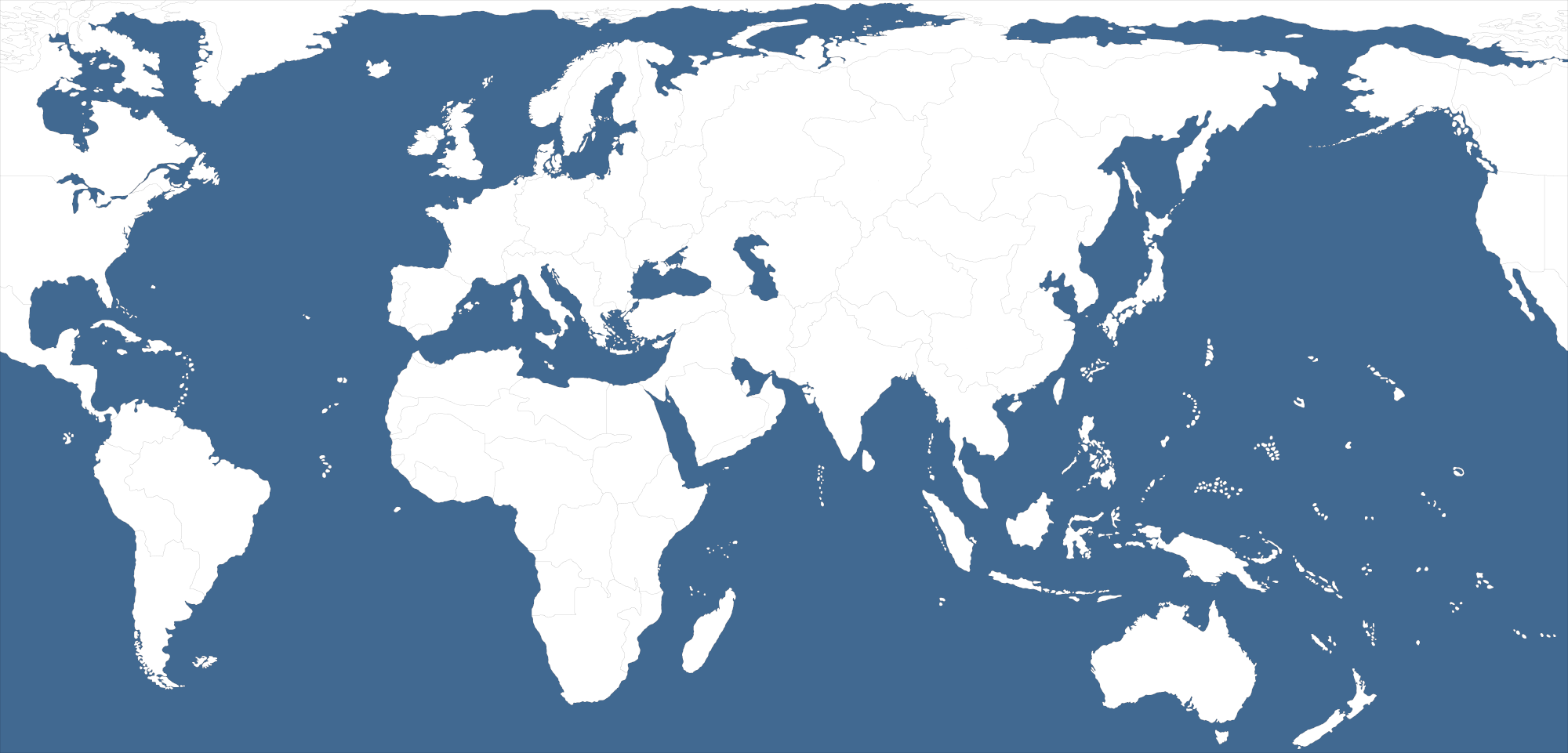
UHD Revised templet

-
Not sure if this seems worthwhile, but I just knocked the larger one down to something more on the scale of Revised. I think the overall dimensions would have to go down from here, the current which is around 5000px but that was for the G40. This would be more for the regular scale boards so I thought 4000px, though I'd have to redraft the base for that. Reason is because units can only go up to like 125% percent, so even with the 54pxers it's just a bit too small units/relative to map size to really work. I think 4000px would probably hold up well though at the 125%
Doesn't have the sz boundaries added yet, just a basic block in, from the contours of the other map.
https://drive.google.com/file/d/1V8gZks8ORy7wW6BYhAmvbCX7FLeo-79l/view?usp=sharing

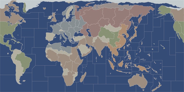
Here the above templet is reduced to 8000px by 4000px
https://drive.google.com/file/d/1q0a9n_u2p05_jmJ9otOyXt2TsCAHcq-t/view?usp=sharing
From this point I will have to use the spotted cow trick to get the baseline back to 1 px throughout, but it's pretty close. Then once the 1 px line is restored at the new scale, I can add the sea zone geometry or added/fewer extraneous tiles from whatever similarly scaled standard map. Some territories can be made slightly more blob-ish to match the more OOB expectations, or where the OOBs maybe have baked-in wonk, but I mean for the basic contours along the coastlines and such, should be pretty serviceable.
ps. Finished the cow trick, just quickly blocking in some sea zones. Got about half way before I hit the wall, but I guess you can see how it might read more generally. Then just do a relief that sorta follows the board conventions for the hex, white border against darker ocean, pastelish hues etc. Use the UHD unit current tints, should work I think to 54px at that scale.

hmmm before I get too far along it might make more sense to use 4000px for v3 and something more like 3000px for Revised. Just thinking about the place at 54px. Issue is that the unit graphics can only upscale 125% so that's sort of a hard ceiling that we can't really go beyond right now. I think it makes sense since current Revised is 2000px and current v3 is actually smaller than that at like 1800px I think. It would make sense to have a UHD Revised scale at 3000px, and a UHD v3 at 4000px, for an upscale I think. Like to keep the unit graphics scale and mapboard scale more in sync. Current UHD global is about 20% larger than the reg global, so that sorta keeps a similar thing in the scale up, except for v3. But that's just cause I made the first one so tiny for 4:3 back when having a 1080p monitor was still a glint in the eye for me. I think for a more upscaled thing I was just ballpark trying to go about twice as tall initially, but units can't zoom-in to 200% the way the map can now, so it's sorta more keyed around the units and their limits I think. 54px tall the current max x 125% can basically ballpark like a 70 by 100px rectangle as the upper limit for them right now.
-
OK I split the difference and went with a base templet 7200px by 3600px
https://drive.google.com/file/d/11nVVagIfzLUqFH423WS0-aIjn9Zve8QK/view?usp=sharing
Using the spotted cow method I grew all the sea zones from UHD G40 and tts from the larger map by 2 px, reduced "shrink selection" by 1px, fill white to restore the base at the new dimensions.
I left the smaller sub divisions on the land and inserted the global sea zone divisions, so they could serve as a templet.
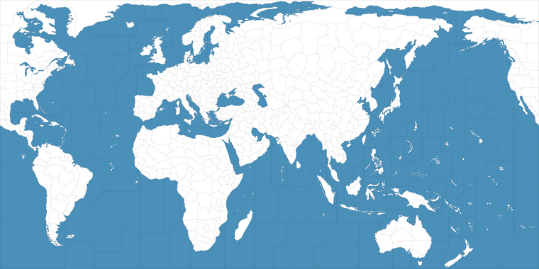
From here we can reduce/erase the subdivisions to create the new map at the scale of Revised or similar, but with a more UHD presentation for the smaller ones to key off the 54 px units/place.
needs the clean up for the blocking, but it'd be different anyway for the smaller things, so I just wanted to get something in the range.
")
-
OK gave it a few more hours.
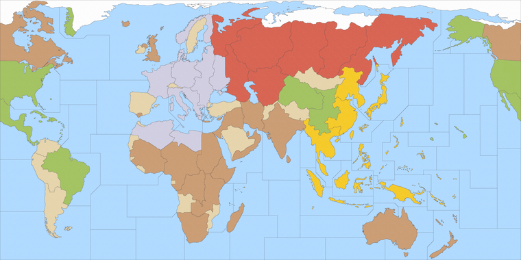
I started from v3 to get something vaguely like this... which is similar to the standard v3, cause my old projection was pretty similar. It had some slides and scales, like to enlarge UK even further stuff like that, but ballpark same deal. I need to rework the v3 sea zones, since I just sorta skipped right ahead, but could upscale that with the same I think. Mostly it's just in the sea zones board to board with a few additions.

Here's the current v3 for comparison, just broad strokes pretty much the same. A few contours here and there that could be blocked in more familiar ways
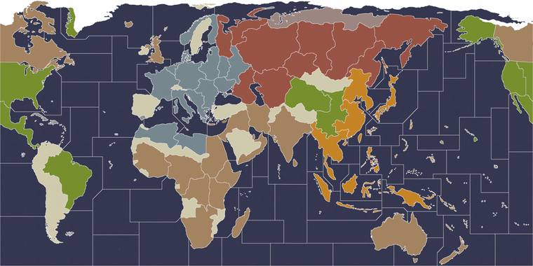
Then working backwards from the new 72x36 version I threw together a Classic and a Revised
I did not double the check the sea zone geometry very carefully here. It was more just to get an impression and I was trying to all 3 at once after midnight, so grains of salt. But again, broad strokes, using some Hexes to differentiate them in the visualization here, might be something like...
V1
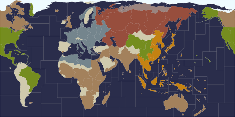
V2
-
took it a little further along
https://drive.google.com/file/d/1n5QJbG1RzhOyqwHe46TLqwwYOdxtNUy8/view?usp=sharing
I think it would need a double check. In there I just threw the base and a quickie relief
I'm just going back over the lines to make sure nothing went weird when I rescaled, like off by 1 px somewhere hehe.
Made a very quick base paintover just to test how it might read when merged together. With the brightest white showing how the highlight would appear like when territory is selected, so normal 50% of that, not quite 100% white the borderline would come out a little more gray. Ocean blue can be whatever, I chose for blends something that would still show the black line pretty readily for a base, here it'd just paintout at 100% but you can sorta see how it might present, going from darker to lighter ocean colors. Or when the hex gets put through a pattern at like 10% opacity. Hex colors could be whatever, I just went with something that seemed to suggest the revised
trying to get something that can also work for v3/v5 so it's in a bit of a hybrid state at the moment
ps. My idea for Malta was to attach the poly to Gibraltar which would be in the same zone. Or to attach crete to greece, rhodes to balkans, cyprus to transjordan (along with the stuff on the trucial coast, aden to somaliland etc). I think it might work alright
-
Hmmm I definitely found a few lines that jumped lol
For the geometry of the sea zone tiles, the goal would be to find something analogous (where the connections are the same.) Also on a physical table maybe like an extra wide king banquet 36x72 that sorta deal hehe.
I think v3 probably makes the more sense to key it that way than revised though, since that one is so small, but I also wanted to get the white border thing working which is always sorta tricky, mainly on account of wanting something that can be blended as well.
If I pass it through a gray instead of white gives different effects, so like to make it more muted, or the sea zone color doing different blues for player preference. Mainly because for revised it's cool to have the dark ocean light sea zone, but other boards like Classic or v3 might look better with the black line, so just trying to get a way to do both from the same sort of templet.
Hello! It looks like you're interested in this conversation, but you don't have an account yet.
Getting fed up of having to scroll through the same posts each visit? When you register for an account, you'll always come back to exactly where you were before, and choose to be notified of new replies (either via email, or push notification). You'll also be able to save bookmarks and upvote posts to show your appreciation to other community members.
With your input, this post could be even better 💗
Register Login