World War I with more territories?
-
Turn Order:
Germany
France
Russia
Austria
Britain
Hejaz
Ottomans
Italy
USA
Victory condition: Capture two enemy capitals.
V3 rules; also;
Purchasable units:
Bedouin 2/2/2 3 IPC (Hejaz Only)
Light infantry 1/3/1 4 IPC (Ottoman/Russian replacement of infantry)
Light artillery 2/3/1 6 IPC (Ottoman/Russian replacement of artillery)
Infantry 2/4/1 6 IPC
Cavalry 2/3/2 8 IPC
Gas 4/0/2 7 IPC, suicidal, can be captured, can attack on its own
Artillery 3/4 8 IPC +1 attack to inf and cav
Fighter 3/4/3 17 IPC
Zeppelin 2/3/5 25 IPC 2-12 bomb
aaGun 0/0/1 10 IPC
Transport 0/0/2 20 IPC
Submarine 3/1/2 12 IPC
Destroyer 2/3/2 16 IPC
Cruiser 3/4/2 21 IPC
Dreadnought 4/5/2 42 IPC, two hits, self-repair.Unpurchasable Units:
Factory: Creates land and air units only. Can be bombed up to 12. Has AA. Enemy cannot use. 1 IPC.
Dockyard: Creates naval units. Cannot be bombed. Enemy cannot use. 1 IPC.
Mine: Same as Axis & Allies 1914. 1/6 chance to hit enemy ships. Cannot be destroyed. 1 IPC.
Bunker: 0/4/0 1 hit. 1 IPC.
Handelskrieg 4/5/2: Spawns 1 sub each round, two hits. Self-repair. Sub abilities. Only Germany has it and only one in the North Atlantic.1 round = 110 days
Round 1: 1 August 1914, Ottomans mobilize at the end of the Ottoman round.
Round 2: 19 December 1914, Ottomans activated.
Round 3: 9 March 1915, Italy mobilizes at the end of the Italian round.
Round 4: 27 June 1915, Italy activated. Bulgaria mobilizes (merges with Austria) at the end of the Austrian round.
Round 5: 15 October 1915, Senussi/Darfur mobilizes (merges with Ottomans) at the end of the Ottoman round. Portugal mobilizes (merges with Britain) at the end of the British round. Northern Greece mobilizes (merges with France) at the end of the French round.
Round 6: 2 February 1916, Hejaz mobilizes at the end of the Hejaz round.
Round 7: 22 May 1916, Hejaz activated. Romania mobilizes (merges with Russia) at the end of the Russian round.
Round 8: 9 September 1916, USA mobilizes at the end of the USA round.
Round 9: 23 December 1916, USA activated.
Round 10: 12 April 1917.
Round 11: 31 July 1917, Southern Greece mobilizes (merge with France) at the end of the French round.
Round 12: 18 November 1917, Russia plays for the last time and leaves the war.
Round 13: 8 March 1918.
Round 14: 26 June 1918.
Round 15: 14 October 1918.
Round 16: 1 February 1919.
Round 17: 22 May 1919.
Round 18: 9 September 1919.Denmark, Netherlands, Albania, and Persia can be attacked by either side at any time.
Britain will have an income penalty that will get reduced and completely removed in round 8, to better represent their first two years:
National objective: Kitchener’s Army
Round 1: -74
Round 2: -65
Round 3: -58
Round 4: -44
Round 5: -37
Round 6: -27
Round 7: -16Here is the USA to represent their mobilization, similar to Britain's:
National objective: War Industries Board
Round 9: -90
Round 10: -80
Round 11: -65
Round 12: -50
Round 13: -35
Round 14: -25
Round 15: -15
Round 16: -10
Round 17: -5Russian penalties will increase until they collapse:
National Objective: Rotten State
Round 1: -60
Round 2: -62
Round 3: -65
Round 4: -70
Round 5: -75
Round 6: -80
Round 7: -85
Round 8: -90
Round 9: -95
Round 10: -105
Round 11: -120
Round 12: -150Russian Revolution: The Central Powers retain whatever Russian territories they hold at the end of the Russian round in round 12. The rest of the Russian territories become impassable. All Russian units are removed from the game.
I do not know if it is possible to implement, but we will see.
Straits: Messina, Constantinople, Suez, Kiel, Gibraltar, Kerch
Normally, subs should be able to pass all of them except Kiel and Suez. But for the sake of simplicity, maybe it is better to make all of them passable for subs.
Mines: Wilhelmshaven, Kiel, Sevastopol, Leningrad, Trieste, Mans, Constantinople, Dardanelles
Factories: Cologne, Munich, Berlin, Königsberg, Breslau, Yaoundé, Paris, Marseille, Bangui, Petrograd, Minsk, Kiev, Yuzovka, Warsaw, Belgrade, Vienna, Budapest, Prague, Sofia, London, Montreal, Lagos, Bombay, Delhi, Mecca, Constantinople, Ankara, Adana, Damascus, Amman, Medina, Mosul, Kufra, Rome, Turin, New York
Dockyards: Hamburg, Stettin, Brest, Marseille, Petrograd, Odessa, Sevastopol, Trieste, Varna, London, Liverpool, Montreal, Bombay, Constantinople, Turin, Rome, New York
-
@Schulz
Search for
equirectangular projection of earth svg free
or europeLoad the one you like into Inkscape as its vector you can scale any part of it easily.
Each TT/SZ and should be able hold 9ish 54px high units at 100% zoom.
Im not a map drawer.
But I would divide Spain, Norway, Sweden & Finland, they are all hard going terrains. -
@Schulz For Turkey the Trans-Jordan territory in the original never made sense to me, I would divide it up into at least Syria and Hejaz territories. Also I think Egypt would do better with Sinai split off.
If you’re looking for names for territories also you can look up maps and name them after cities/major battle sites in that region. This is basically required for countries like Russia that have huge provinces
-
@TheDog Also adding territoryEffects to the map can simulate this further, like mountain territories in Northern Italy/Caucasus. Maybe only a mountaineer unit can have good combat and don’t get debuffs
-
I'm not sure what the best way to split the Ottoman territories is.
Constantinopolis will obviously have both a factory and a dockyard. I'm also thinking about giving both Damascus and Baghdad a factory as well. Splitting Sinai would make defending Suez way too easy, I guess. I would put a few Ottoman infantry units in the Libyan Desert as well to represent the Senussis and make things more interesting.
Arabia could be better off being impassable.
-
The only reason I suggested splitting off Sinai is more to give the Ottomans a bit of early expansion; don't know if that would make Egypt too easy to defend. I like the idea of adding the Senussi front, most people don't know about that and you don't see it in many maps. I agree that central Arabia should be impassable. Though, I wouldn't give the Ottomans too many factories as they were pretty unindustrialized.
-
They need at least one more factory in addition to the one in Constantinopolis to reinforce the fronts. I guess they can get away without the Baghdad factory.
-
Here’s the ideas:
Turn order: Germany, France, Russia, Austria, Britain, Italy, Ottomans, USA.
The Ottomans, Italy, and USA are neutral at the beginning. They cannot purchase new units or move units until they enter the war. They mobilize first and become playable only in the following round. This is intended to help the AI handle them better.For example, Ottoman units are mobilized during their turn in round 1, but the Central Powers player can only control the Ottomans starting in round 2. So:
Italy mobilizes in round 2 but becomes playable only in round 3.
Bulgarian units and territory merge with the Ottomans at the end of their turn in round 3. However, Bulgaria can still be attacked at any time by the bot side. The same applies to Romania, Greece, and Portugal.
Portuguese units and territory merge with the British at the end of their turn in round 4.
Romanian units and territory merge with the Russians at the end of their turn in round 5.
The USA mobilizes in round 6 and becomes playable in round 7.
Greek units and territory merge with the French at the end of their turn in round 8.
Denmark, the Netherlands, Switzerland, Persia, Afghanistan, and Albania are neutral and can be attacked. All other territories (including Pripet Marshes and Inner Arabia) are impassable.
Russian Revolution rule: If the Central Powers control at least 5 Russian territories at the end of the Russian turn, Russia leaves the war and the Central Powers keep those territories. However, these territories exclude the Caucasus and Central Asian territories. So the best outcome for the Central Powers is knocking Russia out of the war while the Ottomans capture as much Caucasus territory as possible.
Otherwise, the rules are almost the same as World War I.
Constantinople, Gibraltar, Suez, and Aden are canals.
The Ottomans will have factories in Constantinople, Ankara, and Syria. They start with a few troops in Senussia, Darfur, and Bukhara.
-
@Schulz What’s the difference between mobilizing and being playable? Like you are placing the units but not setting the players at war yet? Also Switzerland should either have a bunch of neutral units/negative territory effect because I always see the AI attack Switzerland in the original version, it’s unrealistic and should be a poor decision historically
-
Ottoman, Italian, and American territories and units will be represented by neutrals at the beginning. Their territories and units will first be replaced with their respective nations, and they will become playable only in the following round.
Because if Italy only mobilizes and becomes playable in round 3, the Austrian AI would likely leave the Italian front undefended and mess up the balance. Italian units appearing 1 round earlier gives the Austrian AI time to respond.
I agree with the Switzerland issue. It should be defended by at least 6 infantry.
I'm also not sure whether Petersburg or Moscow should be the capital. Germany will have an East Prussia factory, so Moscow would probably be the better capital for gameplay reasons.
-
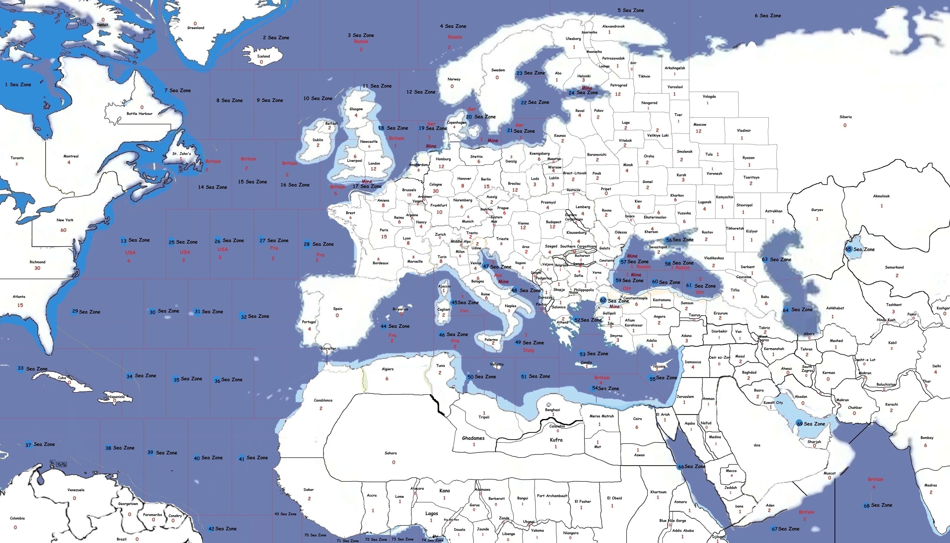
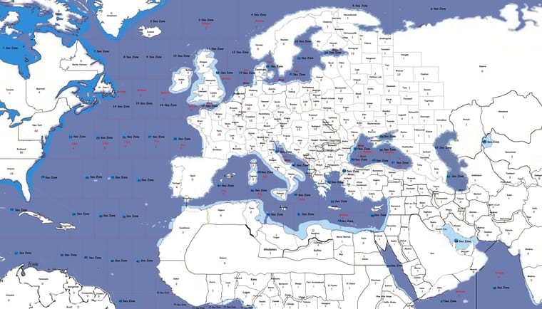
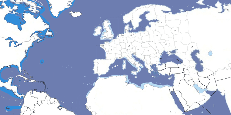
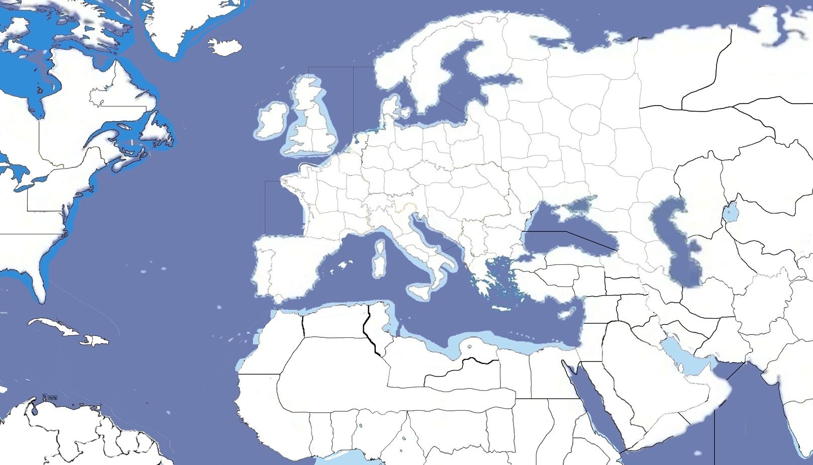
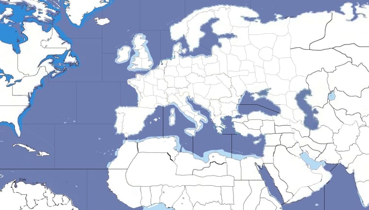
The sea zones.
-
@Schulz
The SZ are huge, not sure the movement of your aircraft, but they might be able to cross the Med and return to say Italy and possibly cross the Atlantic. -
@TheDog One round represents 6 months, so crossing the Atlantic in 1 round makes sense to me.
-
@Schulz I think you’re going to have a problem with setting a time scale because a lot can happen in 6 months, a steamship of the time could easily make multiple Atlantic crossings in one month.
-
@Schulz
Sea, Air movement and Time all are constraining each other and they must be a compromise.In 1941 GCD, time is set at 3 months/turn, but this is only for technology, and as @iratoric says
steamship of the time could easily make multiple Atlantic crossings in one month
1941GCD part answer was ships move faster.
Most Aircraft should move 2-4 TT/SZ, as this works for land, so SZ must fit this.
-
Fighters will be the same as in Axis & Allies 1914.
So the Atlantic shouldn't be crossed in 1 round? The US would join in round 12 if 1 round represents 6 months, and the winner should emerge around round 18. I'm afraid it would be harder to balance the longer the game is supposed to last.
Russia should be strong enough to last at least 12 rounds, but weak enough to collapse over the next few rounds. That doesn't look easy to balance to me.
What about making 1 round = 4 months?
In approximately how many rounds is 1941 GCD supposed to last?
-
@Schulz
The Atlantic should be crossed in 2 rounds, the U-boat need a chance at attacking mid crossing3 or 4 or 6 turns per year but not 2. I would go with 4 turns/seasons per year.
1941 GCD could have been 6 turns/year, but as we got better, settled for 4 turns/year.
GCD usually lasts 18-24ish turns, but it is for solo play.
https://forums.triplea-game.org/tags/thedog
https://forums.triplea-game.org/topic/3741/curated-best-top-maps-triplea-guides -
@Schulz Your math is not right, if one turn is 6 months then the whole war would be 9 turns, US would join turn 6
-
Let's make 1 round = 4 months then.
And here's the new planned sea zones.
What I liked the most is that the Entente can't block the Western Mediterranean anymore by parking in a single sea zone.
Balancing Russia will be tough. Some ideas:
They will get a malus to their income, and that malus gets bigger each round. For example, they get -2 IPC in round 1, -4 in round 2, -6 in round 3, etc. I'm normally not a fan of too many rules, but I can't see how to make it work right now other than something like this. Maybe giving them a very large army but a very low income would balance them.
Another idea is making the rectangle zones German submarine spawn points. Each rectangle will have something like a 25% chance to spawn a submarine each round. With convoy zones, the Atlantic would be more interesting.

-
@Schulz
If there are 4 spawn points, then if I was the Entente, I would swamp each spawn point and shut it down. I would have way more spawn points and not make it obvious that it was a spawn point.Im not a fan of Convoy Zones, they are artifiical. I prefer each SZ is worth 1pu and has ownership flags. But I would say that, as 1941 GCD has this.
Hello! It looks like you're interested in this conversation, but you don't have an account yet.
Getting fed up of having to scroll through the same posts each visit? When you register for an account, you'll always come back to exactly where you were before, and choose to be notified of new replies (either via email, or push notification). You'll also be able to save bookmarks and upvote posts to show your appreciation to other community members.
With your input, this post could be even better 💗
Register Login