Ancient Empires: 222 BC
-
@Name The other nice thing about this is that while you have the detailed topographic layer still in the map... you can get a better feel for where Mountain terrains should be... where things like rivers might want to be natural boundaries for territories.
For example... on your map the divisions in Egypt seem quite arbitrary and the scale of the territories is enormous when compared to Greece. You could make territory divisions that follow the course of the Nile river... crop a great deal of the bottom of the map... and add more smaller territories (sized closer to Greece for all the Egyptian Minors you intend to add.
-
@Name The AI is now updated to be able to purchase 0 move units. Feel free to test it out with the latest pre-release.
-
@Hepps Thanks for all the suggestions. I've started the slow (but somewhat addictive) proccess of painting coasts. Then I'll move to regions and details including much of your method.
-
You could also first find some cool map you can use, then draw the stuff over that one, so that, then, you'll have the relief map mostly done, instead of having to create them from nothing or basic elements. This is what @Frostion does all the time (sometimes he takes actual copyrighted work, asking permission to use it, like I believe in the case of Dragon Wars).
-
@Name I have to agree. Although it is slow... it becomes very addictive once you have made some progress and start to see the results.
-
-
@Name Entirely dependent on how you want them to function. If you want things like major rivers to create choke points... then yes. If you want them just to be sensible territorial division... then no just add it to the relief layer.
-
@Name What I recommend is to look at some of the existing maps that handle rivers and lakes in different ways...
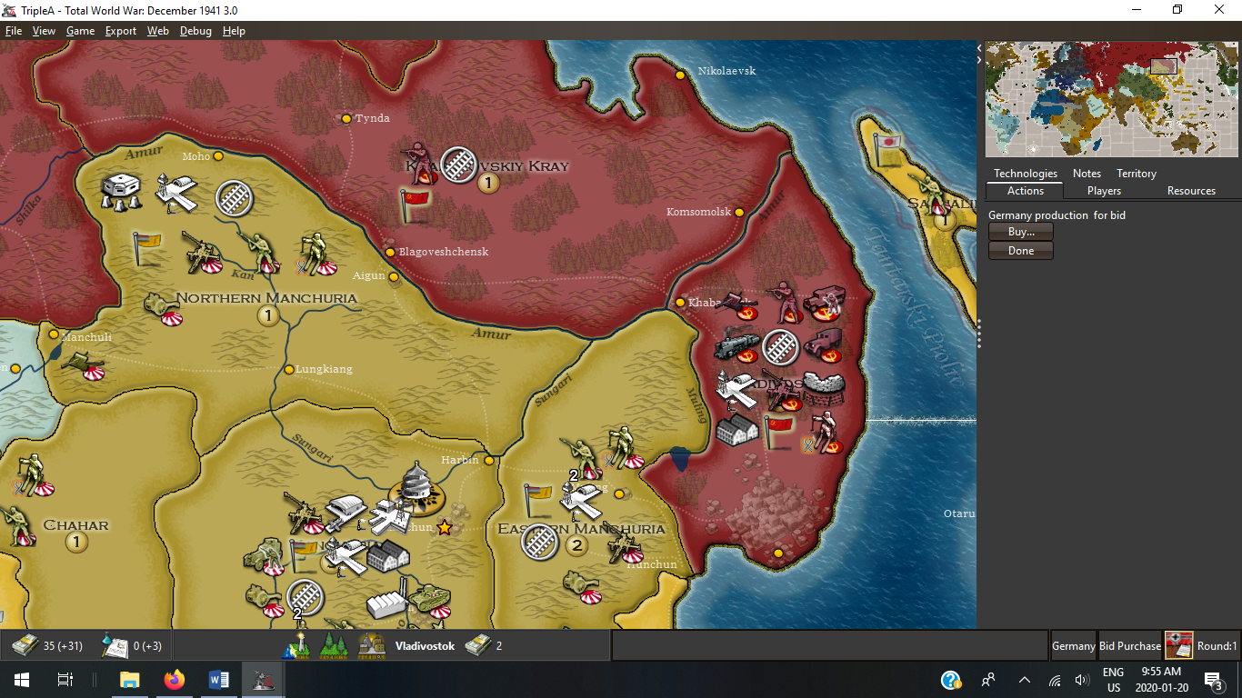
Total World War for instance use rivers as purely decorative but many territorial divisions follow them where actual national boundaries ended up...

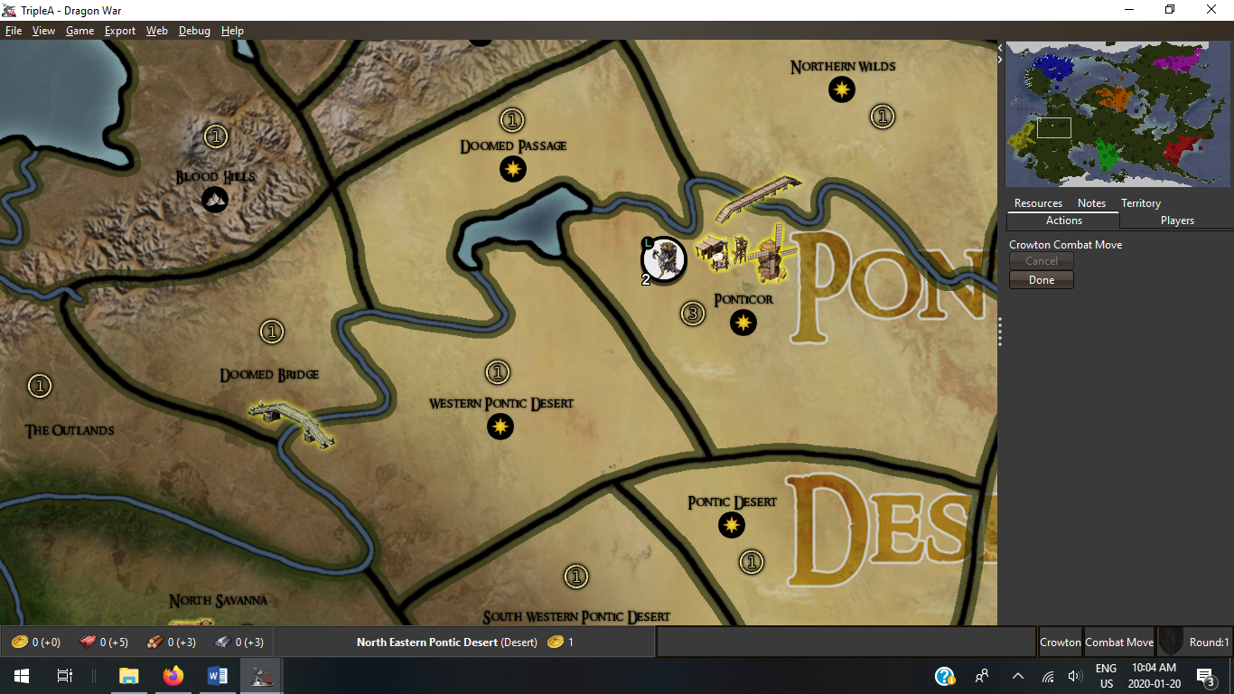
Whereas Dragon War uses them as decorations, but utilizes XML mechanics to limit movement via territorial connection.

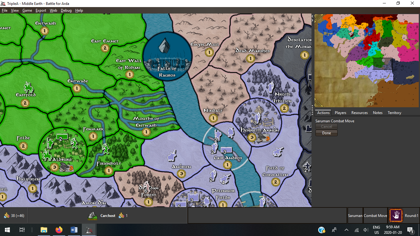
And finally Middle Earth Battle for Arda has them as both. Where Major rivers are actually Sea Zones with crossing points as well as simply decorative features for minor rivers...

There are more exmples... Civil War comes to mind.
At the end of the day you have to decide what you want to include or exclude before you complete the map design. (Unless you want to restart again)

-
@Hepps So far I'm thinking the Nile, Danube, Tigris and Euphrates should be represented, at least as borders, probably not navigable. Then not sure on smaller rivers (or if I should consider more as major ones). Depending on what map artstyle I go for I might include them or just consider them when drawing borders. If there was an attack penalty for river crossing, things would be more interesting. Having a river territory effect now would only make sense if a territory was a river island.
On lakes I'm thinking on equivalent, similar ways.
Anyway I still need many hours of work on coastlines before this matters, till then I'm open to suggestions.
-
@Name Well, you can use canal attachments to simulate some aspects of rivers. For example, you could make it so some units couldn't attack over a canal (only non-combat move over them) by using
canNotMoveThroughDuringCombatMove. But yes, currently you can't have say a attack penalty over them like you can with territory attachments though this is something I'd eventually like to add.You could also create a system like civil war where the rivers are actual territories and you have to build bridges. Then you could have negative isMarine values to simulate lower attack power.
-
@redrum Then I think it makes most sense to add (many) rivers in detail and when/if you add something like this update the map to use it.
-
@Name I believe everything discussed thus far is already achievable.
-
@Hepps I was talking about the penalty when attacking over rivers thing. I'd rather not use canals for rivers, or buildable bridges.
-
@Name Gotcha! I missed one sentence.
-
@Hepps I think I wasn't too clear anyway. But the coastline calls for short replies:p
-
@Name Coastal design is a cruel mistress!
-
@Name But despite her demands... fulfilling her needs feels somehow just right!
-
@Hepps Yeah like 4 or 5 hours of work already and I might be at half of it done? Still feels kind of good to give it attention, and being pushed to improve the map in general:)
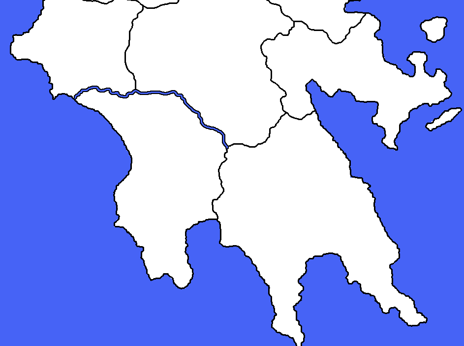
Here's a sample (ignore the dots on the wrong side, I'll mass fix them later).

-
I took a break from the coastline to try some things. What do you think about this style of borders and rivers?

-
@Name So if you have put the river into the base map are you intending to make the connection between the 2 territories impassable?