First time making a map
-
I am not a map-creator myself but "played around" with the tools quite successfully some years ago. Those tools provided with the engine have not changed since that time.
Have you found the "correct" map making information, that is:
First go through
https://github.com/triplea-game/triplea/blob/master/docs/map-making/tutorial/map-and-map-skin-making.mdThen look at
https://github.com/triplea-game/triplea/blob/master/docs/map-making/tutorial/creating-custom-map-xml.mdThen I recommend to excercise the procedures on a small map as suggested by @Cernel before.
Altering a given map of course is easier than creating a map (game) from scratch.At least until the task to create the game.xml-file the first two steps of the TripleA-included Map Creator Tools will help you.
For the XML itself I recommend to look at an XML of a complete map, a map that meets your rules ideas at most could serve as blueprint. Also the XML of POS2 might serve you well.
Then it would be most helpful if you explained at what step of the map making process you got lost. No one can guess where you are stuck, as map making is quite complex.
Good luck

-
@thedog Sorry, yes the transport is a sea transport ship. I was hoping to make cities as separate tiles, and know that I now I need to make my map bigger (maybe 5k px by 4k px? Any suggestions for map size is appreciated.) so I may redraw the map once it's been enlarged. Yes I am on Windows PC.
Then @Panther I will take your ideas/suggestions into consideration. I know it would be easier to take an existing XML and altering it to my map/game then making an XML from scratch.
I appreciate all the help everyone is providing, and I'm sorry if I am vague on any information I may provide.
-
@jackias-revenge
Find the smallest territory on your current map, how many times can you fit a pretend 75x75px unit in it? Lets say you need it 10 times, thats its ideal area, scale up accordingly.If you used a vector program like Inkscape you dont need to redraw the map, just scale it up by x2 x2.5 or even x3, your choice.
If you used a Raster program like Paint.net scaling up might work, but you will have to trim a lot of the territory lines.If you are going to redraw it, you might want to consider using Inkscape it has a trace function for bitmaps and then you scale it as you see fit later.
-
@thedog I downloaded the image from Google then used Paint 3D on my laptop to change it.
-
@jackias-revenge
the image? of what? -
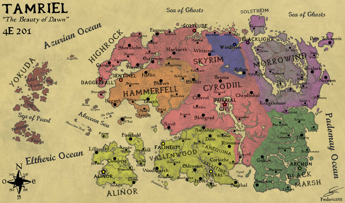
@thedog Here is the original image, I just googled "Map of Skyrim blank" and searched around. As you can see I deleted a lot of islands and got rid of the marshland to the north of Morthal.
-
@jackias-revenge
So thats a raster image and if you scale it up by x3 then the lines are 3 times thicker. It might work with the Polygon grabber and the Connection Finder perhaps someone more knowledgeable than me can advise. -
I would love to see this too. Are you planning on only making the Skyrim province or the entire (Tamriel) world map?
-
Been a hot minute (6 months) since I posted on here I apologize
@qwerty I do hope to eventually move to Tamriel, but want to learn map making with Skyrim first. I do hope to do some full world maps like "The Great War" or the war of the triple alliance during the second era (the war in ESO).
@TheDog after I scale the map up x3 (and the boarders/lines and maybe develop cells for the cities) what would be next on my to do list for map making?
-
For the baseTiles I would use a vector program like Inkscape, as this will allow you to easily resize the your traced map by x3 or x5 etc.
https://inkscape.org/releaseDo not attempt to make the reliefTiles at this stage although tempting you will make mistakes on the baseTiles.
Download a good text editor like
https://notepad-plus-plus.org/downloads/Produce map.properties file by hand (Notepad++) or use Map Creator Tools>Map Properties
Map Utilities
-
Run the Centre Picker (makes centers.txt)
-
Run Polygon grabber (makes polygons.txt, internally TripleA uses this file not baseTiles)
-
Run the Automatic Placement Finder (makes place.txt, for how units are placed in a TT)
-
Run the Tile Image Breaker
-
Build the xml
-
Use vector software like GIMP or paint.net to make the reliefTiles if you are not graphically talented, like me, use inkscape.
https://forums.triplea-game.org/topic/3318/easier-map-making-with-inkscape-reusable-art-assets
-
-
Okay, I will get going on that, one thing I wanted to ask real quick, what changes, if any, do you think I should make to the map (excluding resizing and adding cells for the capital cities)? Should I get rid of the rivers? Should they stay?
-
Decide if you are going for a 4K map, I think you should, so units at a minimum should be 54x54px, round to 60x60px for placement.
This determines the size of a territory (TT)I dont know the fantasy world, but maybe this might be a starting point?
4x4 Capital, hold 16 units without overflow, so 240x240px
3x3 Major Town, hold 9 units without overflow, so 180x180px
2x2 Minor Town
Use some of the rivers to make borders for the territories (TT)Rivers usually are on the reliefTiles and not on the baseTiles.
Defining the above means you can work out the size of a TT and therefore the whole map.
TT should be able to hold 12-16 unit, so armed with the above you can work out.
Guessing your TripleA map dimensions could be 60x60x4=14400px, so use a multiplier of x13 for the above map, rounding that's 15000x9000px as a starting point.
-
Load the png into Inkscape
Trace the map on a layer.
On another layer add the TTs
On another layer add the Capitals, Cities, Towns at the maps widest point. This is to see if the current dimensions work, if not resize. It is very easy with a vector program like Inkscape.If you have not read this before doing any more work.
https://forums.triplea-game.org/topic/3318/easier-map-making-with-inkscape-reusable-art-assets -
Okay, should I resize the map I made or resize the original image? Also, you mentioned that rivers should be on the base tiles instead of relief tiles. What are those? Also, other then resizing the map in Inkscape, what else do I need to do?
-
Resize your traced Inkscape map, in Inkscape. Check that your borders are 1px wide, if not select them all and change the width.
Rivers are usually on the reliefTiles, but you can use the rivers to aid forming the TT border on the baseTiles, but the rivers on the reliefTile might have to be thicker to compensate for the border running down their middle.
baseTiles are white, black and usually a shade of blue for the Sea Zones (SZ) only. (baseTiles folder)
reliefTiles are the pretty/good looking geographical relief tiles. (reliefTiles folder)
To see the difference, pick your favourite good looking map, load it into TripleA, then
View> Show map details> UntickThis will turn off reliefTiles, turn on/Tick to see them again.
-
Ah, I see, thank you for that clarification. I will mess around with the image this afternoon when I get off work or this weekend. I will see if I can't find a good geographical map of skyrim since the map I used was a blank map (unless you just think I should color the map according to the terrain of each hold, i.e. Winterhold and the Pale would be white since they are the snowiest usually, Whiterun would be a shade of yellow because it's plains, etc).
-
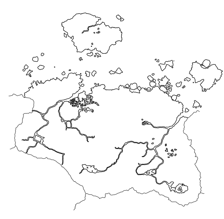
Im certain that you need to trace your map as it will not scale (x13) as its raster based, you a need map to scale.
Winterhold, the Pale, Whiterun etc colours/textures are for the reliefTiles to make them pretty for the human eye, Triple A does not use the reliefTile just displays them.
-
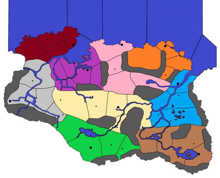
I will work on scaling it up then. You said roughly 15k by 9k px correct? Does this look better for a starting map (prior to both the relief map and base map)? I decided to remove the rivers while keeping the major inlets (next to Windhelm and Solitude) and also keep the lakes (I can get rid of them though if it would be better).
Edit: Feel free to friend me over Discord if it would make it easier then chatting over a forum:
GreenSpartan425#7224 -
Good start to your trace.
I would put the small lakes on the relieTiles, the big lakes/seas should go on the baseTiles as it will probably be a SZ.
Im old school, I dont have a Discord account, so here is fine, also I have time to think about my replies.
-
Okay, so before I trace the map to make the reliefTiles and baseTiles, I just need to get rid of the lakes? Then add the lakes back in for the relief as well as adding the appropriate geographic features (biomes, mountains, etc), then retrace it and add the TT?
Hello! It looks like you're interested in this conversation, but you don't have an account yet.
Getting fed up of having to scroll through the same posts each visit? When you register for an account, you'll always come back to exactly where you were before, and choose to be notified of new replies (either via email, or push notification). You'll also be able to save bookmarks and upvote posts to show your appreciation to other community members.
With your input, this post could be even better 💗
Register Login