Map Display Errors
-
This is for fully tiled maps, map.scrollWrapX=true and map.scrollWrapY=true.
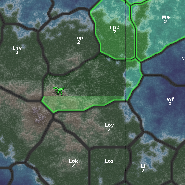
Territories on a fully tiled image can wrap around, thus not constrained to the image border. Maybe this was never tested(?).
The corner territory will appear at the four corners of the map, and is divided into four 'islands', one of which is not drawing. Other border territories also have display anomalies. The territory label and value get hidden by one region but not the mating region, thus partially hidden (sliced). Same with units and their numbers. In the case shown, the entire territory label is missing. There is only one unit, but if there were more, then for this placement the number would be partially hidden.
It looks like display order is the culprit in all cases.
The small-map in top-right corner is a good example of graphically challenged all along right and bottom edge.
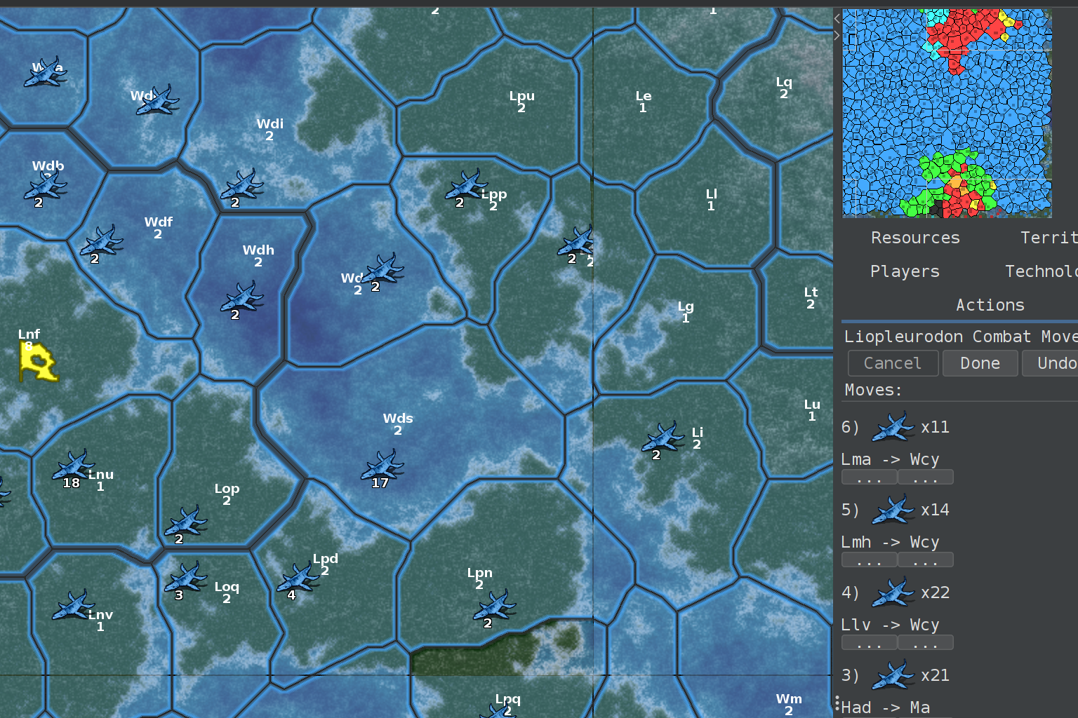
It also shows a unit getting vertically sliced along with the territory label beneath at the map border.
These engine errors can be tested with high repetition rates using CRETACEOUS. New map available here:
https://john.gregorek.com/Games/cretaceous.zip -
Thanks for the discovery. This looks indeed pretty bugged. Could you please report this at https://github.com/triplea-game/triplea/issues? It is easier for us if all bug reports are in one place.
-
-
Off topic, but I'm just curious if you are using some projection allowing wrapping the world on all sides or this is just a fantasy donut-shaped world.
-
Using my own PERL scripts to generate the world as fully tiled, thus donut-world. Scripts create everything from topology to final game map. Previously released here: https://john.gregorek.com/Games/Generic.zip
The README.dat lists the scripts in order of operation and ends with a PERL primer.
Still testing CRETACEOUS, a follow up to JURASSIC. The scripts will get uploaded again. A few additions that will be useful to any map like fading relief-tiles. The primary change is to generic_pl which now produces CRETACEOUS, complete with triggers and other useful examples for anyone to carve up.
The scripts are proving very useful in creating new topology so that the game doesn't get old. The only human part is selecting kingdom locations. A few minutes later and a completely new CRETACEOUS map is made. I am particularly proud of how the bubbler turned out (follows the topology to make the territories).
-
@GREGOREK Sorry again for the off-topic, but why did you go for a donut-world? Since this is about dinosaurs (so our planet), isn't that maybe a bit too much fantasy?
-
@Cernel
The torus environment eliminates 'back wall' defenses and allows more kingdom interactions. The map in this way is infinitely scroll-able. The torus is also an observer point of view that the inhabitants cannot see. Try dragging the map. It's just a continuous land mass with each kingdom at its center. -
@GREGOREK Yah, scrolling both edges sure is cool. I wish this could be possible in an actual (spherical) world (like ours) with some sort of projection, but unfortunately it is not (as far as I know).

Hello! It looks like you're interested in this conversation, but you don't have an account yet.
Getting fed up of having to scroll through the same posts each visit? When you register for an account, you'll always come back to exactly where you were before, and choose to be notified of new replies (either via email, or push notification). You'll also be able to save bookmarks and upvote posts to show your appreciation to other community members.
With your input, this post could be even better 💗
Register Login