Crazy Europe: House of Habsburg
-
@crazyg I like the overall concept. I think the biggest drawbacks are:
- The map image is pretty rough with very thick territory lines.
- Gameplay and the unit set are very simplistic.
Seems like there are some interesting potential concepts around coastal areas and the overall alliances seem pretty interesting.
-
@redrum
The map image itself was designed for a very complex WW1 map, but I decided to publish something much simpler as part of the learning curve (f*ck triggers)The two big cool things of the map are castles and villages. Castles stop 5 enemy units from attacking, which causes a lot of interesting interactions. First of all, you literally have to have 6 units in range to take a castle, which I love. It really helps defenders control more territory through actual defense. It also drastically reduces the amount of times you have to use the battlecalculator.
Villages are interesting two. Especially between Russia and Poland, the early turns have a lot of thought put into taking villages and using them up before my enemy can. I plan to add more villages and make significant changes to the unit set up after more feedback
-
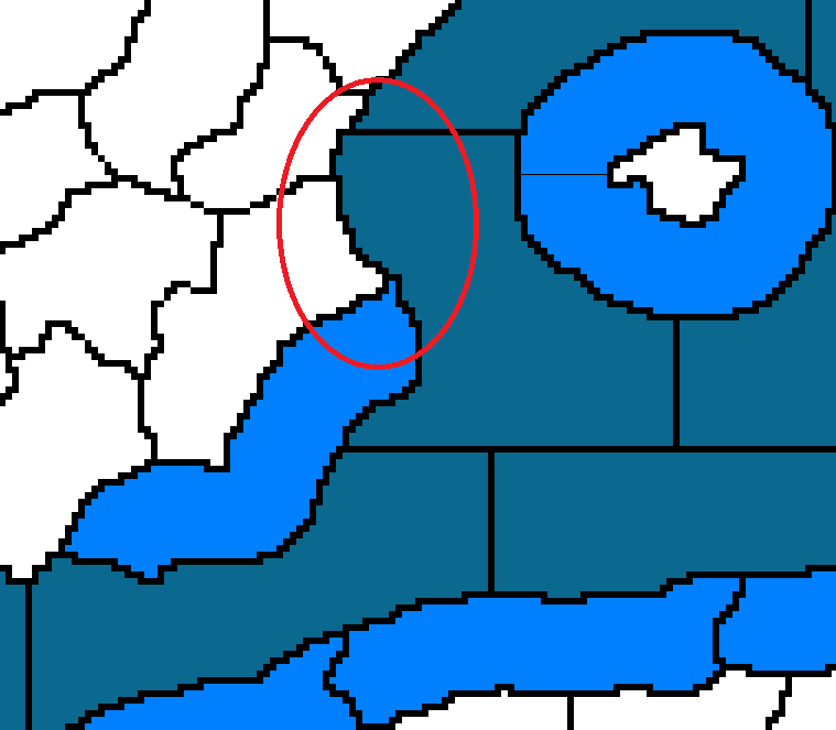
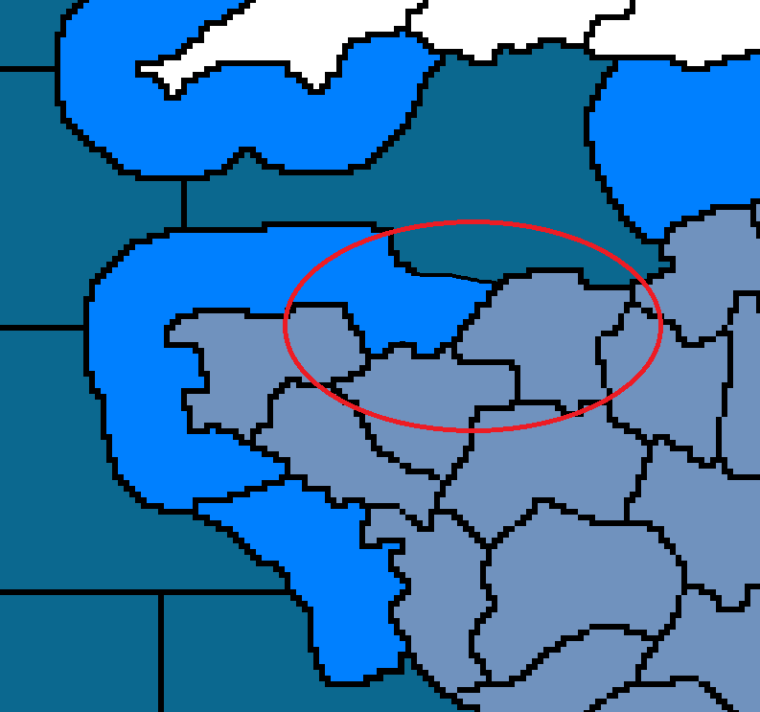
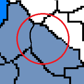
Some planned territory changes. Hepps has expressed interest in assisting me in making this map less ugly.
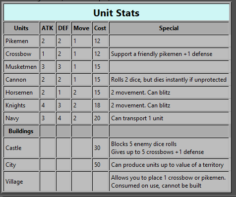
Swedish coast- I want to extend the coastal zone (light blue) so it meets the northern sea zone.
Southern Turkish coast- Combine these two sea zones.
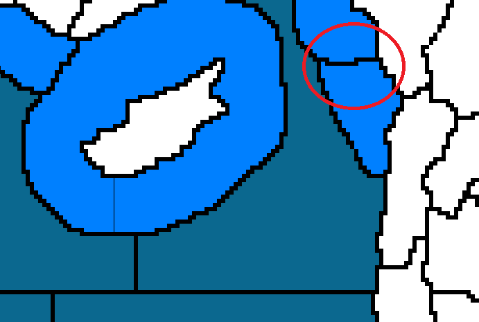
Southern France- combine the two red territories into a single territory. Combine the two orange ones.
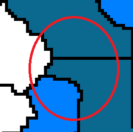
Spanish coast- extend the coastal zone so it meets the northern sea zone. However, it shouldn't connect to that small land territory.
Northern France- extend this coast so that it touches this territory.
Netherlands- I already drew the changes. Extend the coast so it borders the southern most territory of the Netherlands. Slightly redraw so that the Western most territory of Belgium no longer borders the Netherlands.
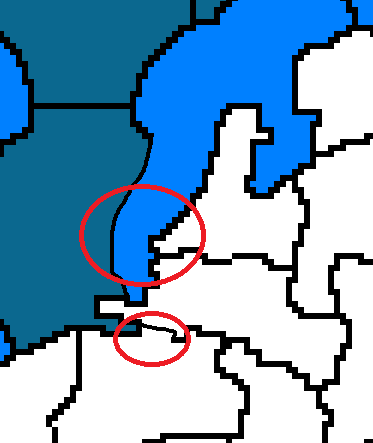
French-Belgian Border- Make this territory larger, so that it bordered the Belgian coast, while the French coastal territory no longer bordered inland Belgium.
This has the four changes within France highlighted, including the two already mentioned. Two new territories in inland France. I have tested a German-French war briefly, currently France can create a strong 4 territory line and hold it easily. I'm confident that adding these two territories will create more a dynamic movement situation.
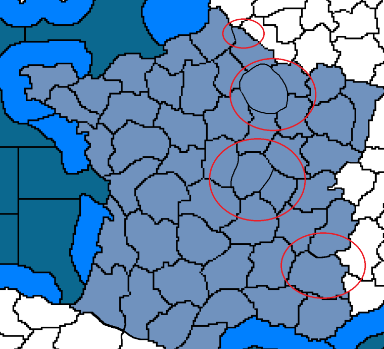
The Baltic Sea- I want the coastal zone in the South to border the sea zone in the East. I did it in the picture by moving the dividing line.
-
@crazyg Ok the process has begun.
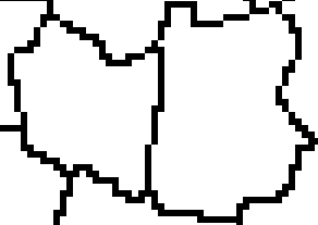
Here is a look at how the base tiles shall change....
BEFORE
AFTER
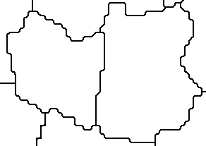
Then after the fact... this will allow for more freedom to make the relief tiles much much better.
-
@crazyg I haven't played yet. But this map is so large, it is saying to me. Need faster units. So some suggestions are.
-
Make all foot soldiers 2 movement.
-
If 2 movement is too much for you. Maybe add horse pulled wagons for foot soldiers which allow them the 2 movement.
-
Make all cavalry at 3 movement.
-
If all cavalry at 3 is too much maybe consider adding a new light cavalry unit which moves at 3. Or make the horsemen, light cavalry, thus moving at 3.
-
Artillery might need a horse drawn version too if you make any increases.
-
On a side note, this would be a great size for a trains maps.
-
-
@Hepps
Looks much better already. Feel free to change the shapes of the territories as well so long as the connections remain the same.- I tried this, its weird.
- I would need art
- I'm fine with testing light cavalry as a 3 move unit. However its really, really powerful in areas like Russia
- See above
- Art. I could borrow art from like Napeoleonic Empires but it wouldn't match. The current art is taken from age of tribes, I'd only add horse artillery if there was an option in that style
- One day I will publish more scenarios for it
-
@crazyg Maybe someone can give you more units in that style if they not too busy.
Light cavalry would still be expensive, (compared to foot) fast but weaker in general, so Russia and others would not simply mass them. And expect good results, I would think. Ah, I see your cost of cavalry is only 3 more than pike or crossbow. That would have to increase if you did it.
I guess once we play it. You will get more feedback.
-
@crazyg Wanted to add that, if this is the early XVII century, Ottomans should have Rhodes and almost all of Crete (Venice holding only on some small outposts), while the Venetians may have the Peloponnese (until 1715).
The one I feel the strongest amongst the renamings I proposed is surely renaming the knights.
-
-
Images the map borders were roughly based on-
https://uk.images.search.yahoo.com/search/images?p=house+of+habsburg&fr=moz35&imgurl=http%3A%2F%2Fwww.emersonkent.com%2Fimages%2Fhabsburg_1547.jpg#id=1&iurl=http%3A%2F%2Fwww.emersonkent.com%2Fimages%2Fhabsburg_1547.jpg&action=click
https://uk.images.search.yahoo.com/images/view;_ylt=AwrWnS816JpaszwAtHdNBQx.;_ylu=X3oDMTIyM3RkZm1uBHNlYwNzcgRzbGsDaW1nBG9pZANhMmMyMDljYzljMjg4OTcwOTE0M2M1NmRhMWE4NWI3ZARncG9zAzEEaXQDYmluZw--?.origin=&back=https%3A%2F%2Fuk.images.search.yahoo.com%2Fsearch%2Fimages%3Fp%3Deurope%2B1550%26fr%3Dmoz35%26fr2%3Dpiv-web%26tab%3Dorganic%26ri%3D1&w=2560&h=1825&imgurl=images4.fanpop.com%2Fimage%2Fphotos%2F20100000%2FEurope-1550-europe-20101490-2560-1825.png&rurl=http%3A%2F%2Fwww.fanpop.com%2Fclubs%2Feurope%2Fimages%2F20101490%2Ftitle%2Feurope-1550-photo&size=4342.9KB&name=<b>Europe<%2Fb>+images+<b>Europe+1550<%2Fb>+HD+wallpaper+and+background+...&p=europe+1550&oid=a2c209cc9c2889709143c56da1a85b7d&fr2=piv-web&fr=moz35&tt=<b>Europe<%2Fb>+images+<b>Europe+1550<%2Fb>+HD+wallpaper+and+background+...&b=0&ni=21&no=1&ts=&tab=organic&sigr=12an0odbp&sigb=134l2pmll&sigi=12i2ishaf&sigt=12712td5i&sign=12712td5i&.crumb=kAhejFGEiY8&fr=moz35&fr2=piv-webYear is 1550 to 1650, I select whatever makes for a more interesting fight
-
@hepps Yes, it is. So, yes, the mention that it ended in 1715 is irrelevant, as that is the XVIII century.
edit: And irrelevant anyways, since that was conquered by Venice at the end of the XVII century. I guess I got a bit confused there.
-
@crazyg Ok; so only Rhodes should be Ottoman, if you want to be strict to the timeline (and, before Ottoman, I think it would be better as Neutral).
-
@cernel I'm giving it to Venice to make that area of the world more interesting. Venice controlled several islands that aren't in the map
-
@crazyg Ok, then, since you surely want to have Cyprus Venetian too, I would just suggest maybe changing the intro to:
"A game based on Europe in the second half of the 16th century."
That would be fine with Cyprus Venetian too (because it wasn't in the 17th century), and would help with having the crossbowmen a bit more around.
Reading the intro as 17th century confused me a bit, making me think in terms of 1601 to 1700, but you did clarify in this post that it was around 1600. -
@crazyg All the map changes you indicated are included.
Just hammering away on cleaning everything else up.
Keep me in the loop if there are any other "moments of clarity".
")
-
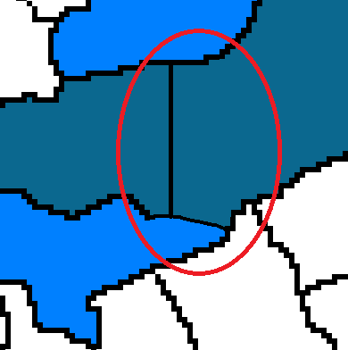
@hepps
As a matter of fact there was
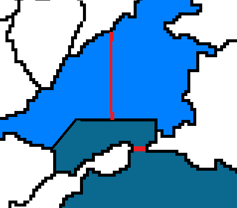
Delete the lines I've put in red. They are pointless, there were only 2 sea zones in the pictureI'm looking at maybe changing something in the Romania-Bulgaria area as well
-
@crazyg On the graphics, regarding the sea zones, a thing I just noticed is that, if you have your sea zones ending in "Sea Zone", then you can avoid having those lines for the sea zones encircling the islands. That is the normal way to handle it (the method you used is a popular workaround, that works too, but looks strange).
Those lines will become more visible if you thin out the actual borders from current (tho, of course, you plan to cover them with the relief). -
@cernel
This is good to know. Would it be possible to extend this feature so that territories beginning with sea zone also apply? I find it really useful to begin with sea zone, as it makes sorting the territories to find all the water very easy. -
@crazyg Uhm, as long as the sea zones are numbered and the land territories are not, as it is usually the case, and it is the case in your map too, I actually prefer it ending in Sea Zone, so that the sea zones (being the only territories starting with numbers) are all listed before anything else, instead of in between of the territories starting with "S".
I see this would be the case in your map too, since the land territories don't start with a number.
Anyways, that would be a feature request, I would agree with, but rather it allowing to set priority without depending at all from the name of the territory, which is still hacky.
So, to answer your question, if I'm not missing some recent changes, as it works now, nope; either you have to follow a hacky fixed engine behaviour or use a hacky workaround.
I already mentioned this matter in:
https://github.com/triplea-game/triplea/issues/1331 -
@crazyg Personally, I'm not big on it, since I tend to think having "10 Sea Zone" is preferable than having "Sea Zone 10". And, if you name it, still I think "Aegean Sea Zone" would sound better than "Sea Zone Aegean Sea".
The only issue I see is only in the case that both land and sea are just numbered (starting with a number), and, in that case, the land and sea territories would end up all mixed up. But this is not your case, as you have "Name Number" for the land territories.
But being obliged to have the name ending in "Sea Zone", to have it deprioritised, is definitely not great, even tho I believe that ending in "Sea Zone" is a good standard itself.
Hello! It looks like you're interested in this conversation, but you don't have an account yet.
Getting fed up of having to scroll through the same posts each visit? When you register for an account, you'll always come back to exactly where you were before, and choose to be notified of new replies (either via email, or push notification). You'll also be able to save bookmarks and upvote posts to show your appreciation to other community members.
With your input, this post could be even better 💗
Register Login