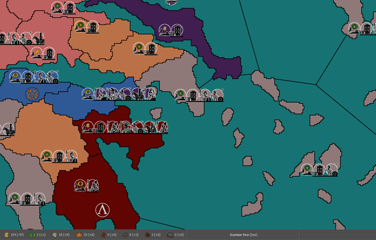
Ancient Empires: 222 BC
-
Experimenting with moving some resources to structures. I'm calling those Agriculture (Supplies), Husbandry (Horses), Metallurgy (Iron/Metal?) and Forestry (Wood). Each structure represents one development level at the respective field and adds 1 per turn to the apropriate resource stockpile. They will be capturable, probably not destructible. I'm also considering giving additional ones to players for free, to place at will each turn, per X of the same type they control (probably a small number).
Are they better to the left or right of governments?
I think I like them more to the right, but would rather have them after garrisons. That would need a gameplay change though, making garrisons isConstruction, thus allowing them to be placed anywhere.
I'm also considering a new unit pricing. In the current, WIP plan, supplies are fuel but not upkeep. They are also payed for advanced governments (urbanization) and the most basic combat unit, skirmishers (simulating a mobilization level that harms food production and allowing wood to be fleet-only, since the AI spammed skirms before it could get fleets)
Here's some basic types:
Phalanx
8 Iron 1 Manpower
Produces Resources each Turn: -1xPUs -1xManpower
Fuel Cost per Movement: 1xSuppliesMerc_Phalanx
16 PUs
Produces Resources each Turn: -2xPUs
Fuel Cost per Movement: 1xSuppliesSkirmishers
5 Supplies 1 Manpower
Produces Resources each Turn: -1xPUs -1xManpower
Fuel Cost per Movement: 1xSupplies -
@Name I like the idea of resource structures for more flexible gameplay mechanics though will warn you that the AI wouldn't understand that.
Not sure the ordering matters that much since aren't you eventually going to have multiple placements in each territory anyways?
I think those unit costs probably make a lot more sense and are easier to think about.
Also, my one visual feedback is that it would be great to see less pixelated territory borders not sure if that is something you are planning to address?
-
@redrum If they stay just capturable, wouldn't the AI handling of them be the same, since it only values PUs when chosing for invasions?
I'm not sure yet on muptiple placements, I kind of like the organized look of the lines (though not when they get too long). Whatever the case, single placements will stay at least for quite a while.
On the border issue, I dislike them as well. But since I still can't do much in Gimp (though such a change should be easy) and most of the map is at an earlier state than what you see here, it's something for later I think.
Btw, if anyone is interested in ancient primary sources, I've found two nice collections:
http://www.attalus.org/index.html
http://classics.mit.edu/Browse/index.html -
@Name Yeah, I meant the AI wouldn't really understand the value of say building additional ones if that were an option. I think it would still try to place ones you gave it for free but probably would just be randomly placed.
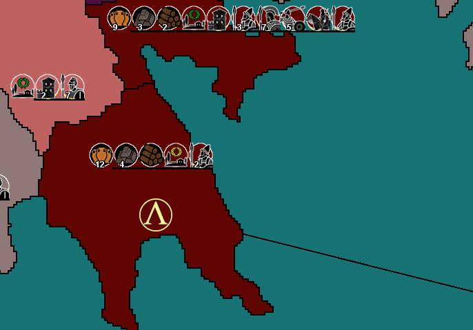
The challenge with single placements and using the line is once you start having multiple different allies in the same territory the number of different units can become 2-3x as many and cause lots of overflow then.
-
@Name said in Ancient Empires: 222 BC:
On the border issue, I dislike them as well. But since I still can't do much in Gimp (though such a change should be easy) and most of the map is at an earlier state than what you see here, it's something for later I think.
Is this something fixible by just making the borders a few pixels wider so they would look "smoother"?
-
@redrum I'll think about the free ones later. For now the issue is, keep those resource structures or not? It's kind of tied to the placements and map look issue as well. But it looks like I'll have to go with muptiple placements anyway at some point. You made me imagine unit lines reaching from Greece to Asia Minor.
@Zaroph But wouldn't redrawing them to be more curved look even better than that?
EDIT: I also thought of an alternative method to keep things AI compatible. What if each development level allows the placement of 1 unit? Then the AI would treat those as factories (and I guess place them at rather safe spots).
-
@Name If the number of resource structures is going to be pretty static then its probably better to just make them territory resources and draw them onto the map. If you plan to have them grow through granting free structures or building them or destroying them then resource structures are better. All depends what your vision is. I personally prefer deeper game play with structures so players can influence resource production beyond just conquering new territories but the AI has limitations there in how much it currently understands.
I think currently the AI only builds 1 factory per territory regardless of the type or how much that factory can build so I don't think it would make a difference.
-
@redrum I was already brainstorming on a system like this:
"Structure" ------ "Cost"------- "Resource Production"
Agriculture-----PUs, Supplies---1 Supplies, 1 Freeman (Basic unit Manpower)
Slave Estates-------PUs---- -----1 PU, 1 Noble (Advanced unit Manpower)
Husbandry-----PUs, Horses-----1 Horse , 1 Noble
Metallurgy------PUs, Iron-------1 Iron, 1 Freeman
Forestry-------PUs, Wood--- ---1 Wood, 1 Freeman
etc..Would be rather interesting to represent population, professions, recruitment capacity and development this way. Also giving a choice of buying units of a type now or gaining more income towards that type some turns later, by buying development instead. Anyway, back to working on the more compatible system.
EDIT: Thinking of it more, I could base my system on that, without the purchase part. Then if at some point it's AI compatible (or with a "rule" choice), those could be buildable. Also, territory PU income could be the sum (or a multiple) of all starting development structures, giving the AI some guidance on places worth to capture.
-
@Name I like the concept. One thing to consider is whether you want to cost to align to what it produces like you kind of have laid out vs the cost to be a different resource than it produces. It mostly comes down to if you want buildings to sort of be a way to invest one type of resource to generate a different one slowly over time (this helps if players have certain resource surpluses vs lacking others) or the way you have it which unless balanced well can lead to just having lots of a single resource (ie. I have lots of horses so I keep building more husbandry to generate even more horses).
And yes the good part about going with some sort of resource structure approach is you could start simple and evolve it over time based on how the game plays and how the AI does.
-
I'm working on the overhault of resources and structures.
RESOURCES
PUs: Unit upkeep, Mercenary/Government purchase.

Nobles: Loyal aristocrats/officials or something. A mix of the previous Authority resource and Special Manpower. Elite unit purchase and upkeep. Garrison/Government purchase.

Freemen: Basic Manpower. Basic unit purchase and upkeep.

Food: Purchase of Skirmishers/Governments and movement (Fuel).

Horses, Metal, Wood, Elephants: Used for the purchase of of Cavalry, (melee type) Infantry, Fleets and War Elephants respectively.


RESOURCE STRUCTURES:
The following are preset on territories and capturable. A few more will be added later. They provide the following income bonusesAgriculture: +1 Food, +1 Freemen.

Husbandry: +1 Horses, +1 Nobles.

Metallurgy: +1 Metal, + Freemen.

Forestry: +1 Wood, +1 Freemen.

Slave Labor (Slavery?): +2 PUs.

Next step is a change of the Government Structures. Some, like Holy Site and Pirate Haven will be converted to special resource structures, so that they can co-exist with real governments (Pirate Haven destroyed on capture). Governments like Client State and Local Autonomy will stay as they are (destroyed on capture), but Government Centers will be overhaulted. Each player will have their version of "native" government center, representing their core regions. Those will be converted to a far lesser version when captured by other players and converted back if recaptured by the original owner.
Not sure yet on what to do with other "governments" like military settlement (+4 freemen), horses pastures (+4 horses) and slave estates (+4 PUs).
Question
Any clue why minimap colors mix with sea regions?
-
@Name said in Ancient Empires: 222 BC:
Question
Any clue why minimap colors mix with sea regions?
I think mostly it has to do with the shrinking process. When you have a giant map (as you do) the mini map gets a little distorted because the rendering has to choose what to colour when it is reduced to (in some areas) 1 pixel. So the mini map has to either render it as part of one territory... or another. Thus there is some distortion depending on the scale difference between the map and the mini.
-
@Hepps Thing is, when I tried a larger minimap (like 400p wide instead of 300), the issue was worse. Or maybe it looked worse because of the extra size? Not sure.
-
@Name Hard to say without looking at it. But as @Hepps mentioned, it mostly has to do with shrinking and having to pick what color for much fewer pixels. The other thing is you can adjust some of the minimap properties to see if that improves things, for really large maps, the unit block size on the minimap is often better as smaller than the default since you have so many units on a large map: https://github.com/triplea-maps/the_pact_of_steel/blob/master/map/map.properties#L100
-
@redrum smallMap.unit.size=1 fixed most of it, looks like it was the units extending into other territories/seas. Now I need to edit smallmap a bit (small white dots revealed theirselves at points), and I guess there's no way for perfect borders at this scale.
-
@Name Those white dots are likely island territories that can only be rendered with 1 pixel.
"A joyous heart sours with the burden of expectation"
Hepster -
@Hepps Most of them yes, but some are also parts of the coastline with one of their dimensions 1 pixel and the other 1 to 3-ish.
-
@Hepps This is why on some designs I over size Island territories so that they will be better rendered on the mini map rather than showing up as a single pixel. I like to call it "artistic discresion".
-
@Name If you open Civil War you will see it suffers from the same issue. If you look closely you will notice that the single pixels in white correspond to the corners of many the diamond shaped territories of the rail system. It is simply something you need to design around while you draw the map.
-
@Hepps Agree. Though usually having islands a bit larger on the main map is also beneficial as otherwise you get like 1 placement and they are easy to miss when looking at it.
-
@redrum Yes... agreed. Having more than only a few pixels to hit with your cursor on the main map is incredibly beneficial from a game-play standpoint.
Hello! It looks like you're interested in this conversation, but you don't have an account yet.
Getting fed up of having to scroll through the same posts each visit? When you register for an account, you'll always come back to exactly where you were before, and choose to be notified of new replies (either via email, or push notification). You'll also be able to save bookmarks and upvote posts to show your appreciation to other community members.
With your input, this post could be even better 💗
Register Login