Map editing software
-
@VonnVary Here is how I have approached map design....
The very first thing I look at is...
-
The number of units I have in my roster.
-
The average number of those units that are going to be in every terr. (there will probably be only a few instances where a territory will have everything).
-
Multiply the average number of units you expect in a territory times the size of the unit... eg. 10 units x (48 pixel x 48 pixel) = the general absolute minimum area you'd want within a territory. Plus add in a couple of pixels high and wide... so if you use 48x 48... put in 50 x 50 for you calculation.
-
Figure out the high end of that scale... eg. you have a total of 14 units per nation.... so you'd want to know how big to make a terr. that is either a Capital or going to see heavy action throughout the game. Remember to factor in Allied nations.... if 2 nations are going to share a territory to hold a front.... think about that because you would then end up with 2 of each of the basic unit types.
-
Draw one of each territory with the appropriate area. Eg. Draw the capital of a nation and the frontline territory for the conflict.
-
Now you can transplant that territory into you map.... If it takes up half the map... its time to rescale the map. If you haven't drawn the map... then you have a great starting point to know how big the map will need to be.
-
-
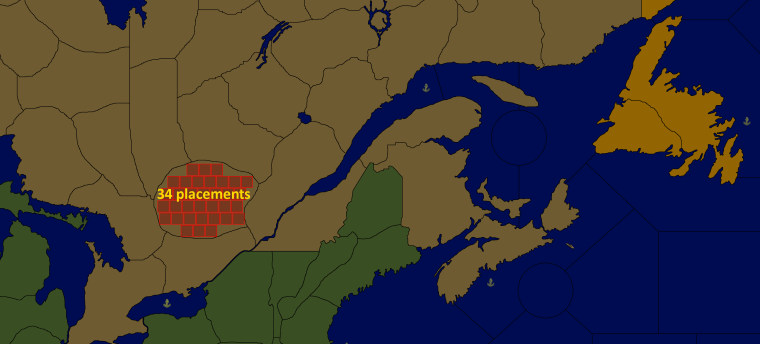
This is how a section of placements look in my not yet playable Iron War Europe map:
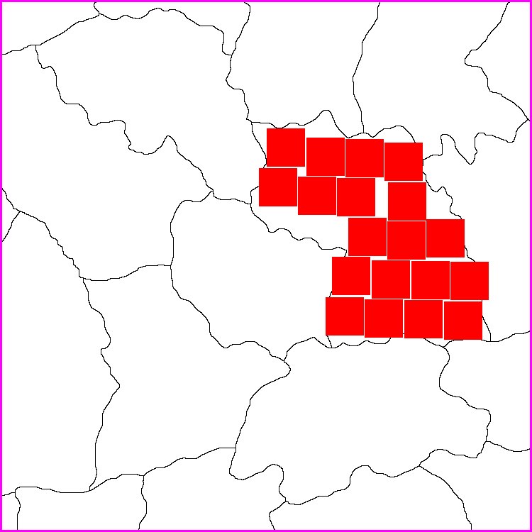
I made the map to be displayed at 100%, also the units at 100%. My units aim to be max 54 pixels high (also 54x54 in map.properties). My experience is that this is the maximum height that still allows units to be displayed in all the windows without being cut in any way.
My map has a lot of unit types, but I don’t make my territories as large as Hepps. On the other hand I don’t want to make them so small that there is no room and unit types would overflow and make that ugly line to the right.
I would advise you to define all the placements manually and not automatically. The result is so much better even if it can take a loooong time to do
") Remember, when making the placements, to save an area of the territory you are working on for last, so that the last placement can be placed in the right side of the territory, so that you have control over where that overflow line is made and that it does not overflowing and cover other units in the same territory.
Remember, when making the placements, to save an area of the territory you are working on for last, so that the last placement can be placed in the right side of the territory, so that you have control over where that overflow line is made and that it does not overflowing and cover other units in the same territory. -
Totally agree with all of that. I was going with just map design without dealing with the next steps... but since Pandora's box is open I will add one more thing about planning your manual placements out.
When you are laying out manual placements.... aiming to leave one of the last placements on the right side of the territory..... also plan to have that last placement as one that will not run straight through the center of the next territory.
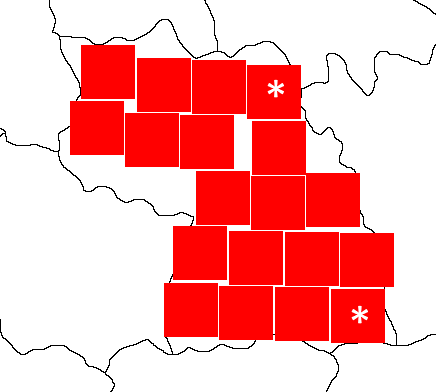
Building on Frostion' example... the two territories marked with the asterix (*) would be ideal choices for a last placement. That way any potential overflow would run through the border of the neighboring territory and allow you to still move units from that neighboring territory without having the overflow blocking a good portion of them.
-
Great tips @Hepps & @Frostion! Since the maximum amount of units I could ever have in each territory is limited to 8 (Infantry, Hepp's Highlander, Artillery, Tank, Factory, AA, Fighter, Bomber) that would mean I should consider each territory to have room for 8 x 54 pixels each. I think that's workable. Like I said the other day I am still working redrawing and scaling the map properly. But perhaps I should be drawing the 3 conflict zones first (Ontario, Quebec & the Maritimes). Again, thanks for the help. I will get back to you guys when I've made some progress.