Keeping areas very realistic in Mercator projection

-
We all know that areas gets bigger and bigger while getting closer to the poles in Mercator Projection which is very unrealistic and unpleasant to see. But it is a necessary thing to keep angles straight. I just though there is a way to scale landmasses more realistically in Mercator.
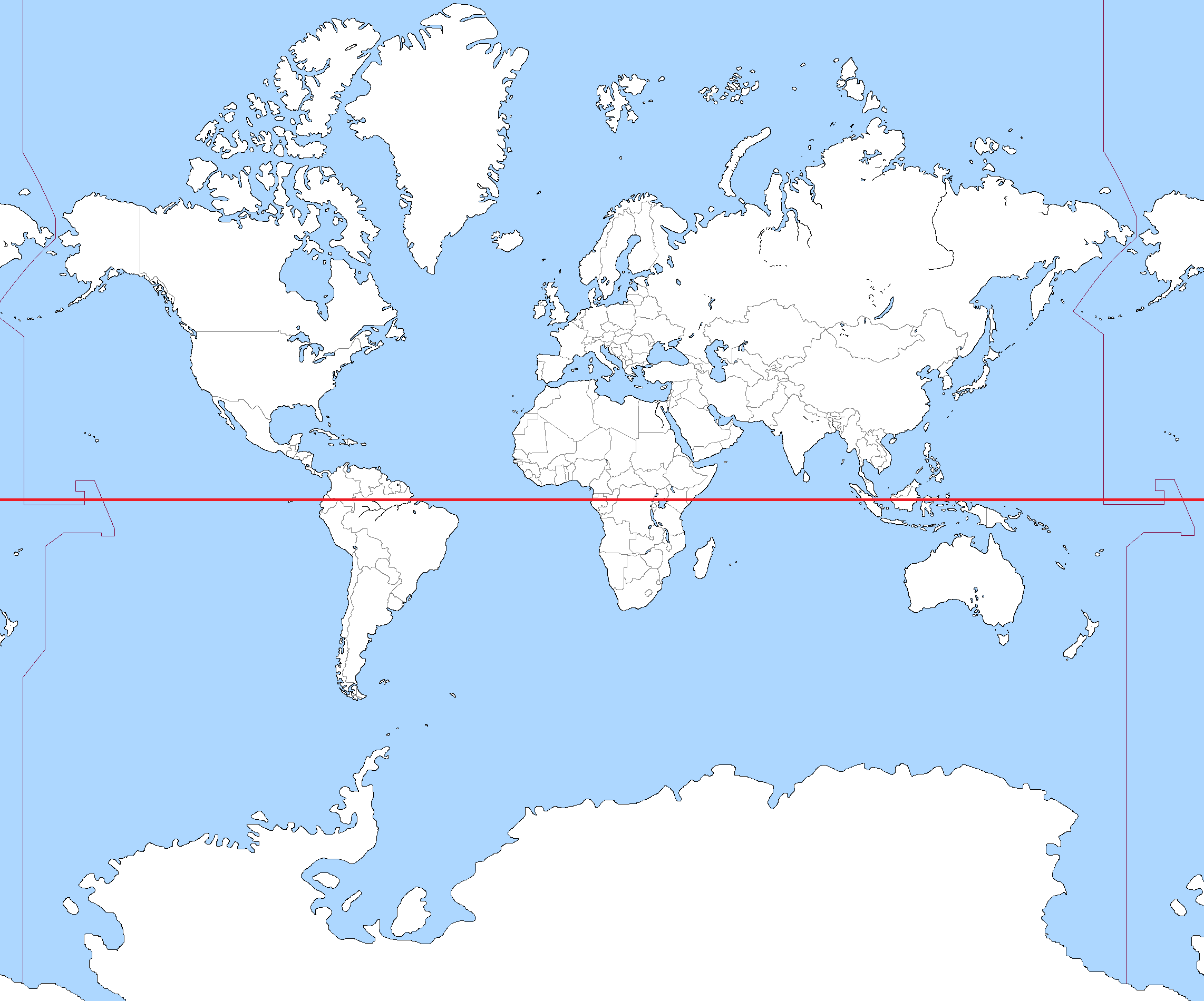
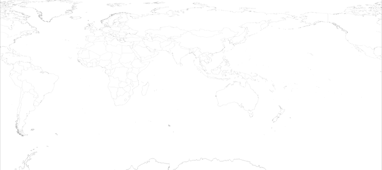
Here is the World map on Mercator. Red line is Equator.
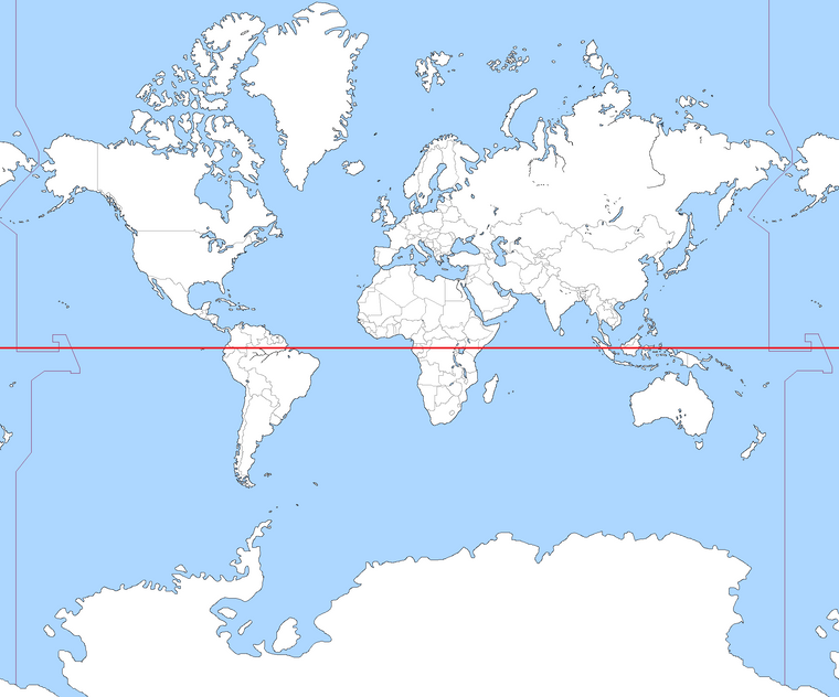
Here is an Alternative World map which Equator Line is moved towards the North.
My question is which line would be the best as hypothetical Equator Line to scale maximum amount of landmasses more realistically? Is there any way to create new World Map based on Mercator and hypothetical Equator line?
-
@anil-yuksel mercator projection isn't very useful for this game since most of the areas of conflict are shrunk and the areas where nothing happens are enlarged i dont think the equator placement has much to do with it
-
@ubernaut I know a distortion is still needed but Mercator is still better than other projections for this task because it enlarges Europe and keeps angles and original land shapes.
-
@anil-yuksel most of the maps are mercator-like but not actually mercator
-
@anil-yuksel If you would make a para-mercator with the equator at +30, like in your second picture, I doubt you would obtain what you are aiming for. That would
- make the +30 the smallest-drawn part of the map, also smaller than all Africa south of it, so you have the most important part of Africa being the smallest one (so very little space for Rommel) and
- make everything south of +30 increasingly bigger, especially making Madagascar, Australia and New Zealand very huge.
However, such escamotage would also reduce the scaling north of +30, with the result that that portion of the map will be somewhere between Mercator and equirectangular, which would help toning down the area distortions within Europe, but I'm not seeing why not just going for equirectangular, instead.
This said, using Mercator set at an arbitrary equatorial latitude so to distort dimensions as preferred is a rather smart idea, but I'm not seeing it related in any way with this topic because this would certainly not "keep angles straight". I would rather pick the latitude I want to blow up in dimensions and have two para-Mercators north and south of it, each having a para-equator equidistant from that latitude.
All in all, if you want to have any sensible degree of geographic realism (especially representing the fact that moving longitudinally is increasingly faster the farther away you are from the equator, which, TripleA-wise, means wider and wider zones), you really must not use the Mercator unless you are fine having increasingly bigger territories the more you go north (like, for example, having much bigger territories around Leningrad than in Caucasus). Moreover, a realistic WW2 map needs to have northern Norway, Murmansk and Archangel as part of it, which means you will have a Scandinavia being much bigger than Italy when Italy is arguably no less important than Scandinavia.
@ubernaut Are they equirectangular, right?
-
@cernel kinda i guess but really the areas that need more space are blown up usually and a lot of the distances for oceans are not correct at all depending on the map.
-
@cernel Currently I am not interesting in to create a World Map, just wondering how would the things looks like with this hypothetical Equator line on Mercator.
-
North Africa is already very big, so the shrinking problem can easily be solved by incorporating more areas from Sahara.
-
Madagascar, Australia and New Zealand would be indeed bigger but these areas can be easily cut and replaced by the defaults ones from Mercator.
-
-
@anil-yuksel You want a Mercator map with latitude +30 being the equator?
-
@cernel Yes.
-
@anil-yuksel said in Keeping areas very realistic in Mercator projection:
@cernel Yes.
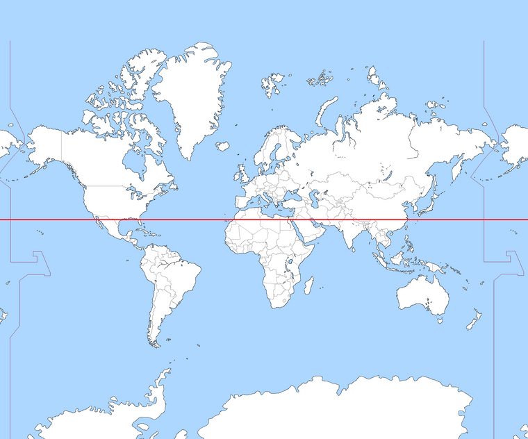
Here it is a Mercator projection made under the assumption that +30 latitude is 0 latitude (the equator) and +90 latitude is +45 latitude (-90 latitude is still -90) while there is a huge empty sea north of +45. As you can see, Australia is relatively very big. I've cut some space north and south.
-
@cernel Thank you. Which program did you use to create it?
-
@anil-yuksel "G.ProjectorWin", from the NASA if I remember correctly.
Here it is a less cut version: it goes up a pixel past the northernmost land border and down till part of Antartica:
-
Slightly off topic, but I thought y'all might enjoy this read: https://www.mapbox.com/blog/adaptive-projections
Hello! It looks like you're interested in this conversation, but you don't have an account yet.
Getting fed up of having to scroll through the same posts each visit? When you register for an account, you'll always come back to exactly where you were before, and choose to be notified of new replies (either via email, or push notification). You'll also be able to save bookmarks and upvote posts to show your appreciation to other community members.
With your input, this post could be even better 💗
Register Login