Proposed Map: Domination 1941
-
@thedog said in Proposed Map: Domination 1941:
@Black_Elk
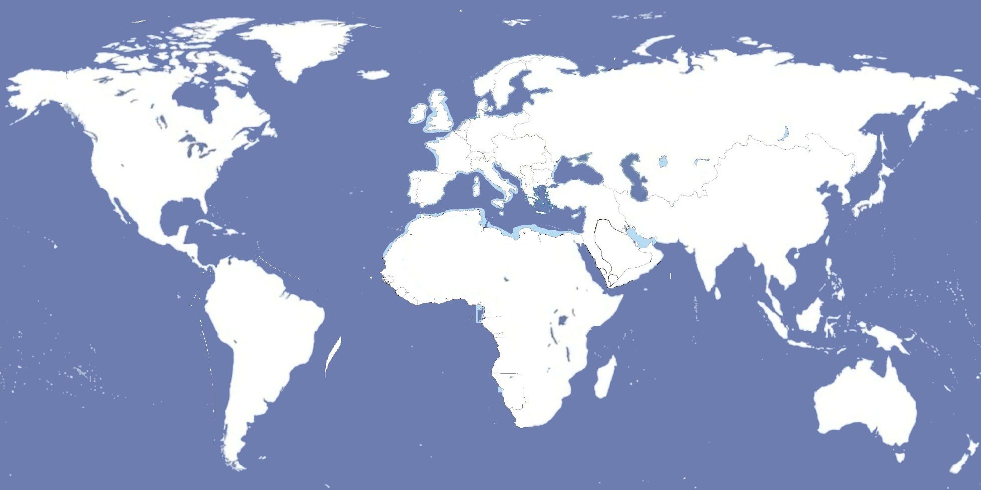
Please look at the map colours for Italy and Britain, on my mini mapl they are not easily distinguishable?Also look at the mini map, Italy owns most of the Horn of Africa and Britain a strip of countries down to South Africa.
.
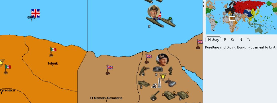
The color scheme there looks like it may still be following the Iron War hex colors. Just from the quick glance around mini map, seems to be the case. Frostion's color scheme works alright in Iron War, the way he did his relief for that, with the details turned on, but wouldn't be my first choice for a new one. I agree it's pretty easy to confuse the Brits and Italians there, also would probably be a bit off for some of the national unit hues we did. I'm partial to the Hex's from the earlier draft map samples myself, since I thought they held up pretty nicely even without a relief. These were the values I used for the earlier paintjobs...
Americans: 026400
ANZAC: 5ba399
British: 9e7035
Chinese: 533c69
Dutch: e77600
French: 0063a5
Germans: 656565
Italians: 6c4513
Japanese: e19521 (Something more orange tinted might work better to match Japan's new units. The color the Italians are using above in that detail you posted might be pretty decent for Japan actually hehe)
Mongolians: a13030
Russians: 940000@thedog said in Proposed Map: Domination 1941:
@Black_Elk
Request for an Oil-Field / Oil Rig / Nodding Donkey/Pump Jack icon.To represent an Oil Field, this is my temporary version

.
In game it looks like this

.
Could you either beautify this one or do another icon to represent the above?On the reliefTiles I think we need to make the Panama & Suez Canals clearer/bigger?
Code-wise these are the canals
Danish Straits     112-113, Juteland & Copenhagen-Denmark
Gibraltar Straits  091 A-092, Gibraltar
Bosporus Strait    100 A-129, Ankara & Istanbul
Dardanelles Strait 099 A-129, Istanbul & Smyrna
Panama Canal       064-089D, Panama
Suez Canal         081-098, Cairo-Egypt & Sinai
How best to represent canals? (Frostion's barriers don't do it for me)
On the reliefTiles we could have a layer with;- On the border of the two SZ we could have a deeper blue dashed or dotted border
- On the land TT we could put light houses like this,
Thoughts?
I'll see what I can cook up for an oil derrick icon
We can look around for a Canal alternative if you're not feeling the Frostion icons. Dashed SZ border sounds good. To me the bollards seemed pretty recognizable, though perhaps some sort of drawbridge motif would be better? Lighthouses make me think more of like cliff rocks and fog horns rather than canals per se. The international symbol for waterways like that is a pair of wavy lines right? Or maybe something like this...?
Also, Happy New Year!
And great work!!! -
@black_elk
I was using Frostions nation colours, now yours are in game and are way more suitable for my eyes.
In the UK we have very detailed walking maps by The Ordnance Survey, their stylized waterways symbols are below;
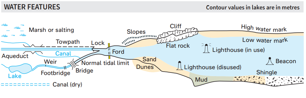
Link to one of OS legend pdf
https://www.ordnancesurvey.co.uk/documents/50k-raster-legend.pdf.
Instead of lighthouse maybe think beacon for the canal entrances.Here are some images for inspiration.
https://www.google.com/search?q=panama+canal+beacons&rlz=1C1CHBF_en-GBGB812GB812&sxsrf=ALiCzsbpxNbWn1i3_7LGIwdZVxjdE4Y_sg:1672565492100&source=lnms&tbm=isch&sa=X&ved=2ahUKEwj6pJSAiKb8AhUTnVwKHQwsBK4Q_AUoAnoECAEQBA&biw=1600&bih=767&dpr=1Happy New Year!
-
Sounds good, I like it! hehe
Here I threw this together right now using that same idea for the icons you had, but just with some color information with images from the wiki instead of bw. Might work alright for a placeholder, till we can make something cooler...

-
@black_elk
That will do nicely!That was quick you must be itching to do more graphic work

-
Hehe right on! We'll have to cook up something for the straits and canals that works for the quick read too. I like the ideas you mentioned. After the holidays I'll lean back in for sure.
Game is looking aces thus far! Have a blast dude -
quick attempt at a tiny lighthouse type icon... I took one from a postage stamp that had a simple design that I thought might double as a beacon. Just isolated the tower, stripped down the colors and added a little light. Might work in combination with something

-
@black_elk
Yes a light house or beacon like that would be fab!As this icon represents land TT ownership, it needs to be placed on the land or touching the land TT at an obvious point.
As the SZ dots/dashes will be on the reliefTiles, I too think we should put the Beacon/Lighthouse directly on the reliefTiles, so not as a decoration, what do you think?
-
Ok here it is with those icons added to relief in case you want to try it out and see if the display holds up.
https://www.dropbox.com/s/wkn989vmfic4qy3/Domination 1941 relief 25 opacity lighthouses.png?dl=0
If we need more than that we can probably add a symbol or dashed line in blue like you mentioned, but least it gets the ball rolling hehe
-
@black_elk
Another request, this time for flags.
Lets use the correct aspect ratio for flags?
https://en.wikipedia.org/wiki/List_of_aspect_ratios_of_national_flagsSo for my map, I would like the following;
16px _small used in History and Tech table
32px, Bottom right-current players turn, politics panel
54px _large & _convoy for Sea Zone ownership
For the following nations
Australia, Britain, China, Germany, Italy, Japan, USA, USSRwhere Australian flag will be used for the Pacific Allies
If you wanted to do a buoy for SZ ownership then please use the 32px flag with the buoy underneath as the flag pole.
If you wanted to do all the nations for the "Global" maps then be aware they should only be used on 4K screens as 1920x1080 is not wide enough without the screens looking squashed/crowded, the flags are better left as square.
For reference my map, 1941 Global Command Decision only has 8 nations/players, not the usual 16+.
-
Just to confirm you want to the height at 54/32/16 and the width to hold the historical aspect ratio? Those would be the larger sized banners I made included in the unit sticker at 68 tall there. Here they are reduced to 54px and the smaller sizes, shown all together...


Doing the variable aspect some nation's will appear rather larger than others, like USSR or the UK with wider banners. I forgot France below, but it's basically in the same aspect ratio as Italy and Japan at these scales. German flag is made up, but it's at 3:5. Let me know if that's what you meant for the sizing or something else?

-
@black_elk
So quick!
Copied the US ones, they look perfect in every way, just like Mary Poppins.I will put them in game to see the whole effect.
Thanks!
-
-
@black_elk Is there a version of this without the country colours, but has the labels?
-
@ctj13
Check out this map, it has territory labels, not sure what you mean about the country colours.UHD World War II Global
https://forums.triplea-game.org/topic/3458/uhd-world-war-ii-global?page=1 -
Hi @ctj13
The Territory labels are in the "misc" folder. The Player colors are in "map.properties".
Go to "downloadedMaps" in your triplea folder and open the map you want.
Then open the "map" folder and you will see the above misc and map.properties folders.
Ahh ... this is for Domination 1941. Yea Idk about it but as Dog mentioned above, UHD will probably work as it's basically same time frame.
Edit
You also need to have a "decorations" text which tells triplea where to put the names. Use UHD as a guide. Let us know if you have any trouble. -
@beelee Thanks!!!
-
 T TheDog referenced this topic
-
I have a 9800 px wide draft map with more realistic land shapes, while Europe is enlarged enough to fit more units (ignore the WW1 borders). If the project is still alive, we can work on this.
-
@Schulz
Been a while. If you want to use this threads map you are welcome to use it. It is used in 1941 Global Command Decision, but be aware it has nearly 800 locations so is probably best for solo play.
")
Hello! It looks like you're interested in this conversation, but you don't have an account yet.
Getting fed up of having to scroll through the same posts each visit? When you register for an account, you'll always come back to exactly where you were before, and choose to be notified of new replies (either via email, or push notification). You'll also be able to save bookmarks and upvote posts to show your appreciation to other community members.
With your input, this post could be even better 💗
Register Login