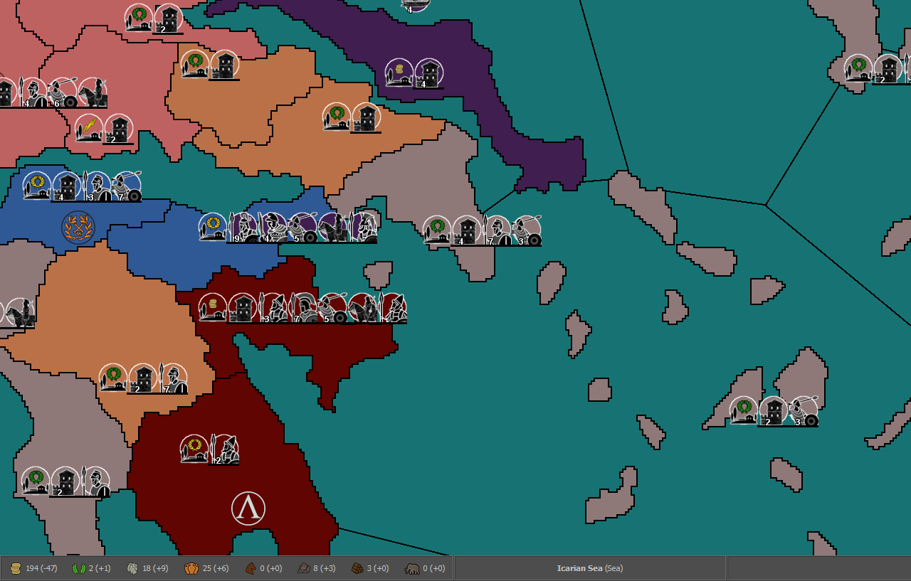
Ancient Empires: 222 BC
-
@Name The biggest issue is playability.
A severely small or thin territory is a nightmare from a gameplay standpoint because...
If you are trying to move into it... hitting it with your cursor can be very tedious and frustrating.
Trying to click on a very small or thin territory inorder to select all units is the same.
This problematic issue is compounded further if you intend your map to be played at a dramatically zoomed out view.
-
@Hepps Yeah that is out of the question already. I just threw around the idea to generate discussion on possibilities of the use of rivers. I'd only use something similar with much thicker river territories.
-
@redrum I think you accidentally edited my post instead of yours.
-
@Name Indeed. Reverted that
") My bad here is my post:
My bad here is my post:So the way the connection finder works is it searches a certain number of pixels away from a territory for other "adjacent" territories. And then if enough pixels of another territory are found then it considers it adjacent and adds a connection. You can adjust the distance it searches to try to handle different border widths (think your original wider borders vs the thinner ones you have now). But a larger distance means it might find incorrect connections especially around territories that say come together at like 4 corners. You can always manually adjust these or manually do all connections but it is fairly time consuming for a large map.
Territories with multiple parts are group together into a polygon definition: https://github.com/triplea-game/triplea/wiki/Map-and-Map-Skin-Making#413-polygon-grabber
You could use the thin rivers just for naming though it would probably be better to instead just write the names like TWW does in the relief tiles on the map itself as hovering over the 3 pixel river is going to be challenging anyways though you could do both.
-
@Name Here is a possible solution...
Add a circle (big enough to be clickable at any zoom)
Manually add the placements to ensure they fall along the river avoiding the circle so that it is easily clicked on.
Add some kind of colouration or detail to the relief layer to clearly indicate which units are in the river territory.
-
@redrum I'll think about it. Both ways have pros and cons and none seems clearly better or bad.
The way you present it made me realise that besides being challenging, hovering over the river won't display adjacent territory names if it is a relief, since that 3 pixel area would be a border on the original map. However now river borders might be in territories, so some black pixels will display territory names while others not. Plus I need to be carefull to exactly match borders and rivers. Quite small issues though. On the other hand not using them as reliefs has the extra connection work.
@Hepps It's interesting in this (show)case but still I don't think I'll use that feature. Some rivers will be too long for it to visibly make sense. Not sure it's a good idea to include a semi-confusing system and having to split the Danube in 20 or 30 territories.
-
@Name said in Ancient Empires: 222 BC:
@Hepps Auto connection finder? I've been adding those manually in the XML.
Wow!:face_with_open_mouth:
My suggestion, run it at 2 pixels more than your boders' wideness, so you'll have no missing connections, then just manually remove those in the crossed borders, if you have any (usually those are only on sea-to-land borders, in the traditional maps).
-
How about just doing it like in Lord of the Rings? Also, on a map of these dimensions, you may want to allow ships to go into the big rivers.
I'm not sure how can it be justified not being able to walk over the Dardanelles/Bosporus, in the moment they are not really wider than what big rivers like the Danube or the Dnepr get to. Just talking from a realism stand point; not saying the map has to be realistic, unless wanted.
-
@Cernel I'll consider those. By LOTR you mean the Battle for Arda map or another one, and you mean make rivers like they did?
-
@Name said in Ancient Empires: 222 BC:
@Cernel I'll consider those. By LOTR you mean the Battle for Arda map or another one, and you mean make rivers like they did?
I was actually talking about "Lord of the Rings: Middle Earth", but it applies to that one too.
-
I'm almost done with the coastlines. So since I was led to take designing the map more seriously and take my time, I'm considering to add things I intended to skip, like canals and navigable rivers. Any additional gameplay considerations related to those, keeping in mind the large map size, territory count, often extensive river length etc?
-
@Name Canals? Isn't the only canal the Suez canal (to use modern naming)?
I thought sometimes adding the Suez Canal to 270BC, since it was made shortly before, but that's really too unimportant.
-
@Name I think we've mentioned the ones I can think of. The biggest thing to understand is that you can adjust lots of things visually in relief tiles or from a gameplay perspective in the XML but the base tiles determine the "clickable area" and lead to area you have for placements so those 2 things are difficult to update once you've started building your map on top of it. So making sure things are large enough to easily click on for movement and have enough space for the proper amount of placements tends to be the key, most other things there are ways to adjust without having to change base tiles.
The only other thing is as you start thinking about drawing the territories, is try to generally avoid corners of territories coming together as it often makes it unclear if they are connected.
-
@Cernel I mean canal attachments, wouldn't that be the best way to do things like Dardanelles/Bosporus? I think something similar to Suez was active during a part of the Ptolemaic reign in Egypt, connecting Red Sea to the Nile, and through it to the Mediterranean. I'll search for details.
-
@Name If you are considering having sea canals, like Suez, for the Dardanelles/Bosporus, I believe that makes no sense. Only in late medieval, with very big cannons, was possible partially to do something like that. On the other hand, if you are planning making rivers, then maybe those might be closed, but probably not the very big ones. Practically, it needs to be small enough for a boom.
-
@Cernel I haven't looked much into their function yet, but aren't canal attachments the way to have units cross a territory only under conditions? I also thought you were suggesting that for the Dardanelles/Bosporus in a previous post, but might have misunderstood you.
-
@Name No I meant walking over the sea, since those straits are about as wide as a big river, at their narrowest points, since you said that all rivers would be walkable.
-
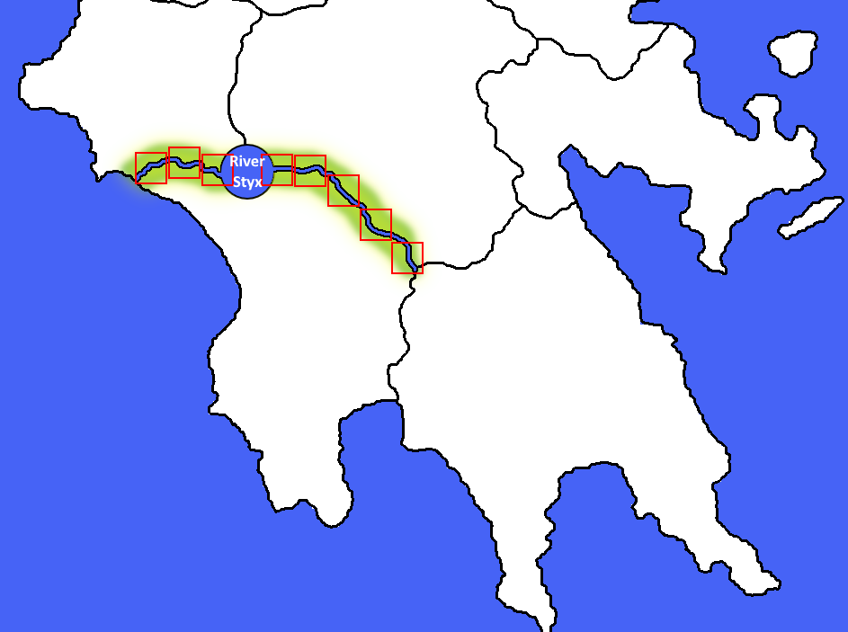
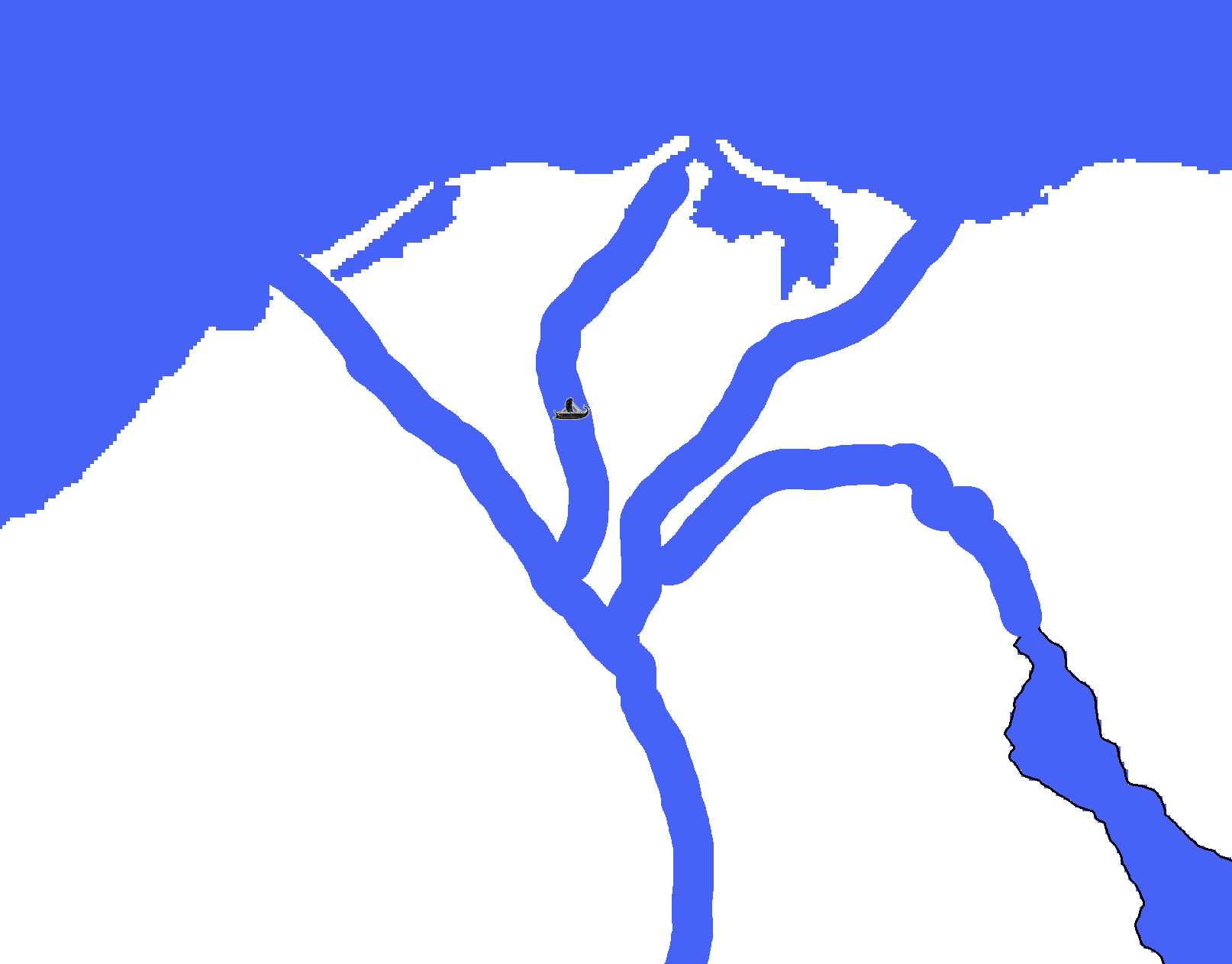
@Cernel Ok. I'm actually currently testing related things, and from an aesthetics point of view navigable/non-crossable rivers might be a bad idea.
Check the Nile delta. I need at least this thickness for gameplay reasons, but I don't think I'll like the looks.
-
@Name Yeah full sized rivers can be a challenge to fit into a map. Especially from an aesthetic standpoint.
-
@Name In my map Dragon War map rivers were just un-passable borders, some of them with decorative bridges that made them passable (had connections). They were not actual territories, just borders between territories drawn with a distinct blue color. But the system is kind of strange when air units show up, as they also have to cross by bridges.
It’s perhaps possible to make crossing connections with limited and customized access, where only air units can cross, but I have not explored this possibility.
I imagine that your map could also make similar use of this option, like if big heavy units (Elephants? War wagons?) could not cross a river, but the lightest infantry had no problem getting over.
Does this option exist? Could someone find and maybe copy/paste an example code into this thread?
Hello! It looks like you're interested in this conversation, but you don't have an account yet.
Getting fed up of having to scroll through the same posts each visit? When you register for an account, you'll always come back to exactly where you were before, and choose to be notified of new replies (either via email, or push notification). You'll also be able to save bookmarks and upvote posts to show your appreciation to other community members.
With your input, this post could be even better 💗
Register Login