💥 1941 Global Command Decision - Official Thread
-
@black_elk said in
 1941 Global Command Decision - Official Thread:
3 on land, 2 at sea, 1 in the air
Yes, 321 produces a different style of play, encouraging you to over commit to ensure a victory in a turn. It also allows battle fronts to hold, like Kursk if you dont have enough to punch through in 3 rounds, you weaken your forces and can be counter attacked, I think more realistic and less like Risk. It does take a bit of getting used to.
-
Yeah quite different I'd say lol. I'd guess this is the principle motivator behind wanting to limit the stack sizes? Cause clearing a large force in just 2 or 3 combat rounds can be a pretty tall order, and clearing a smaller force can sometimes be even more difficult. By smaller I mean engagements where there are only a couple hitpoints involved on either side.
Just as a quick example, in A&A attacking with 2 inf units vs 1 inf unit defending is fairly reliable, roughly 70% odds to the attacker. Like I'd almost always run that attack in A&A. But with a battle round limit those odds drop dramatically, pushing it well out of range, even for peeps who aren't particularly risk averse I'd wager heheh. Other similar battles, small engagements with fewer units that are more high risk/high reward, would be off the table for me under such a scheme.
This is different enough from standard expectations that I'd maybe put it among the top lines in the notes, like as a scenario defining feature. Also to help highlight and explain how it's meant to work. Though I'll admit I'm not sure where I fall on this one really, since it breaks my mental math pretty hard lol.
I get the rationale, like probably nobody enjoys a battle that just drags forever waiting on a single infantry unit to stop shooting duds hehe. I think Iron War had a limit as well right? I think it was 10 combat rounds there, though I'm struggling to recall might have been 6. But the dynamic was that after the round limit, the attacking units became like frozen in the TT, and treated like defenders on the opponent's follow up turn. This worked reasonably well I guess, though sometimes it'd throw me. A human would just withdraw after 9 battle rounds I'd suppose and throw in the towel, though the machine would often just hit the limit since I don't think it knows what to do there.
My initial thought is that 3, 2, 1 a bit brief, and I might enjoy something more like 6-4-2, but then I am curious so don't want to judge too quickly. It's a novel dynamic. I think I could get into it as a feature of the air game for sure, since it's not too dissimilar from the escort/intercept or sub opening strike type situation. Or perhaps if the limit was the same across types, like I don't know capped at 5 battle rounds or something so it's not quite as extreme? Well anyhow, it was sorta my main hangup for the second round of starters. I've mostly just been trying the first 2 game rounds and then restarting, so I really haven't seen USA2 yet hehe.
Oh one other thing I noticed, just cause I've tooling around with the battle calc a fair bit. I think the situation where G inf are trained or elite but Soviet are conscripts 1-1-1 or elite on G1 can be confusing. When I pull up the calc Russian Trained-Inf don't appear, so it's kinda hard to parse at a glance. I think having an example on the board of every unit type available on the round 1 purchase is helpful for the player. So that basically the player can parse what the opponent has at their disposal, based on comparison with the player's own unit roster. But where the units are different (cost/abilities) of the same type, to me this can make the map hard to read at a glance. I think in this situation giving the Soviets some regular infantry for parity might work, so the player can see that there's a difference between the conscripts and the reg inf. I haven't played LL at all yet, since it's not my favorite mode, but even there I find conscripts make it challenging for me to count pips in my head since I'm so used to 1-2-1 lol.
In this game baseline Inf (trained) is A1, D2, M1, Cost 4. So similar for the attack/defense count, but different for the TUV calculus. This is fine for me. Conscripts are 1-1-1 cost 3 (USSR/China exclusive right?) Elites are 2-2-1 cost 5, so in my head I think of them as like A&A naked artillery and that sorta works in for me in my head. Anyhow, the challenging part is running through the G inf vs R conscripts, since the main fodder pip is different by sides there, which is kinda tricky for me. Anyhow that's where I'm at. Power's back up. Still having fun! -
Ps. Tooled around with the UI themes, I didn't even know that feature existed! I've been using Substance Graphite I guess, for years lol
Odd the upvote feature doesn't seem to be working properly today for this thread. I tried to up vote your post above but it was showing as a -1 for some reason. Weird.
I like the Tunisian stronghold idea. I always thought a factory in Algeria or Libya would be a cool idea for A&A, as a way to anchor the fighting in N. Africa. Especially since in a lot of WW2 games, G has a strong incentive to abandon the N. African theater to focus on Russia, and the Allies often have such a strong incentive to go north to Scandinavia that the theater kinda gets short shrift.
I dig the idea of Germany having some skin in the game in the region, and not necessarily needing transports to funnel units there, so the Tunisia idea definitely works for me. Though my suspicions were that if I doubled back then the Italians might fold hehe.
I think giving the French overseas territory to Germany would work for this start date, basically treating Vichy as Axis. Like everything except French Equatorial Africa could work, Syria and Madagascar and such, though I'd probably leave them empty of units. I think this would motivate the British player to conquer those TTs over other similar neutrals , which would be kinda thematic for the period.
I'd just do de Gaulle in Gabon and FEA as British units maybe to highlight the split after the fall of France. But anyhow, for the N. African territories that declared for Vichy, I think you could put a German garrison there and a starting base to help jumpstart the action and it'd seem pretty reasonable. Cause otherwise it's a 3 round delay to get going. 1 round to take the neutral TT, and then another round to build the production center, so you wouldn't get to produce till G3. Also the question of whether to leave the spot for the Italians to take. Though I feel like seeing the French TTs in German hands would feel somehow better than them going Italy, which is maybe likely if they're in neutral hands from the outset hehe.
I could be wrong, but I think Algeria was administered differently than other French colonies. Like where it was considered part of metro France until the 1960s. Cernel might know. But either way I think giving Algiers and such to G could make sense under occupation the way Paris is handled.
I gotta game up now watching the AI hammer against itself while I cook dinner. Just started. It's fun to watch!
Anyhow, back to battles! Catch ya in a few
pps. Nevermind, I thought the upvote was being weird, but was just someone else on the thumbs down there. Not sure why though?
-
@black_elk said in
1941 Global Command Decision - Official Thread:someone else on the thumbs down there. Not sure why though?
my bad
I hit the wrong thingy. Should be back to zero now.
Its a medicinal thing
")
-
@beelee all good, I think you just zero'd it like I did for the Dog's above. I was hella confused earlier lol
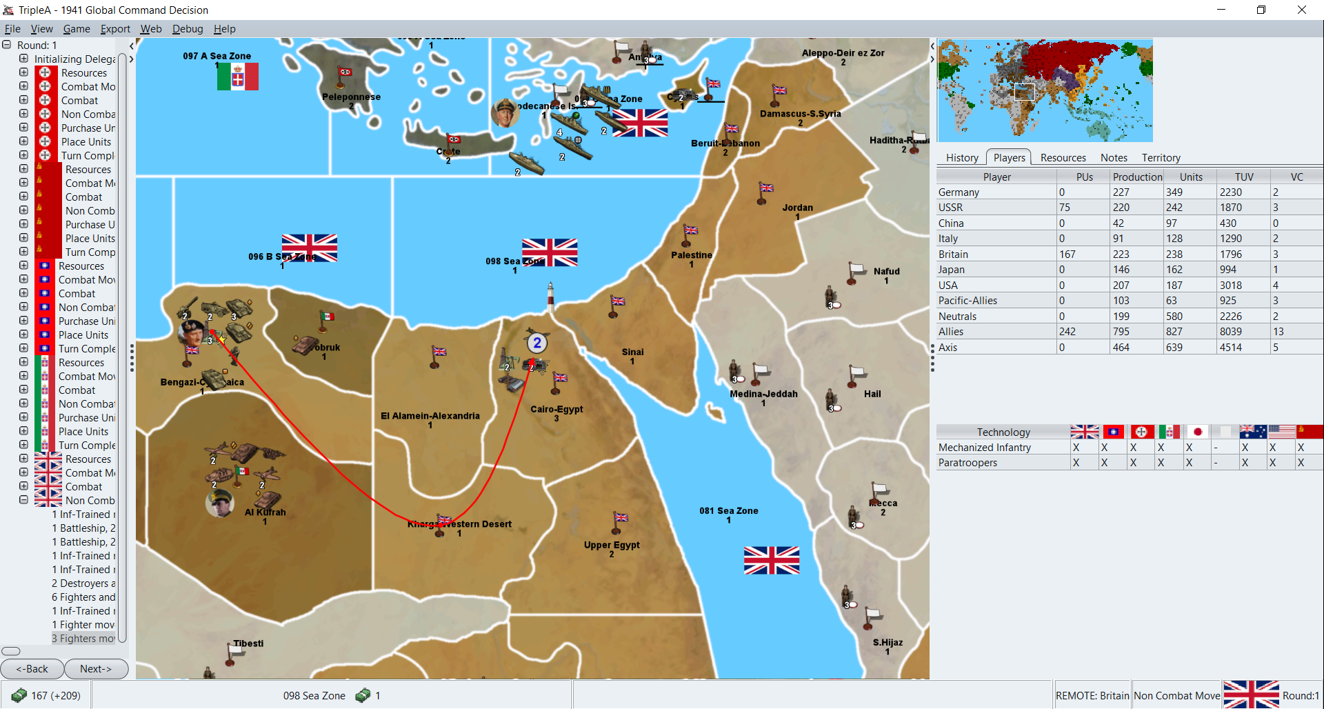
Anyway here is my quick G1 opener in case you wanted to see. I wasn't able to reach Tunisia for an attack on G1, so I did the walk-in to Timbuktu with 1 dude and sent everything else forward towards Egypt. For the Eastern Front, I cleared everything except Bresk doing the northern push, just going like head-to-head, TT to opposing TT down the line. Probably taking more hits than if I double teamed a couple, but since the battles were all high 90% range to clear the tile I just tried to see what the line would look like after. For the subs I wasn't quite sure, so just did the all in 109 thing again. Still seemed like overkill, but in this game I failed all the initial sub spawns rolls, so figured to just launch everything lol. Doesn't show the Finland moves since I forgot those. I restarted after I noticed haha. But basically just pushed there the same way 1 to 1 along the whole front to do the dash on Leningrad I guess.
2023-1-8-1941-Global-Command-Decision.tsvg
2023-1-8-1941-Global-Command-Decision_non com.tsvg
here's another with the Finland move, pretty similar result down the rest of the line. I just followed the default casualty selection order, which will nix the art first I think. Wasn't sure, so I just let hit return and rolled with it.
2023-1-8-1941-Global-Command-Decision non com 2.tsvg
ps. third time's the charm.... In this one my sub spawn hit 3 so that felt solid hehe. I remembered Finland that time, but forgot Africa lol. Still that might not have been half bad, since I was nervous about El Alamein anyway heheh.
-
For reference Iron War has 10-10-2 rounds, all my testing has been on 3-2-1 rounds, so I am reluctant to change it, however I value your opinion and if more players express an opinion I would change it

When I pull up the calc Russian Trained-Inf don't appear,
Look lower down the list/or scroll, Trained-Inf are listed;
.
So USSR does have Inf-Trained although they as a nation/player cannot buy them. Every turn their national theme(code) buys for them, Im simulating their command economy and their national doctrine.
2x Inf-Trained
1x Artillery-Hvy
1x Anti-Tank
and deducts 21pu, as this is their cost. The Inf-Trained represent Guard Infantry, so survivors, as they had better morale and equipment..
National Themes;- Germany gets free subs in the Atlantic and later in the game more HQ-Army
- Japan gets Bunkers, this is to help the AI buy Bunkers for island defence.
In the next beta release USSR will get Industry-Hvy in Khanty-Mansiysk & Tomsk automatically placed on turn 3, I forgot to include these

Simulating the move of Heavy Industry over the Urals. -
@Captain-Crunch
You down voted this post (at the top of the page)Yes, 321 produces a different style of play, encouraging you to over commit to ensure a victory in a turn. It also allows battle fronts to hold, like Kursk if you dont have enough to punch through in 3 rounds, you weaken your forces and can be counter attacked, I think more realistic and less like Risk. It does take a bit of getting used to.
Is that because you dont like 321 rounds?
-
Nice! Must have missed that. Yeah I need to settle in for the long haul just to see how it comes together round on round. I was kinda just dipping the toes by running G1 a bunch of times lol.
So is the basic idea to have the Germans just kinda sweep the whole line on G1 and force a general Soviet retreat there? I felt like north was the cleaner push, but like landing the fighters to reinforce Italy/Romania maybe, and just leave the USSR player like "what, you really want to counter attack now with just the dudes in Brest?" heheh. Not sure if that's the best play. Leningrad seems like a stack into Vyborg would force me to bounce if I was playing, especially with the Lithuania units coming up, but I expect the AI maybe kinda sticks it out.
I do feel like the lack of a garrison in the west of France gives me minor panicky attacks haha. Like I see the naked fighters over there and those Brit transports hovering about and I get pretty nervous lol.
I've been hanging out on Italy and Japan now trying to get my bearings. Catch you in a few
-
So is the basic idea to have the Germans just kinda sweep the whole line
Yes, but it will fail, pick your battles, I would push to Leningrad otherwise the Finland northern force will never take Leningrad.
Hold in Krakow-Lublin as it blocks/borders 3-4 Russian TTs.
Elsewhere check the TT terrain type, ignore the Prypiat Marshes(you have to, as only infantry can enter) look at the status bar to see the terrain effect. The Battle Cals takes the terrain into account Im told.
Push hard in the south to get to the Steppes as those TT have no defensive terrain and drive for the oil fields.
Sound familiar

I do feel like the lack of a garrison in the west of France gives me minor panicky attacks
lol, the Germans must have felt the same, you can reinforce the west but I would not.
Decisions decisions, the Atlantic subs, the French coast, The battle of Britain, Russian invasion, the Desert, who got us into this mess
Oh yeah the Fuhrer..
I failed all the initial sub spawns rolls
There are 6 SZ for u-Boats with a 33% chance to appear in each one, so to get none, UNLUCKY !!!
-
Right on! I expect my play to be super sloppy heheh. This is a J1 from earlier tonight...
I found this one a puzzler, because I couldn't find any attack to run in China that wouldn't be suicidal lol. Like all the China battles were out of range I think, and the hit on Pearl seemed out of range too. So Japan was kinda on their heels. What do you imagine for the J1? Looking at the board, I don't know like maybe a little push in Burma, but not sure what else to do hehe. With the fleet I guess bounce to Truk or home waters? Not sure, I'll have to sit with it for a few I guess haha
-
@black_elk
Japan, so I too dont know what to do for the best?
Its coded that USSR will not attack Japan, they had a non aggression pact.
Have I put too many US defenders on the Philippines?Mainland I would take Anhwei, then Wuhun.
Be aggressive with the sea/air units v US sea/air units.
Move on Calcutta.
Get an invasion force for Borneo from Japan.
-
I didn't show any units that could reach Philippines on J1 so I figured the timeline was maybe more pre-1941 there or something? I was going to nail Guam with the transport, cause Hong Kong seemed too deadly with the bunkers. Bunkers always give me pause lol. But it could just be my expectations, like stomping on J1 hehe.
For this one, I could be over-reliant on the battle calc, but I didn't see any battle I could run at odds in China on J1 hehe. So like for Anwhei, bringing everything in range I got 2% odds for attacker with like a 96% draw hehe. But even the TTs with just a couple naked bunkers show out of range, so maybe I'm just not sorting it correctly in my head? The calc on Pearl shows 8% to the attacker 92% draw. Maybe I'm just not parsing the calc correctly though, cause I'm used to the draw being narrow I guess.
Yeah I'm pretty sure that's what was messing me up. I don't think I was reading the battle calc percentages correctly lol.
I'll have to start again cause I accidentally kami'd all my fighters in the pearl attack hehe. I swept the attack but got smoked using the auto casualty with nowhere to land lol. I noticed I was able to move the Bangkok infantry pretty far afield with a connect to Kunming, so that might be one. Here is the save of the attack I was about to run...
Global command J1 kunming.tsvg
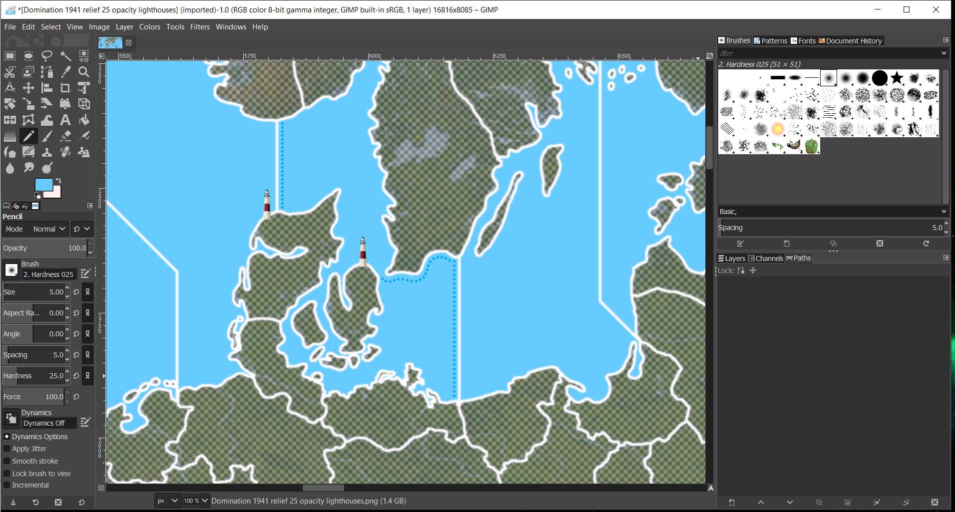
Oh also, unrelated to the gameplay, but I saw another spot I need to fix for the relief. The lines by the netherlands also were showing the older draft same as west texas. I made a note to clean it up on the next pass.
I've been using the map details on, but blends off. Though one thing I noticed is that blends will show the underline from the base, so when I was testing that out I noticed the other issue in the low countries. Wouldn't be surprised if I missed something else somewhere lol
ps. well I got murdered a bunch of times in a row from that position. My best case was a pair of stalemates in the ground attacks. For pearl I had one sweep with nowhere to land, but every other time I ran the attack the IJN went down hard, so didn't seem reliable for a J1. I think I would take everything and pull back probably - not run any attacks, or at least that's what my instincts keep telling me heheh. The damage I can inflict on the US going all in doesn't seem worth the hits I'm taking on the clap back, so I'd be inclined to withdraw I think and make the US player chase me instead of trading the TUV. Anhwei felt similar, like pretty heavy losses when I brought everything. Couple times I got in with a fair number of units surviving, but never managed to clear the TT.
This was the one I was trying. Pearl heavy with the carrier too.
Global command J1 pearl heavy.tsvgBut I was definitely defeated everywhere hehe. Like I just got rocked to the floor more than a few times haha.
My A&A brain tells me to do something more like this... which was pretty much all non coms.
Global command J1 stack and run.tsvg -
Headline - redoing the Pacific
Thanks for testing the Japanese, I think I have made it too hard for them, that is not fun from the start. I dont use the Battle Calc much, so I started looking at the odds you are correct, they are not good.I am redoing the US Philippines defence as Dec 41 and will give Japan a Formosa-Philippines invasion force.
Im thinking of randomising the US carrier fleet location, one where the Japanese can go for it, one where its safe, thoughts?
Japan will always have the option to get Pearl Harbour or maybe the US carriers.
-
All good! I still had a lot of fun teasing it out tonight.
One thing I noticed for sure is that the bunker unit is probably the main decisive unit in the ground game. Since I was having a tough time breaking through, my thought for that second run was to just build bunkers on all my coastal stacks and then some transports to funnel units from Japan. Keeping the fleet in home waters basically to shuck. I think I bought a pair of bunkers for each frontline tile and like 4 transports. It seemed like the presence of bunkers was pretty key in all the battles I fought as the attacker, and they were relatively cheap, so I'd probably spam them a lot. But they're also the unit that makes it tricky for me to ballpark my chances at a glance, since I'm not super familiar with the dynamic. For fighters I've just been thinking of them as flying hitpoints. It takes some getting used to, because the attack/defense value is low from what I'm used to, but it still seemed like they were still pretty helpful on defense when they were in the opponents stack for the ground game, so that's why I flew mine off the carriers to land in coastal China.
One thing with the roster is that it can be tough to spend the remainder at 3, so I bought an extra fighter. But I noticed afterwards that I wasn't able to place it on the empty carrier deck in sz 006 A.
Anyhow, my thought for Japan is that it'd be cool to have a flashy attack at Pearl and also to smash into the Philippines pretty hard on J1. But as a player it's hard to justify going forward vs USA unless the kill is pretty clean, otherwise I'd preserve the IJN, since it's always the lifeline in the games I'm used to playing. Coming out of Classic it was always fun to try and pick up the dudes from the islands and figure out how best to get them into the fight, but end of the day it was do or die based on whether the fleet could be maintained. So I just lean that way, unless the odds are way in my favor to open up guns blazing, I pull back to cat and mouse position heheh.
Philippines did look like a mighty fortress for sure! Anyhow, I'll hit pause and swoop back for the updates. Catch ya in a bit dude!
ps. Oh also so for me the Battle Calc is how I learn how to play a game if I'm unfamiliar with it. For A&A or if it's fairly similar, where I already know what's what, I can ballpark stuff and don't need to use it so much. But if there are units in the roster that I'm unfamiliar with, or novel combat mechanics, then I will rely on the Calc almost exclusively to tell me if a battle is worth attempting. I've been doing the same with the default casualty selection, allowing the comp to tell me which units should be taking the hits. I wasn't sure a few times though, like with the Japanese carrier, hitting spacebar screwed me a few times lol. But anyway, that's sorta how I do it. Just moving troops around and checking the odds in the Calc, although it can be tricky with the high draw % which I think comes from the battle round limit maybe? Anyhow, still fun to mull it over and think on what to do!
-
reliefTiles
So Texas, the Netherlands to do.
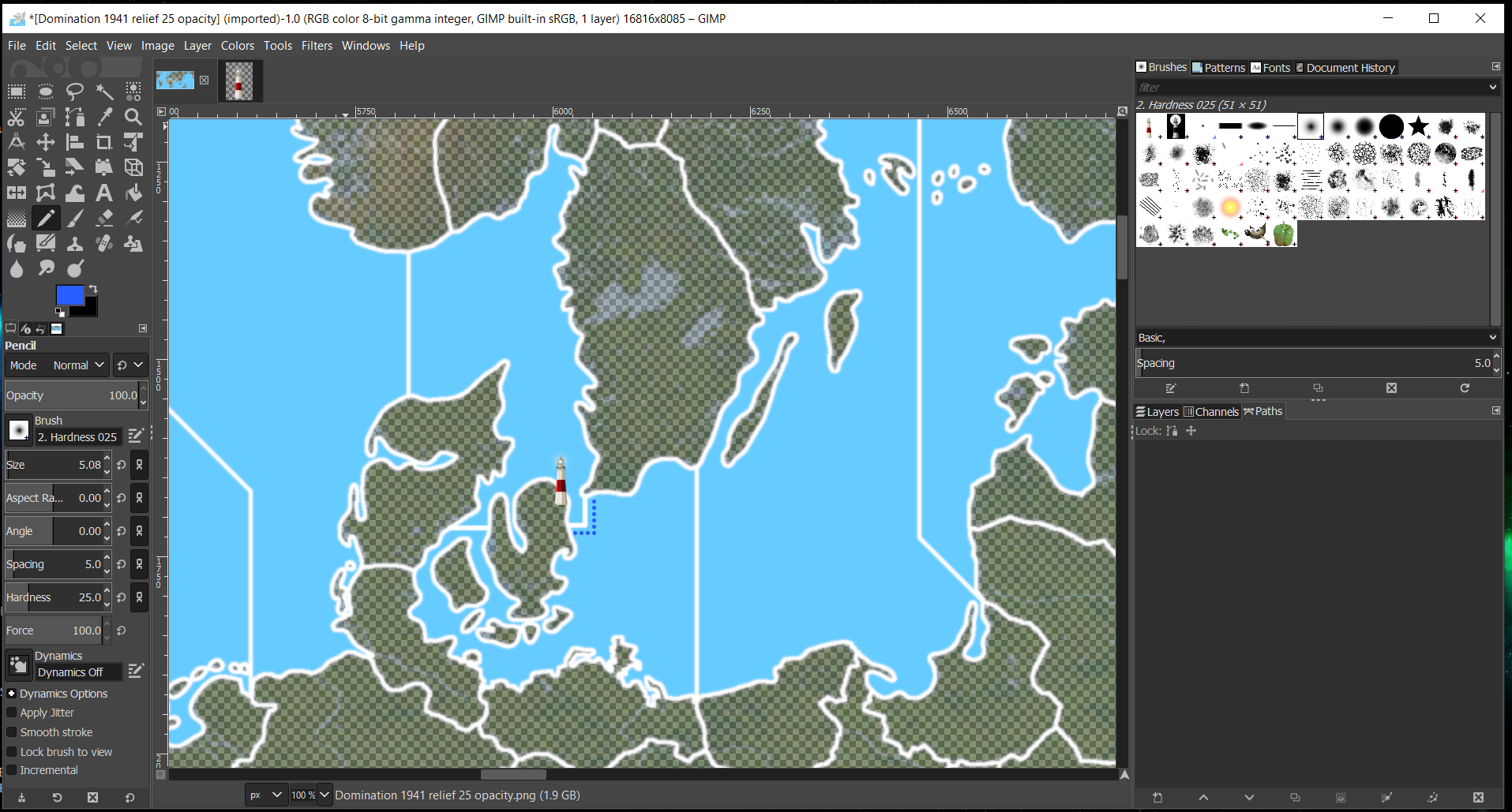
The Map Blends stats came from The Shogun, so if you want another variant go for it. But the current one does show up the Netherlands borders of the two layers very well, Texas less so.Need another Beacon/Lighthouse at the Southern end of the Dardanelles Straits.
Did I sneak in another SZ, 129 the Sea of Mamara?Danish Straits needs a Beacon on the north of Juteland.
I think we need Dashed/Dotted lines here?
112-113 Danish Straits
91A-92 Gibraltar Straits
What do you think? -
Sounds good, I'll make that my plan for the week to get those all handled.
I can do a dotted/dashed line for all the straits and canal entrances.
Yeah I didn't catch sz 129, I thought you had meant a single strait but you mean like double straits right? For Denmark (the Lighthouse in Copenhagen) is that meant to control sz 113/114? I had assumed it was sz 112/113 earler. If it's for 114 I'll make the dashed line come up that way, so it's clearer which Sea Zones are being effected, and then add the one Skagerrak on the other side.
Maybe something kinda basic, like this...?
Or something along those lines. Probably need to set a wider dash so it's easier to see when zoomed out, but some sorta dotted line motif like that more or less.
Let me know if there's anything else relief wise and I'll toss it on the pile. Catch ya next round!
-
129, I thought you had meant a single strait but you mean like double straits right?
Yes
.
Denmark
Current code says, you must own both land Copenhagen-Denmark & Juteland to pass between 112 & 113.
But, ignore the above as you have made me relook at this.How do show this on screen?
Own land Copenhagen-Denmark to pass between 112 & 113
and
Own land Juteland to pass between 113 & 114.Maybe you could shine a light from the relevant beacon on to the dashed SZ border line?
If you could do this by Friday/Saturday, in parallel I can do some testing and then release an update by next weekend?
-
Yeah no worries. I read that just as I was falling asleep, but I can probably bang it out this Wed.
I also want to make sure I understand exactly what you want though. The reason I was confused is because the Copenhagen TT is a separate island right? If so, having that TT control passage into sz 113 would make the tile impossible to reach for the Allies, since that's the sz that the island is contained within. Unless it has a connect to another tile by land or something like paratroopers that don't need a naval transport for the amphib. You'd have a similar issue going the other direction from 114, again cause of the island thing.
I think originally I thought Copenhagen/Juteland would be the same TT or with a land bridge to Juteland if separate, but probably got mixed up in the labelling. Another option if you really want to have both straits would be to modify Copenhagen so that it's not a true island, and make that visually obvious. Like I could add a bit off a border, to split off some of the Jutland tile or the Holstein tile and add it to the Copenhagen tile in the base, if that seems sensible?
Anyhow we'll dive in on it this week for sure!
ps. another option is to break sz 113 into A/B. I'd be among the smaller SZ tiles, but there are others about that size elsewhere so might not be too off the wall. Then you could have the new boundary between 113A and 113B at Kattegat if you wanted, which might be easier to parse for the visual. I imagine the most important passage is 112 into 113 (Allied approach), but I like the idea of a clap back from the Baltic, which I think is what you're after maybe? Like where the Allies could land at Juteland or push up the coast, but the Germans could still hold the strait into the Baltic proper, if they can hang onto the Copenhagen-Denmark tile. Might be a bit tight for the units though. Like maybe not for G, but for a combined US/Brit fleet there'd prob be some spillover. Tweaking the land tile might be simpler hehe.
I think the cleanest visual would just be to have the beacon closest to the relevant white line, and then a second dotted blue line along whichever SZ boundary is controlled.
For the actual canals, Suez/Panama, I was thinking to do something different though, because the lines there are shorter. Like maybe at the entrance do like a half circle in dotted blue?
Or in misc folder I saw Frostion had a bridge graphic that might work for something. Not sure though.

I think the beacons alone can be sorta easy to miss, I might punch up the chroma for the red, but hopefully the blue dots or something similar nearby would help highlight.
For the canals though, and the Dardanelles/Bosphorus zones, the area around those crossings is a little tighter than it is with the straits like Denmark and Gibraltar, so probably needs something to help it pop out more. Maybe carrying the dotted line across the land for the canals?
With a shape like )(
Or something like that for Suez/Panama.
I'll have to play around with it some more, I was just kinda riffing above heheh.
I tried to do a directional beam for the lighthouse earlier, but the light cone looked a little off heheh. Like it would seem ok, but then when I shrank it down it would just sorta lose the visual. There might be a plug in light effect that does it better, that I just don't know about. I'll look around and see if there's something I can pull.
-
@black_elk
As you were/reset.Ignore my previous rambling about a Beacon on the north end of Juteland and 112 & 113 SZ. The sea area is not narrow enough for a canal zone.
I like your idea 113 A & B, with Copenhagen-Denmark as the land component controlling the canal, so lets go with that?
I will manually do the unit place co-ordinates for the 113 A & B SZ to get more in.
.
As to graphics, you have the final say, but my 2p worth.- No to the Frostions bridge icon.
- I like your "half circle in dotted blue" idea.
- It would be nice to be consistent between graphics for narrow canals like Panama/Suez and other wider canals maybe with the same dotted/dashed blue.
- If using a Beacon a brighter red(like you suggested) and maybe a yellow light with an aura instead of a white light?
-
Sounds good. I'll do that then
I tried the directional cone of light but still felt kinda weird. This one looked decent though. I added a yellow tinted hallow and punched up hue a bit for the reds to try and make it pop a little more. I could also make them larger, since there's really no need to cap it at 68px tall, if just drawn into the relief. I just defaulted to that from working on the units, but they could probably be 100px or whatever if you want a larger icon.
I can keep tinkering till we have something you like. The narrows are tricky because there's only so much room for the blue dots hehe. I was trying a few at different size for dots, but not quite sure what I like best. For the straits, this is crude, but shows pretty much what I was thinking....
Trying to find something that registers but isn't like too pronounced. By making the blue dot's more vibrant it may catch the eye somewhat better, even across a relatively small area like shown here. I think you probably need like Not sure if something like that works for you?