My map editor for TripleA
-
Lay out unit places
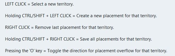
Could do with showing the px size of the unit & its zoom size from the map.properties file, before placmentNeed to show the direction of unit overflow of the last unit in a TT/SZ. The default is to the Right, but depending on where the last unit appears in the TT/SZ the mapmaker might want to the left.
Using a toggle say ctrl+O to switch between Right and Left overflow.
On screen an arrow should indicate the current overflow direction.
In place.txt overflow is seen as
| overflowToLeft=true (overflows to the left)
| overflowToLeft=false (default, no need to show as overflows to the right)The ability to add one more placment in the selected TT/SZ
The ability to remove, highlighted placment.Current mapmakers are used to these, but maybe a right click menu is the way to go? (even for the toggle)
.
Wish list questions
As the placement is based off center location it would be great if the app suggested moving the center coordinates to fit in more placments?
What value upto would work, 27px as this is half the maximum height of the unit?
Would the reiterations take to long? If so reduce the maximum pixels to move.
If it made a suggestion then an option to do it. (right click menu option do it).
Save
Before each save in Expert mode, a mapmaker needs to know what is going to be saved.
This is critical if you accidentally change something unintended or forget you have changed something.
A section that you can tick as read only/Dont save for each of the files to be saved.
Especially the. xml as it messes with the order and formatting.
The app should remember these setting from last save.
Places (should be sorted & grouped, here is a suggested order)Units --- Capitals – I prefer a yellow star, not C Centers Comments Decorations Names PUs – should show the PU value as well as P, eg 6P Terrain Effects Victory Cities/Centers --- Blockade Convoy KamikaziPlaces Options
Right Click on TT/SZ for a menu to add/remove the items shown
Left drag to move the selected itemWhen there is no file or nothing to display, against the selection it should say None)
.
Earthquake
The map gets shoved down and I lose my train of thought.
There is a space reserved for shoving the map down to display things, like

Can this space be reserved by moving up/compressing the ‘white’ space above the map, so the map does not move, please, pretty please.
Yes this space will be ‘white’ space, but its better than moving the map. -
@xxXEddieXxx Nice work. The first useful TripleA-related project I have seen using AI. How long did it take you to do this?
-
@RogerCooper
About a week but it is not finished.
I thought a more collaborative work would be better here so if you have suggestions I try to implement them.
-
Update
- Draw borders hides the relief while you draw, so you see exactly what you are editing.
- No more shadows: after Make territories, the relief is rebuilt where you drew. One Undo takes back both. On older maps, run Create relief… once first.
- Other reliefs stay untouched; a message offers Create relief… instead.
- Unit places: the unit size shows before you lay them out, and centers can move up to 27 px to fit more places.
- Overflow arrow on the last unit place; switch the side in the right-click menu.
- Right-click menu to add or remove unit places and to put markers where you click.
- Save lists the files it will write and keeps the XML's order and formatting.
- Places menu sorted and grouped, with "(none)" for empty kinds; capitals are a yellow star, PUs show "6P".
- The map no longer jumps when a banner or goal appears.
-
@xxXEddieXxx I would find useful it you could automate drawing a grid pattern over a relief map without existing territories. You would need the following options
- Square grid without diagonal connections
- Square grid with diagonal connections
- Hex grid with straight rows
- Hex grid with straight columns
- Offset squares with straight rows
- Offset squares with straight columns
You could set the width of the territories or alternatively set the number of rows and columns.
-
@xxXEddieXxx
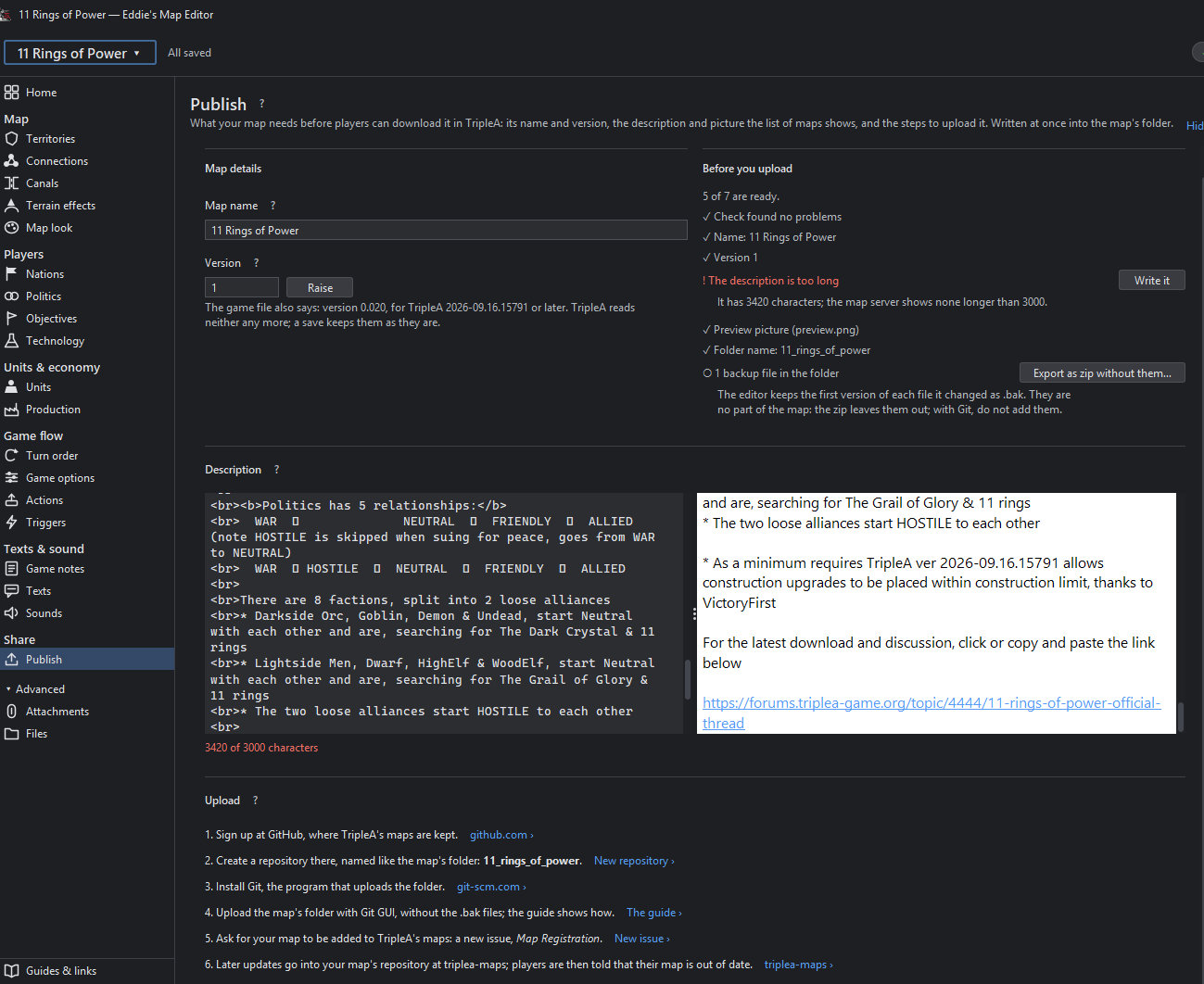
I have not ran the latest version, so bear that in mind .Publish
Does not scale to the width of my screen 1920x1080
.
Version
There is a version in the xml, <info name="1941 Global Command Decision" version="1.285"/>TripleA does not read the version but the app can.
TripleA does read the minimum versison and enforces it with a stop loading and usually offers an upgrade <triplea minimumVersion="2.7.14848"/>.
Help
.
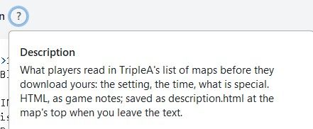
All help buttons should say on the top line what the file being read/written is..
Repository
Most(51%+ probably much higher) maps repository name is the same as the xml name, The A&A style usually don’t.
If GitHub repository=xml name could say Published.
GitHub Desktop vs Git-Scm

For us mere mortals GitHub Desktop is a better graphicial frontend to Git, yes? It is easier to use than Git-Scm (mainly command line)
Only downer is GitHub Desktop has no official Linux support..
FIles
Great addition, but;
I would increase font size and reduce the ‘white’ space between each line
Bolder green ticks, Orange o, Red already red !
This would make it more readable to my tired old eyes.
.
Attachments
Make a column called Type, to list all the Attachment types
Remove the options word and put the numbers in Column headed Options
Two lines can be reduced to one saves boring scrolling, a lot.‘White’ space
With heading like that you know what coming.
Each of the pairs eg Name & relationshipTypeAttachment field can be on one line, saving hortizontal white space, so less scrolling, yay.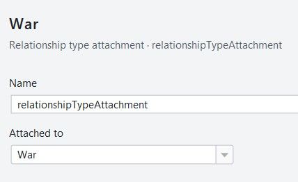
.
Map
Remove and add to the Map left hand pane all the View menus.
Note Connections & Neighbors are the same, so one can go anyway.Assuming View into Map column above, then the Place contents can be on permanent display, probably over two lines, when the correct Map option (left hand pane is selected) less mouse work, or maybe for Expert mode?
.
Territories
The right hand should be a table, less scrolling, I know you can search, but with 800 TT/SZ its still a lot
Columns of TT/SZ name, Faction Owner, and PUs
Then you can sort by these columns as well as search. -
Update
- Remove nation: also taken out of unit options that list nations (captured by, given to, destroyed when captured by)
- Impassable sea zones hatched on the map and darker in the small map
- Territories: sort by name, owner or PUs
- Attachments: one line per attachment; Name and Attached to side by side
- Files: tighter rows, bolder marks
- Publish: uses the full width of a wide screen
- Help "?": says which file the tool reads and writes
- View "Neighbours" renamed to "Connections"
- Text editors (Files, Game notes, Description, Texts) are new:
- Coloring for XML, HTML, properties and yml files
- Line numbers and folding; brackets are paired
- Find with Ctrl+F
- Text size: Ctrl + mouse wheel, or right-click → Bigger / Smaller text; one size for all texts, kept
- Colors: right-click → Colors from a theme file… (an RSyntaxTextArea theme), or as the app
-
@xxXEddieXxx
For version 0.1.9Map Look> Resize map
1941 GCD cannot be increased in size only shrunk. But it says it can grow 60% this is not correct.
Also it should not offer what it cannot do, eg offer 50% and custom shrink of 60%
Ideally the resize should work up to a bigger px size, that is bigger than 16816x8085px
Can this be increased so I can make 1941 GCD bigger ?
Also what are the maximum limits of this resize ?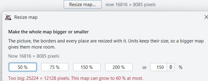
.
Infrastructure labels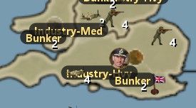
Im not a fan of the Infrastructure labels can they be unit icons instead ?
If this is/was a request then maybe these display options
--Infrastructure only
--Units (not Infrastructure)
--All units.
Places> Reload places from the files
When selecting this without place,txt or decorations.txt loaded, just get this timed popup, where are the place,txt or decorations.txt ? (not displayed)
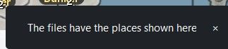
Ideally it should tick these on the menu and therefore display both place,txt or decorations.txt
.
Places> Placement
When working in a TT/SZ it would be good to highlight, say with an Orange shade all the units in that TT/SZ, as sometimes you are not sure which TT/SZ the units belongs to.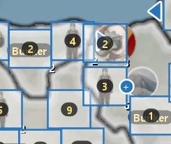
.
Places> Placement
When selecting a unit, a nice addition, using the 4 arrow keys to move a px at time, for micro placement would be cool..
Map Look> Resize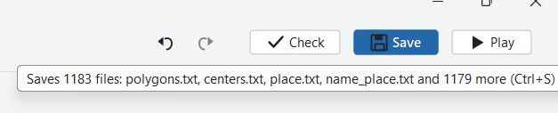
This should also say all baseTiles & all reliefTiles, not 1179 more.
Said Saved without a new relief ? (I could not screen capture this)
Checked it does resize reliefTiles, so message above is wrong.
.
More help/intelligence can be given to the mapmaker by
Giving this suggested size calculation
1 / current unit.scale (round up to the nearest even number)
eg. 1/.875 = 115% but thats an odd percentage, so best 116% or 120%
If the map is 6500 x 4000 at 120% = 7800 x 4800px also change the unit.scale to 1
The app could also offer to change this ?.
Map Look> Resize - Line Smoothing
The map resize function is awesome, it does so much for very littler user input.
Here I am being really fussy, but if you don’t ask you don’t get
Can the resized line images be smoother ?
Settlers: Fallen Empire, 120% resize at 200% zoom
Circle drawing is rough ?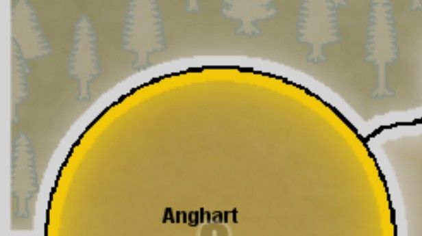
.
Settlers: Fallen Empire, 100% so before resize at 200% zoom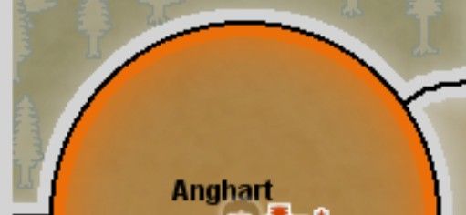
-
I need to think about how to handle bigger maps. A Image file that has 600mb is actually quite large.
In my first round i will make the UI resemble the rules the editor applies so only 60% will aviable. The rest are good points and will be implemented! -
Map Look > Resize
- 1941 GCD: the message was wrong, not the resize. The editor holds a resized picture only
up to 50 million pixels, and 1941 GCD is already 136 million, so it can only be made
smaller. It now says "can be made smaller, to 60 % at most", and the 150 % and 200 %
buttons are greyed out with the reason as tool tip. - Limits are now stated in the dialog: 25 % to 400 %, at most 50 million pixels, each side
at least 200 px. Making 1941 GCD bigger would need a tile-by-tile resize; that is an open
issue, not in this release. - The Saved message now names all tiles and relief tiles written, no more "1179 more".
The relief tiles were always resized, only the message was wrong. - units.scale: the dialog now offers the size you suggested. With units.scale 0.875 it
shows "115 %: units at their pictures' size"; tick it and the resize sets units.scale
to 1. - Line smoothing: enlarged flat-color maps are now smoothed and then snapped back to the
map's own colors, so curves no longer get steps and border lines stay one color.
Have a look at Settlers at 120 % and tell me if it is good enough.
Places
- Reload places from the files now ticks Units in the menu, so the reloaded places show.
- The clicked territory's unit places and units are shown in orange, so you see which belong
to it. - Arrow keys move the place under the mouse by one pixel, Shift+arrow by ten.
Infrastructure labels
- Those name badges appear only when the editor finds no picture for the unit, so something
in the picture lookup is off for that map. Logged as an issue; I'd like to check it with
1941 GCD before adding display options.
- 1941 GCD: the message was wrong, not the resize. The editor holds a resized picture only
-
Those name badges appear only when the editor finds no picture for the unit, so something
in the picture lookup is off for that map. Logged as an issue; I'd like to check it with
1941 GCD before adding display options.This might be because the folder that holds those images is the root of UNITS
\triplea\downloadedMaps\1941_global_command_decision\map\unitsThis means that ALL factions share these images, so reduces file size and duplications.


Hello! It looks like you're interested in this conversation, but you don't have an account yet.
Getting fed up of having to scroll through the same posts each visit? When you register for an account, you'll always come back to exactly where you were before, and choose to be notified of new replies (either via email, or push notification). You'll also be able to save bookmarks and upvote posts to show your appreciation to other community members.
With your input, this post could be even better 💗
Register Login