Crazy Europe: House of Habsburg
-
Uhm, I was thinking about the Turkish straits myself, sorry. For the Kerch Strait, that is too wide to matter for this timeline. Still I would agree having that sea border. Seems the most natural way to draw it.
-
-
Sea of Azov changes done.
-
@crazyg Also, on the other hand, you may want to consider having canals dynamics for 184-190-191.
This is a tuff one, as canals are very strong, and it may overvalue the ability to close the straits at that time, but the Turks were indeed able to do something the like, with very big cannons.
A compromise might be to require having both sides to block sea movement, but that would be not that right, either, as you just need to a 1 side to put a big cannon on it and shoot at the ships passing through.
On this matter, I really don't know; as having a canal would be too much, as the Venetians were able to pass the Dardanelles, despite the Turks having both sides, but having nothing is too little.
The correct way to do it would be to invest in costly stuff to block sea movement from the shores of a strait, and getting a sort of AA shot for it each time a hostile ships tries to pass through; but, as we all know, that is not supported. -
Ok so a bit more work than I had hoped for.
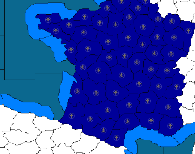
France is now done with a couple other isolated areas...

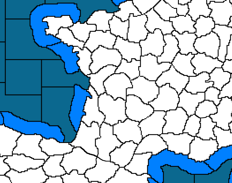
France before...

Taking a break and will get back to it later.
-
Making more head way.... but as I was zooming out to get a glimpse of the overall picture something dawned on me....
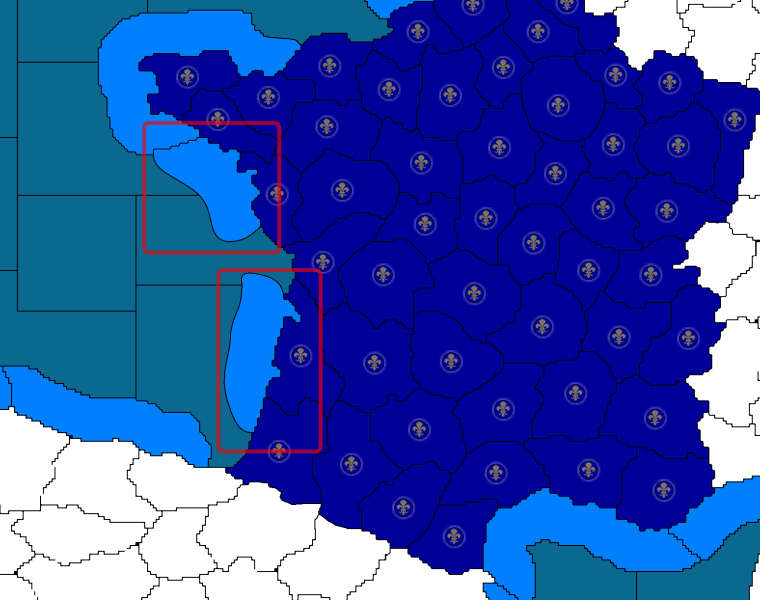
since the Sea Zones are square.... and the Land territories are all jagged.... would make sense to visually differentiate the Coastal Waters by making them rounded.

Let me know.... since I have to re-draw them either way.
-
@hepps
I agree. They were supposed to be rounded from the beginning, if you wanted to remove things like the pointy bits they sometimes have (the french picture has one) it would make sense too -
@hepps The rounded ones look better but then it makes me want the land territories to be a bit more rounded as well.
-
I'm a beggar, and therefore can't be a chooser, but I agree with redrum, the rounder shapes just look better in general
-
I want to begin the process of changing the names, and I'm asking the members of TripleA for help.
If you are knowledgable about a certain area of Europe, please offer name suggestions in this google doc.
https://docs.google.com/spreadsheets/d/1WlcjYfF2-p46yBz3kq2y_9RWWMQZBztyXeZi7zi2rJI/edit?usp=sharingPut your name at the top of a column and offer suggestions. You can offer more than one if you like. I'm in favor of well known names, even if they aren't quite historically correct.
I put a few up, which are primarily major cities. -
I updated a new BETA version today. Changelog
-Unit set up drastically changed
-Venice made weaker, Poland made stronger
-Far more villages than before
-Some territory values changed-Crossbows removed
-Horsemen removed
-Muskets now give enemy pikemen or knights -1 attack, -1 defense
I call this "suppress", its supposed to be the opposite of support.
-Knights -1 attack
-Pikemen get +1 defense if the enemy has a knight (1:1 ratio)
Its flavorful and helps make the pikemen more interestingCastles can now be placed anywhere, max of one per territory (as originally intented)
-
@crazyg As a heads up, if you want players to be prompted that there is a new download version available then you need to just increment the entry in the yaml file: https://github.com/triplea-game/triplea/blob/master/triplea_maps.yaml
-
@crazyg I like it C to the G.
Big map. Lots of room to play. Just muddled around with it for a short while but my initial reaction is that I like the relative purchasing power verses vast expanse of territory.
Needs more play time before getting too wound up about starting units and placements and what-not. Glad you are trying to get the European community to help with the naming. Smart move. I shall fill out a portion of the Google Doc with the historic locations of Hepplonia and its vassal states when I have some time.
-
@hepps lol at the Heppalonia

-
@crazyg I named some areas I feel confident about. Note that the names are for the Habsburg map only, some of them would be inaccurate or offensive for a WWI map.
-
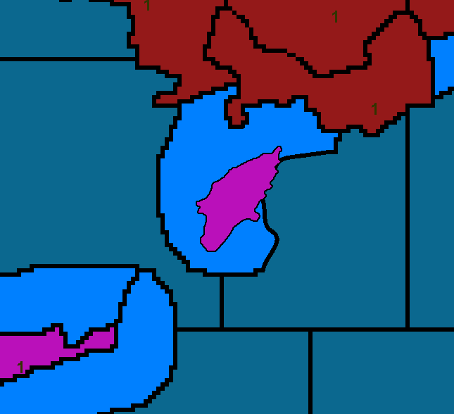
@crazyg As a work around C to the G.... Some of the islands that have the connecting lines can be solved with some creative changes in how you have drawn the shallows....

For instance this simple change does not alter the functionality of the game.... but eliminates the need for a connecting line.... while allowing you to keep the naming convention of Sea Zone 182 or something more creative like Coasts of Rhodes.... rather than 182SZ .... which of course makes no sense in the English language (This naming convention should have never been implemented in the first place as it is so abnormal)
-
I just updated from depot, it doesn't seem to have the new changes.
-
Just wondering about the suppressing fire. This would require unique units for each nation, to do what your describing. Otherwise a friendly musketeer will suppress his own pikes and knights.
-
You shoulda changed horsemen into a light cavalry option.
-
-
@general_zod Good point Zod.
-
@alkexr
I appreciate it. Those are the areas I didn't have clue what accurate names would be@Hepps
Isn't there another way around the lines? That does work but it looks a bit odd. TWW has true islands, right?@General_Zod
No it doesn't suppress friendlies, only enemies. I played several rounds today and it was working as intended. I tested the download, Venice is missing a city but everything else seemed in order. -
@crazyg said in Crazy Europe: House of Habsburg:
@Hepps
Isn't there another way around the lines? That does work but it looks a bit odd. TWW has true islands, right?Yes but to achieve this we had to use the deplorable ##SZ mechanic. Which has bothered me from day 1.