Proposed Map: Domination 1941
-
@thedog Yeah for sure! My thought would be to include all the same major terrain features that Hepps laid out for the various mountain ranges and deserts, marshes and whatnot. Even if not all of them would come into play in Global, they could still be depicted on the gameboard in some way. I also dig the idea of coastlines and things like straits or canals beyond what we typically get in A&A. His 1914 map was pretty ambitious, cause in addition to all the politics stuff, he was pursuing a seasonal weather feature as well. All that stuff seems pretty cool to me, though perhaps outside the scope of this one.
@KurtGodel7 Sorry I meant to respond to the combat and manpower ideas, but got sidetracked hehe. All sounds pretty good to me! I'm certainly not wedded to the standard rules by any stretch. I've tried my hand at many HRs for AA50 and Global, prob enough to give Beelee experimental headaches for a decade lol, but am always intrigued by new ways to get more strategic depth out of the combat scheme. Manpower was an idea I liked as well, I tried to do an HR for something like that based on VCs in AA50 at one point, but don't know if it even caught on hehe. Not sure how easy/difficult it would to implement the scheme you laid out, but it's probably possible. That said, I still think quite a lot can be accomplished just with the production spread and the money. I'm a big fan of being able to parse the information at a glance, as displayed on the actual gameboard, as opposed to say tracking a bunch of Objectives that sort of exist outside the map. I haven't wrapped out with Larry in a long time, but my view was always that the A&A maps would have been more fun with higher value TTs, more production lily pads, and a higher economy generally. Fewer TTs worth zero or 1 PU, and more TTs at 2 or 3 PUs basically in Classic terms. But those values are also easier to change than say the shapes of the TTs or the TT connections, so I'd kinda just leave everything blank and figure it out later. We'll start with the map and go from there, prob the simplest hehe. I'll try to get something working svg in the weeks ahead, and push out a draft map raster at scale that you can mess around with once I get my head around inkscape.
Oh also, one final consideration, but kind of an important one, is whether you want a game which works for the single player too, or just a more traditional head-to-head PvP type game for 2 or more players. I only bring it up, because if you think you might like to try the former I have quite a few ideas. For the most part people seem to avoid designing maps with the AI first in mind, so we have a number of maps that are essentially unplayable outside the usual PvP - like they'll use features that the hardAI is just incapable of understanding/utilizing. I think there are certain approaches to map design which could potentially make a WW2 game a lot more entertaining for SP, or to make a game which can at least be learned that way before requiring a live opponent. But whether that's something you're interested in or not, I wasn't quite sure. Hepps for example has designed most of his maps to be entirely PvP exclusive, and kinda categorical on that one. Ironwar almost works for SP, but again, the main thrust of the design was PvP. We really don't have any larger WW2 maps that actually work with the hardAI under the v3 ruleset, so that might be a way to set any new offering apart from what's currently available. Not to suggest that you hobble your map design just based on what the AI can do lol, but I think there are ways (particularly in the opening round) where you can design for stronger and more consistent AI first turns (compared to playing vs another human) and set it up so the divergence there isn't quite as pronounced. Trying to play to the strengths of the HardAI basically, in designing the opener at least. Or similarly, to develop a standard difficulty setting vs AI from the launch, to create a challenge there that's entertaining. I think the odds on hooking a single player who wants to try something new, and just paint the map their colors for a few hours, are probably a little higher than finding 2 players itching to do the same in a lot of cases. Or at least, if you can get 1, then maybe they get really into it, and bring more opponents along. Anyhow, just something to think on.
-
Im a big fan of writing the xml with HardAI in mind, so I dont like National Objectives. Humans in game and the real world make up their own objectives as the war changes. So I write for single player with the hope that the map has enough interest for PvP.
Also I like upkeep/maintenance, in its simplest form of 1pu per unit, the AI does not factor this value in, so using 1,2,3+ pu per unit although attractive and realistic it's a none starter for me. Im happy that the system has a form of self limiting production.
With upkeep in mind the TT PU needs to double/triple/or more (last two maps I did I just doubled the PU, Lord of the Rings War of the Ring and britannia_roman_invasion2), so this fits @Black_Elk with your idea of more PU on map.
I wish to move away from AA style of play and to play the strengths of the TripleA engine. I would like to see a new unit type, lets call it a Combat HQ (insert better name), these are the Rommel's, Monty, Pattons HQs etc, each army has at least one. For example the Germans lots and the Russians one, the British could have a Sea Combat HQ, USA could have a Air Combat HQ.
These Combat HQ could have AA, AT +Attack/Defence so that say 5 units they are stacked with get combat bonuses.Also could do with a new map/project name?
maybe 1941 Command Decision? -
@thedog yeah for sure! I feel like if we could get one really solid SP AI showcase map going, that's sort of tripleA total war WW2 next level, that'd have very strong appeal for me. I like the HQ concept or like General/Admiralty officer corps something. The air superiority concept KurtGodel7 mentioned also sounds cool to me. It's such an air war, but then the base game always had some trouble getting that to mesh quite right hehe. All the newer A&A games feel very bomber centric to me. I don't know, it's a lot to mull over. I think the idea I liked is just taking your Global map say, and for every large territory there, just breaking that up into 2 or 3 or 4 more tiles, till you get something with a bit more push and pull going hehe.
In terms of TT divisions, I also like the idea that at the end of the game, something like this would at least be conceivable. Like where the final TT possession could break down along those territorial lines. You know, like doing the Konigsberg to Kaliningrad division and stuff of that sort, or using rivers, to get a few more tiles in there that break more 1945 in shape. Or at least to allow for a holdout endgame with more place to go in central Europe generally hehe.
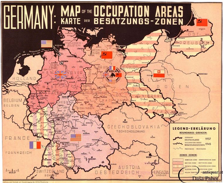
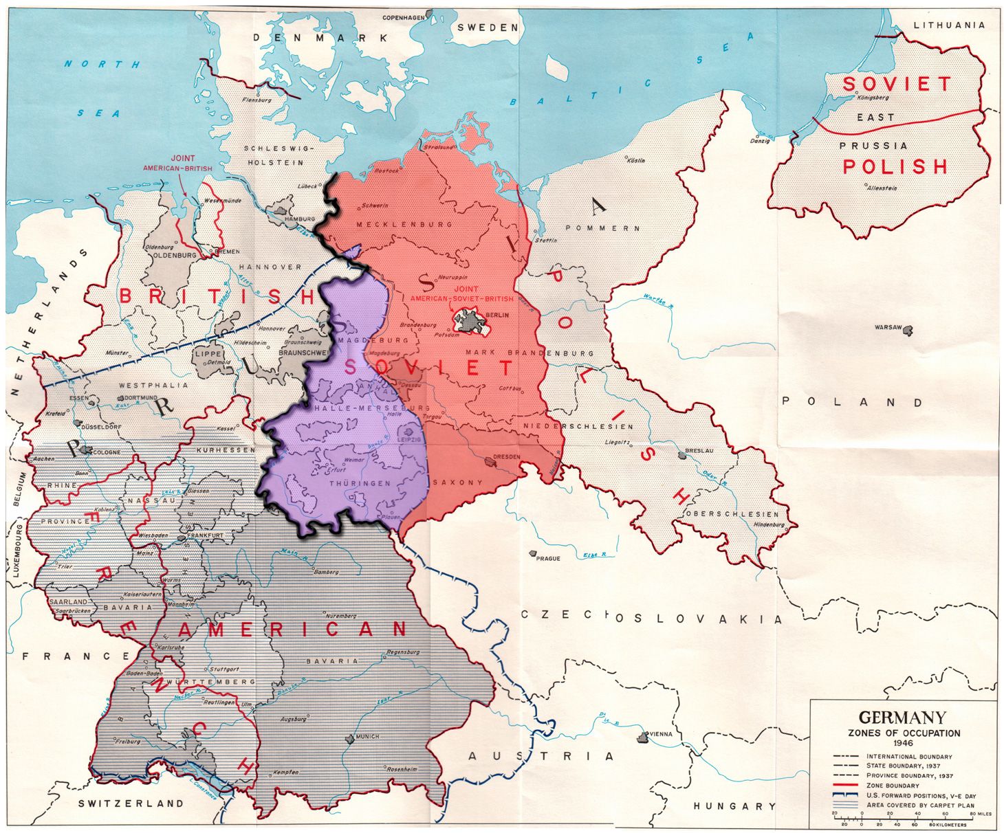
ps. thinking about terrain features, I'd like to see something with a bit more in the Americas as well. You know like the Rockies continental divide and southern desert for N. America and the Andes and Amazon in S. America. Few more contours following the rivers maybe for some TTs there. Just to match the sort of stuff going on in Eurasia and to give it some more interest in the geometry. Perhaps for the High Castle type scenarios, or at least to leave that open as a possibility at, as sorta the opposite end-of-the-end game, of those occupation zone images above lol.
-
Thinking about Sea Zones, Convoy routes etc and how to represent them on the map.
In my games I give the Sea Zones, 0-2PU values, this is meant to represent trade/fishing and the take over of those trade routes. (So no Convoy route circles)
For this map we could make each sea zone in the North Atlantic British owned. Each American Coastal sea Zone would still be American. When a U-Boat, enters the Sea Zone, it is just like a land TT, 0-2pu to Germany -PU to Britain.
(xml-wise we might be able to make the taken over Sea-Zone neutral and therefore not a gain for Germany)If an American ship moves into a German own Sea Zone it reverts to being British.
Does the above work or should we stick to circular Convoy route zones?
https://forums.triplea-game.org/tags/thedog
https://forums.triplea-game.org/topic/3741/curated-best-top-maps-triplea-guides -
@thedog I like the idea of handling sea areas just like land areas.
-
The terrain effects chart may look complicated in TWW, but it's not like it's 208 different interactions with no pattern; it mostly boils down to about 20 or so more basic interactions. It also helps that those basic interactions are mostly based on whether the units are real world effective in that terrain.
In my gameplay experience with TWW, it does add a fair bit of strategic depth; perhaps not a lot, but some, and it impacts what you want to build based on theaters of focus.
I'm not sure the issue is necessarily bad ratio of complexity to strategic depth; I mean, I doubt you've even played TWW to have a good sense of its strategic depth at all. I think it's at a more basic level: lots of complexity and a learning curve makes people avoid maps in the first place, regardless of whether the strategy is interesting.
One thing I can highly recommend to incorporate from TWW that helps address the 'one Japan situation' you mention is TWW's minor allied nations systems. It helps ensure a spread of theater investment, as well as limiting focused builds in one theater; while still all being one nation.
Strategic depth is often less about design choices than it is about fine-tuning the balance very precisely.
As to tech pigeon-holing; that mostly occurs when a tech improves one or a few units but not others; that changes the balance between units, rather than the balance between nations. It can change it in a way which makes one unit simply better than others so it becomes the primary thing built. The most extreme example I've seen is in Big World 2. The base-line units are reasonably well balanced, but if say the US pushes air tech, then you can reach a point where you've got all the standard units at standard costs OR you can build a 4/5/6 for 10 plane. And it turns out that 4/5/6 for 10 fighters are just crazy brutal and apply control to such a large area that sheer fighter spam is more effective than building much else. While you can't win a war without some ground troops, you can have the US be a pure air force that shuts everything down while the other allies handle the ground invasions.
While tech strategy and military strategy are intertwined, that doesn't always mean there's depth. It depends on how many different viable tech choices there are; which again is often more about fine-tuning the balance than anything. In NML, it's pretty good, but there are some issues; on average the econ techs tend to just be better for everyone. They're often the first filled techs for every nation. Naval is rarely used, though that's less because the naval techs are 'weak' and more because the central powers simply are'nt naval powers, and trying to focus on navy tends to be a bad plan for them.
I'd recommend you play a game or two of the Arda map, as it has some interesting unit diversity and complicated gameplay (albeit too complicated at times).
-
@thedog said in Proposed Map: Domination 1941:
Thinking about Sea Zones, Convoy routes etc and how to represent them on the map.
In my games I give the Sea Zones, 0-2PU values, this is meant to represent trade/fishing and the take over of those trade routes. (So no Convoy route circles)
For this map we could make each sea zone in the North Atlantic British owned. Each American Coastal sea Zone would still be American. When a U-Boat, enters the Sea Zone, it is just like a land TT, 0-2pu to Germany -PU to Britain.
(xml-wise we might be able to make the taken over Sea-Zone neutral and therefore not a gain for Germany)If an American ship moves into a German own Sea Zone it reverts to being British.
Does the above work or should we stick to circular Convoy route zones?
@thedog yeah it's an interesting Q. I think attaching money directly to Sea Zones is the easiest way to get the naval game out from under the ground game, so that everything there isn't just subordinated to the transporting dynamic. The standard sort of convoy feature is a bit of a relic though, cause it's based on the older theater games from 2000. I can't remember the exact release order there for tripleA, but it's an early feature, that's been around since before Revised even. None of the later 'official' post v3 World War II maps make use of it however, so it's in a bit of an odd place for general familiarity. Still, compared to how Convoy Raiding works in Global, I think the older system is a lot simpler.
Like this is a very clear example of what I meant in that previous post, about being able to parse the visual information at a glance. In A&A Pacific (2000) you can just look at the map and get a pretty quick read, to know what's going on there and what's at stake, whereas in A&A Pacific 1940 (2009) you're doing a lot of bean counting and tracking and prognosticating on probabilities. Convoys in Global are just confusing I think, even with markers on the board, to have the totals there based on the adjacent land TTs and the economic damage calculated in that much more laborious way. I prefer the earlier conception myself, but it's still sort of limited, since SZ control or 'ownership' still works a bit differently than it would on land. Thematically in the earlier games Convoys were more about denying money to the opponent, with that sort of vibe, but I don't know that that's any better than just assigning a value to every SZ tile, so that's it's more consistent with how stuff works on land. The kink is that SZ 'ownership' can't really be graphically represented in the same way that land TT ownership can (with a color change), so you really need the roundels to step up and serve that purpose. I suppose the same could be achieved with a colored border, though I don't know if that makes oceans a bit too busy/colorful? Probably why the circular motif was adopted, just to set those zones apart somehow visually, or for less roundel clutter maybe? Not sure which approach is best. I'd definitely start with the land, and come back to the SZ boundaries later once the land stuff is all done. Least for the baseline, it makes sense for me to stage it like that probably.
-
@black_elk Is there any program that can subtly alter the size of continents and land masses?
I think distortion is still a necessary evil to fit more units in some territories. But it should not be too excessive otherwise world map would look like too ugly and unrealistic.
Europe, Mediterranean, Baltic Sea, English Channel and Pacific islands definitely should be bigger. North and South America, Africa, Asia and Oceans can be shrinked subtly.
-
@schulz said in Proposed Map: Domination 1941:
Is there any program that can subtly alter the size of continents and land masses?
Yes Inkscape, because its vector based with layers you can pick say just South America or Africa and shrink it or stretch or resize it. There are limitations but it is a lot easier than using a raster program.
-
@black_elk
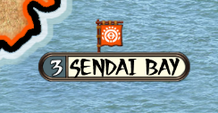
Below is an orange Mon/Flag from our Shogun game it is a _convoy flag and can be any size, this is 40x40px. So bigger WW2 flags can be used to denote SZ ownership.
.
Here it is in game
-
@black_elk Hey Brother ! Good Action Here ! You gonna bust out a Big Bad Ass Global Map and let people fill in the Blanks ? Do the xml how they want accordingly ?
Or do we still need to crunch some stuff out how it's all gonna work first ?
Wish I could help
") but I'm stoked you're into it because your Maps ROCK !!!
but I'm stoked you're into it because your Maps ROCK !!!:grinning_face_with_smiling_eyes: :grinning_face_with_smiling_eyes: :grinning_face_with_smiling_eyes:
-
@thedog said in Proposed Map: Domination 1941:
@black_elk
Below is an orange Mon/Flag from our Shogun game it is a _convoy flag and can be any size, this is 40x40px. So bigger WW2 flags can be used to denote SZ ownership..
Here it is in game
Is this for a unit as opposed to the map ?
Edit
Ahh Flag not unit. Seems they work similar to units. I thought Schultz was asking about changing the map. Sorry if I'm clueless here. Just stoked on the idea of a new map
-
@schulz Oh the Dog beat me to it haha. Yeah I was going to say, so in Inkscape for that equirectangular wiki map I posted earlier, you can morph the individual territory tiles if you want by just selecting them, or a group of them together (more likely). I'm sure you can achieve a similar stretch in say GIMP, but it's a little easier/quicker to do in Inkscape with a vector if you just want to stretch say Europe or France or whatever. To create v3 or the domination one that's basically what I did, just using photoshop. So I stretched out the European landmass and the South Pacific, compressed and titled Asia, tried to carve out some of North Africa so the Med could be larger, shrank the Americas and generally just warped it all around with the transformation tools in PS till I had something that seemed like an alright compromise. Then I redrew all the borders in MS paint zoomed in at like 400% or whatever hehe. My first pass for v3 was pretty tiny, I really wanted v3 to display more of the World at a glance, so the baseline was quite a bit smaller than even Revised or Pact of Steel at 100%. Map scaling was pretty rough back then, so I figured to draw something the would look alright more panned out that way. The idea being to use default unit sizes at like 75% or whatever and tighten up the centers since that was a newer feature, but basically just to avoid so much patch pan and drag. 4k resolution wasn't even on my radar, since that was almost 20 years ago lol.
@TheDog yeah, using a flag is prob the best way to go, I think it defaults to the roundel even just with the standard oldschool convoys and it's fairly easy to track that way. I kinda went crazy with the Great War, trying to include as many convoys as I thought I could get away with in that one, but that map was made before reliefs were a thing, so it has a bunch of weird extraneous stuff drawn into the tiles. I was checking out the Shogun map last night. Looks pretty clean!
@beelee said in Proposed Map: Domination 1941:
@black_elk Hey Brother ! Good Action Here ! You gonna bust out a Big Bad Ass Global Map and let people fill in the Blanks ? Do the xml how they want accordingly ?
Or do we still need to crunch some stuff out how it's all gonna work first ?
Wish I could help
but I'm stoked you're into it because your Maps ROCK !!!:grinning_face_with_smiling_eyes: :grinning_face_with_smiling_eyes: :grinning_face_with_smiling_eyes:
Hey dude! Yeah that was kinda my thought. I mean knowing myself I'll go hot for like 6 weeks on enthusiasm and then burn out in the new year haha. If I think too far in advance it just never gets done lol. I'll bang out a couple maps in svg when I can, cause I like that idea to have some vectors that others could use, and then pass the baton most likely hehe.
-
I Dig It

-
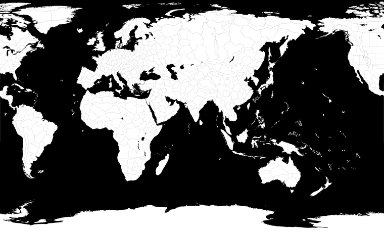
Ok so this a rough pull for like a working draft... It'll need to be cleaned up some more, but I kept basically all the work that Hepp's had added, just upscaled as a vector for the 4K idea. I added back in the Arctic and Antarctic regions as well. Even if they just get cropped, figured might as well put 'em in there for the draft, in case someone wanted that sort of extended view for some reason. I threw in some more terrain features as well, like the Rocky mountains and whatnot, and some more tile divisions up north just to start filling it out. I wanted to give myself something to play around with like that, even if they don't make the grade in the final pass hehe, just for the tooling around.
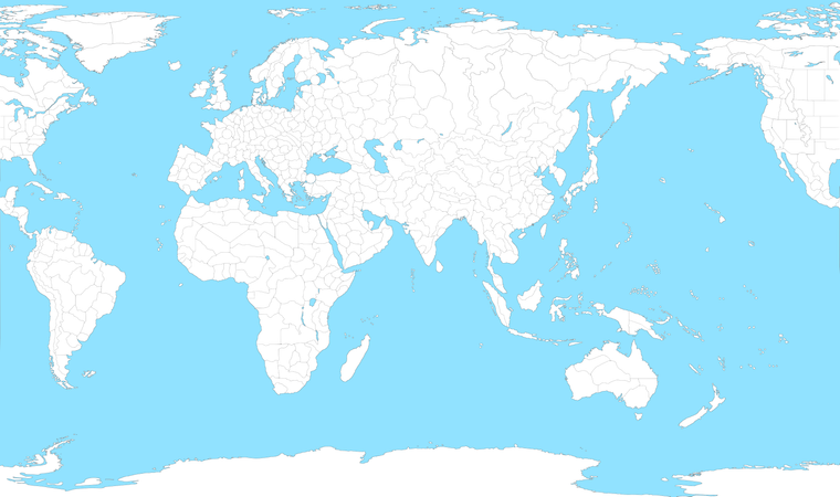
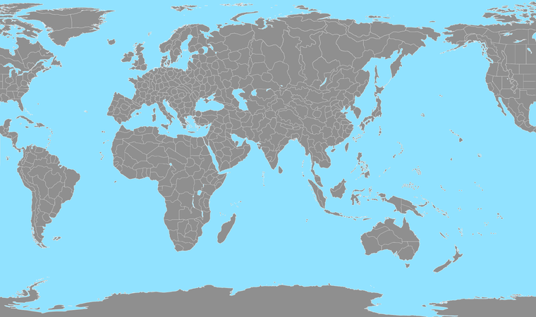
The forums will only display as a raster at 25% but the svg is at 13000 pixels wide. You can get a sense for the process. First layer will be just the tile divisions, the black lines essentially. Then one can isolate by color, to make the sea blue (it can be whatever shade one prefers), or to change the TT borders from black to white, like in relief, so it's easier on the eyes. I did a second one like that, with the land at 50% gray just to give an impression.
When you trace bitmap in inkscape to isolate and pull the borders, you'll get a bit of that stained glass effect where the boundaries come together, but it works well enough. We can always clean that up with some edgework and feathering once all the morphs are set and the borders are decided. Ultimately we'd probably want a topo relief stretched to the same dimensions, and maybe a relief that's more graphic, just to have both styles available, then yet another separate relief layer for any decorative stuff lol. Probably will take a hot minute or two, but whatever, least the ball's rolling again hehe.
-
Looking very good for a first draft !
What is the diameter in pixels of the Berlin/London/Paris circles?
Putting you on the spot have you thought how many SZ there will be for;
Brazil to Africa
New York to Liverpool ? -
@thedog Thanks! Wasn't too tricky once I got in the groove. Was just trying to block it in quickly so I'd have something to riff off of as we go. I did a little guess work there based on what Hepps was cooking up with the labelling, just to try and fill in some of the gaps. I think having a bit more of the arctic ocean might actually help with unit overflow and to disguise the warp a bit. Could probably try a couple other things to carry that a little further, maybe shrink Spain a slight bit or whatever, but seems to look alright thus far. For the SZ I just nixed everything so as not to get too distracted, but the 1914 layout has basically 7 tiles between New York and Liverpool and 4 between Brazil and Morocco. The Atlantic is simple enough to stretch if one wanted more space, guess it depends what they're after, might be a little snug still in a couple spots. I think the current dimensions should work alright for Global divisions though. Circles at scale are about 150 in diameter. Not sure if those should remain, or just get blobbed out, but round about that size hehe.
-
You probably saw on The Shogun we went for 3x3 units for square cities, but that looks OK. Kyoto was 4x4. units were 54px1.25=68px square.
So for WW2 3x3 units for capital cities should be fine.
Crunch time are we going for 48px or 54px high units? (+2px /unit spacing)
So maybe the 13000px wide map needs to be bigger?
Or the city TT need to be a lot bigger?
Thoughts? -
@thedog 16000x9000 looks pretty clean for the larger units. It crops with just a little bit of the Antarctic showing and the diameter of those circles at around 200 diameter at that scale.
-
I think 16000x9000 is the way to go. In this case bigger is better

It will be a monsterous map :alien_monster:
What do think of having a regular shape for capitals maybe square-ish but with rounded corners? (you could always fractal a square shape to be make it look irregular?) Extensions> Modify path> Fractalise...
As its a big map, it might help to have a regular shape when zoomed out, what do you think?
Hello! It looks like you're interested in this conversation, but you don't have an account yet.
Getting fed up of having to scroll through the same posts each visit? When you register for an account, you'll always come back to exactly where you were before, and choose to be notified of new replies (either via email, or push notification). You'll also be able to save bookmarks and upvote posts to show your appreciation to other community members.
With your input, this post could be even better 💗
Register Login