Navigation

    TripleA Logo

    TripleA Forum

    • Register
    • Login
    • Search
    • TripleA Website
    • Categories
    • Recent
    • Popular
    • Users
    • Groups
    • Tags

    Crazy Europe: House of Habsburg

    Maps & Mods
    11
    453
    423744
    Loading More Posts
    • Oldest to Newest
    • Newest to Oldest
    • Most Votes
    Reply
    • Reply as topic
    Log in to reply
    This topic has been deleted. Only users with topic management privileges can see it.
    • Hepps
      Hepps Moderators last edited by Hepps

      @CrazyG Just some more info for corrections...

      The Italian Trade routes don't appear to get captured when an opponent occupies the SZ.

      The following connections in Turkey are missing...

      T37<-> T57
      T22<-> T58
      T24<-> T58
      T27<-> T57

      Hepps 1 Reply Last reply Reply Quote 0
      • Hepps
        Hepps Moderators @Hepps last edited by

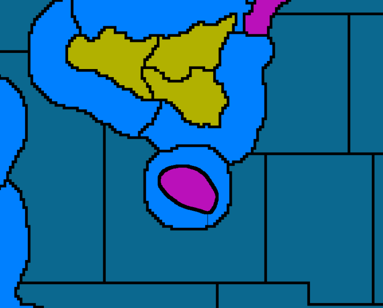
        @hepps Here is another screen shot.

        None of the finishing graphics are done. this is really just supposed to detail the territory outline changes.

        0_1520874701568_Sicily Before.png

        0_1520874712017_Sicily After.png

        redrum C 2 Replies Last reply Reply Quote 3
        • redrum
          redrum Admin @Hepps last edited by

          @hepps Looks like you added a bit of 'texture' to the land territories as well? I hadn't noticed that in any of the other screenshots.

          Hepps 1 Reply Last reply Reply Quote 0
          • Hepps
            Hepps Moderators @redrum last edited by Hepps

            @redrum Well some guy suggested that I redo all the territory lines... so I had started over. The land texture is just the outline I am using to create realistic land forms. Once I finish all the "beautification" @CrazyG can make a determination of how much or how little decoration he wants. Then a separate skin can be done if the detailed version is wanted left out.

            1 Reply Last reply Reply Quote 1
            • prastle
              prastle Moderators Admin @CrazyG last edited by prastle

              @crazyg all bot servers have been updated Except JP and GA. They also are all running .9687. Thanks! @ssoloff .

              1 Reply Last reply Reply Quote 1
              • C
                Cernel Moderators @Hepps last edited by

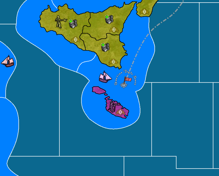
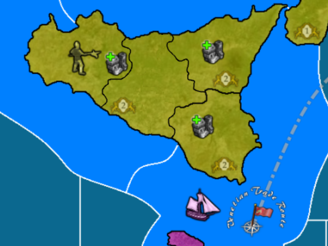
                @hepps @CrazyG For Sicily, since it is wider east-west, than north-south, how about these territories, for better capturing the shape of the island:
                0_1520893314528_Sicily_4_parts.png
                On the other hand, as per the meaning of its alternative name Trinacria, Sicily being split into 3 would be more in line with its traditional partitions.

                CrazyG 1 Reply Last reply Reply Quote 0
                • CrazyG
                  CrazyG Moderators @Cernel last edited by

                  I really don't think I need to add any more territories.

                  Its obviously nice for movement and combat to have lots of territories, but it also really inflates the income. And having that extra territory doesn't seem to change much about combat or movement to me.

                  @Hepps
                  It appears you are right. Turkey 57 and 58 were changed late in the process its why I forgot

                  No clue whats up with the convoy zones.

                  Hepps 1 Reply Last reply Reply Quote 0
                  • Hepps
                    Hepps Moderators @CrazyG last edited by

                    @crazyg well I may be wrong... just one of the things I scribbled down while playing.... I was looking at the map using the territory tab... and when I hovered over it it said it was controlled by Italy.... even though there was Ottoman vessel in the SZ. I did not re-verify Italian income however.

                    1 Reply Last reply Reply Quote 0
                    • Hepps
                      Hepps Moderators last edited by

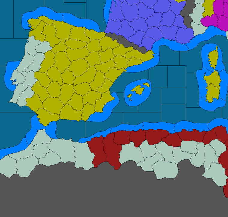
                      Here's a bit more of Italy and its surrounds....
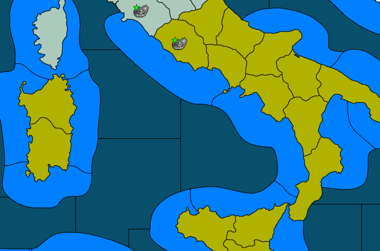
                      0_1520951619112_Italy reworked.png

                      Work continues.

                      1 Reply Last reply Reply Quote 1
                      • Frostion
                        Frostion Admin last edited by

                        @Hepps and @CrazyG
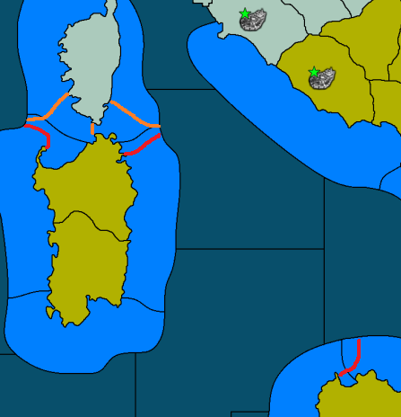
                        I really think that a tiny bit of texturing would lift the graphics up to a higher level.

                        Also, I think there are some minor border lines that should be clearer for the players. Like the connection from the deep sea above Sicily to the shore west of Sicily. I think this “passage” should be more visually obvious. I tried to redraw the border.

                        And if the top of Sardinia, and the sea invasion possibilities, should be more obvious, then maybe my drawn red line could work. Otherwise, and if it fits the map, maybe the orange could work.

                        Just want to help! 😄

                        0_1520966972485_1520951618278-italy-reworked-resized.png

                        General_Zod C 2 Replies Last reply Reply Quote 2
                        • General_Zod
                          General_Zod Moderators @Frostion last edited by General_Zod

                          @Frostion @Hepps

                          I like the way it coming out, very nice. The stars will be very helpful too, nice addition.

                          Yeah I also thought some of the borders of invasion beaches was slightly confusing. Although some of them also make it an extra sea zone to sail, which might be a god thing too. Hard to say until its played more, which I'm sure it will since it's such an appealing map (many ignore off putting maps regardless of play quality).

                          If can make a request on texture, try to keep it 50% zoom friendly for those of us who like big picture and territory tab style play . 🙂

                          1 Reply Last reply Reply Quote 0
                          • C
                            Cernel Moderators @Frostion last edited by

                            @frostion I'd say red. Makes sense that Corsica to S.Sardinia is a longer way to go.

                            This also reminds me that, at this scope, I would definitely consider adding the Elbe island (representing all the Tuscan Archipelago), but only if you add Cefalonia too.

                            1 Reply Last reply Reply Quote 0
                            • Hepps
                              Hepps Moderators last edited by

                              This has been more work than I intended... That being said... I now have all the coastal outlines done and the internal connections are much easier.

                              Work has picked up momentum significantly. Crazy I shall continue to plow through this as quickly as I can.

                              Here is a bit of a preview...

                              0_1521772319780_South West Progress.png

                              prastle C 2 Replies Last reply Reply Quote 4
                              • prastle
                                prastle Moderators Admin @Hepps last edited by

                                @hepps can I add more carrots to prompt you forward? Nice stuff 🙂

                                Hepps 1 Reply Last reply Reply Quote 1
                                • Hepps
                                  Hepps Moderators @prastle last edited by

                                  @prastle Going well Pras... Scotch not carrots would help.

                                  Should be at 50% by tomorrow morning.

                                  prastle 1 Reply Last reply Reply Quote 1
                                  • prastle
                                    prastle Moderators Admin @Hepps last edited by

                                    @hepps that requires a drive to boonie land :0

                                    1 Reply Last reply Reply Quote 2
                                    • C
                                      Cernel Moderators @Hepps last edited by

                                      @hepps It always is... it always is...

                                      The map looks very nice, and demostrates that you don't even need relief to have a very good looking map, except that I'm not getting why the Dardanelles are so much wider than the Bosphorous. I know that in some games you have a canal in the Bosphorous and not in the Dardanelles, and also at this time you have some Turkish forts more in there, with some big cannons pointed at the sea, but I think that, whatever the rules, the Dardanelles and the Bosphorus should go the same way, because they are geographically about the same deal.
                                      They used to be called the Straits of Saint George, in medieval times, at least in Venice, but I don't know if the name stuck until this age.

                                      Hepps 1 Reply Last reply Reply Quote 0
                                      • Hepps
                                        Hepps Moderators @Cernel last edited by Hepps

                                        @cernel Purely has to do with placements Cernel.

                                        Also there is nothing to prevent setting both Sea connections up as canals or straits. CG designed the map in such a way that both are possible. I am trying to keep the overall structure of the map consistent with the original and trying to keep unit placement quantities in mind while making revisions. Having adequate placements per Terr. or S.Z. is of greater importance than exact geographical representation.

                                        1 Reply Last reply Reply Quote 1
                                        • Hepps
                                          Hepps Moderators last edited by

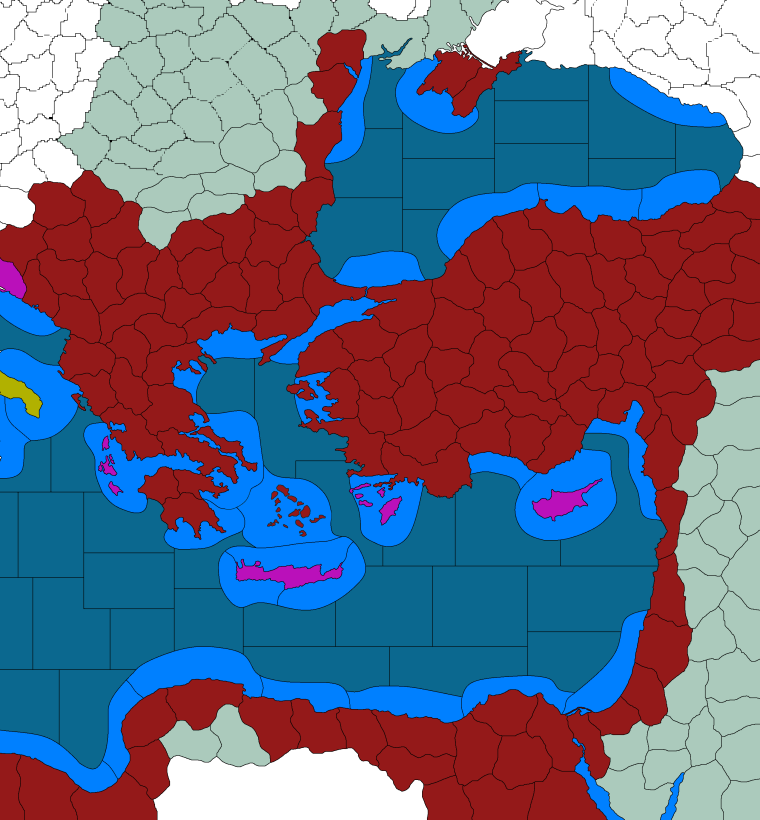
                                          Central parts of Europe are certainly more spacious with the reduction in the line widths.

                                          0_1521995187998_Central Europe.png

                                          1 Reply Last reply Reply Quote 3
                                          • Hepps
                                            Hepps Moderators last edited by

                                            Closing in on the finish line.... maybe 10% of the map left to do.

                                            Here's another teaser....

                                            0_1522016373416_spain and surrounds.png

                                            General_Zod 1 Reply Last reply Reply Quote 2
                                            • 1
                                            • 2
                                            • 10
                                            • 11
                                            • 12
                                            • 13
                                            • 14
                                            • 22
                                            • 23
                                            • 12 / 23
                                            • First post
                                              Last post
                                            Copyright © 2016-2018 TripleA-Devs | Powered by NodeBB Forums