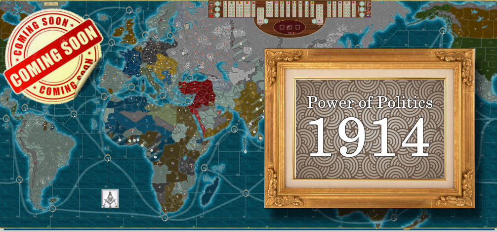
Power of Politics 1914 : A WWI scenario
-
@Black_Elk Yes. When you said it I immediately thought of a situation where you buy a "mechanical crate" That crate can be turned into any number of units without the need of a factory... the big gamble is how far do you press your luck in moving it around before you turn it into a... Tank... Fighter.... Mech...etc.
Because if the enenmy captures the crate... they get the crate and can build a...
-
Anytime I try to imagine a fog of war, I feel like it needs to be something kind of simple to succeed. I think whenever I've tried to pull it off, it was hidden force markers (like ghost units), or like in space games where you have a warp-point where forces can be spawned. Some hybrid of the two? Maybe the enemy knows what you got, but not where its coming at you. Doing it in A&A seems kind of tricky though. Like the opponent needs something to work off of to prevent it from just being a total guessing game. I feel like anything that might work needs to be fairly limited in scope, so it doesn't overwhelm.
That's interesting, I like that concept! capture the mechanical box would be very interesting. Units like that present some interesting gameplay choices, anytime something can trade hands.
-
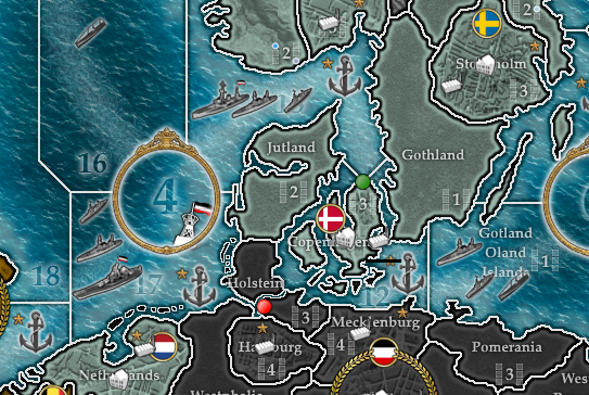
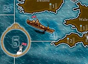
One more spoiler...
-
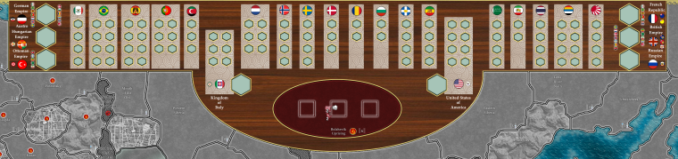
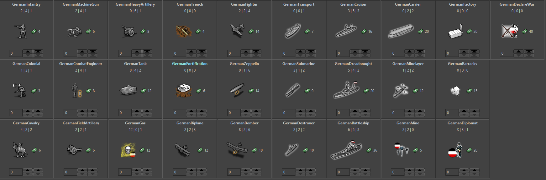
German roster is starting to come together...
-
@redrum is the mono fighter historic or a what if ? I didn't think there were any.
Ok I checked and
https://en.wikipedia.org/wiki/Fokker_Eindecker_fighters
Never knew that. I learned something today
") Snoopy and the Red Baron was what I remember lol
Snoopy and the Red Baron was what I remember lol -
@beelee It will require techs and is representing some of the early monoplanes towards the end of WW1.
-
@redrum I suggest changing "Fighter" to "Monoplane". Actually, if we want to be strict, "Biplane" should be changed to "BiplaneFighter" and "Fighter" to "MonoplaneFighter", as I see that the "Bomber" is a biplane too, but I guess that, if you don't specify it, it is reasonable to assume you are talking of fighters (this is what I immediately assumed, as well, for the "GermanBiplane"). However, I know that the definition of "fighter" is applying WW2 concepts to WW1, as back then the definitions were different and less precise.
There are also some other names I would have chosen differently, but mostly on a subjective level (like "DirigibleBalloon" instead of "Zeppelin" and "SuperDreadnought" instead of "Battleship").
-
There's a precious few that can prove at the root
This is all nothing but cold calculation...
Clearly entranced, you're leaning back now...
Defanged destroyer limps into the bay...
Down at the beach it's attracting quite a crowd...
As kids wade through the blood out to it to playOkay, you made me scared, you did what you set out to do
And I'm not prepared, you really had me going there for a minute or two
He said, you made me scared too, I wasn't sure I was getting through
I got to go...
It's been a pleasure doing business with you. -
@Hepps Where can I download "Power of Politics 1914 : A WWI scenario"? I cannot find it.
-
@LovePlayingAAA Its not yet complete or released.
-
would like to volunteer for playtesting if you need anyone, FWIW i've mostly played the ww1 variants of tripea in recent years up until i recently got into TWW.
-
@ubernaut If some lazy dumb ass would finish the units... we may just get to Alpha or Beta testing.
(The "lazy dumbass" being me of course.)
")
-
@Hepps let me know if i can lend a hand.
-
@ubernaut Do you have the ability to manipulate the fabric of the universe and warp time to give me anywhere between 30-60 hours each day? Cause if you do... did that butter churn just move? Cause if it did...
-
@Hepps i've been working on that kind of thing for quite some time actually. My first thought was clones but i've been thinking more and more about tardis tech lately.

hmm… just thought of a cool idea for a secret unit for power and politics.
-
@ubernaut Have any skill in making unit images?
-
@redrum maybe, not an illustrator per se but i'm pretty handy with photoshop.
-
@ubernaut Well, I'm dealing with a "lazy dumbass" that could probably use some assistance
-
@redrum more than happy to pitch in.
-
@ubernaut Cool. Let me talk to the "lazy dumbass" and see if there are some areas you can help with.
TripleA Developer with a Passion for AI: https://forums.triplea-game.org/topic/105/ai-development-discussion-and-feedback
Hello! It looks like you're interested in this conversation, but you don't have an account yet.
Getting fed up of having to scroll through the same posts each visit? When you register for an account, you'll always come back to exactly where you were before, and choose to be notified of new replies (either via email, or push notification). You'll also be able to save bookmarks and upvote posts to show your appreciation to other community members.
With your input, this post could be even better 💗
Register Login