Proposed Map: Domination 1941
-
@black_elk said in Proposed Map: Domination 1941:
haha! That's a good one!
I mean this works for me provided the scaling is smooth...
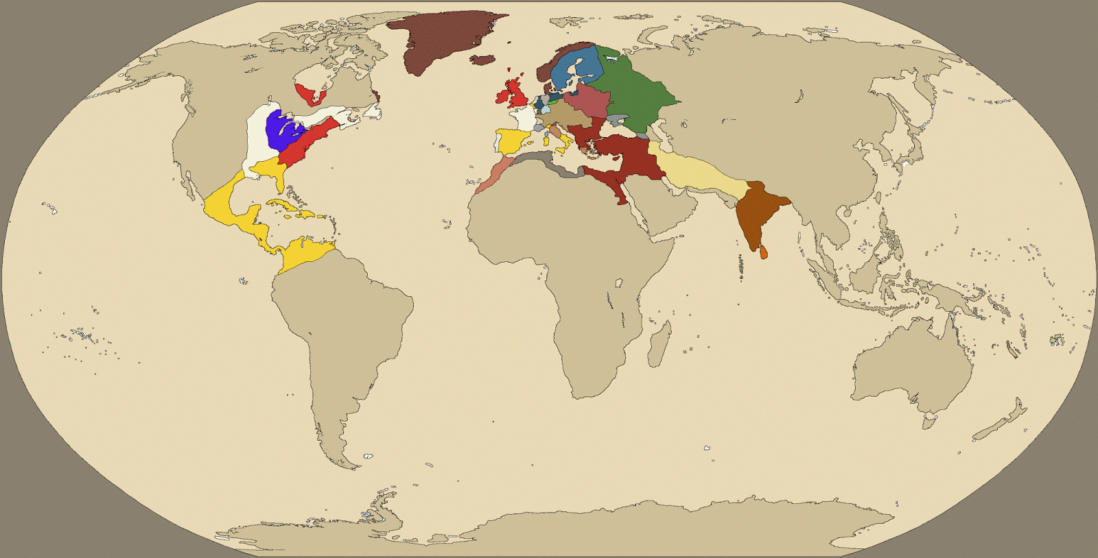
It's already in svg format, so like the Dog mentioned we could upscale that to 13000 or whatever for the high def. I'd probably crop at the Antarctic just for a tighter zoom at whatever height. Then isolate by color to add in the basic borders from there. That one shows modern political boundaries, so you'd still have to decide how to divide stuff up in Europe for the 1941 theme or for the larger TTs like USSR, USA, India, China etc. Prob on a separate layer with the SZ stuff (pacific would be quite large there), or terrain features like mountains or deserts etc done the same way so it could be revisited or revised later.
You've posted several maps to this thread since I last posted, including a Global War map; as well as the above-quoted equirectangular map. The Global War map definitely has some merit to it, but the Pacific is way too small a percentage of the total map. (At least for what I'm looking for.) On the other hand, the Pacific is plenty big enough in the Equirectangular map. Perhaps even too big. I mean, it takes up roughly half the map! Yeah that's realistic, but not ideal from a game play perspective. The Pacific needs to shrink somewhat. Not too much though, because it still needs to be a nice, large area for plenty of naval and amphibious war!
")
I'd love to help get this off the ground in any way I can, so by all means let me know if you have any questions or if there's any input you'd like me to provide.
-
@luhhlz said in Proposed Map: Domination 1941:
@KurtGodel7 @Black_Elk
bad ass! Agree the Pacific theatre in WAW/Rising Sun is one of the most dynamic and interesting theatres in all of TripleA! The island chains being connected by 'canals' is a key ingredient.@KurtGodel7
Elite infantry at 5PU? Needs amphibious +1 modifier and/or 1PU reduction.
I almost never buy 14PU bombers. 16 is too high. Am I missing something?
otherwise, kudos on tech and PU balancing. I started to complain about some of the other choices until I read through it all.country-specific units look fun! My nephew loves stuff like that. Assault rifle and jets and megaships :zany_face:
Tangent - can someone make a fix so that 1 destroyer does not negate infinite subs? A tech scale would be cool, like the battle of the atlantic, in september Germany gets n+1 tech, subs are much more effective, in october the allies get n+1 tech, sink 30 subs
It's funny. The high cost of elite infantry has been eating at me ever since I posted that OP. Instead of 5 PUs each, 4.5 PUs would make more sense. I want elite infantry to provide less bang for the buck than regular infantry, but not too much less. They are intended to be the right tool for certain circumstances.
To be honest I'm a bit concerned about redundancy. Does an elite infantry fill a substantially different role than a heavy gun? If not, it might be necessary to eliminate heavy guns.
Why do bombers cost 16? My reasoning is as follows.
- In NWO, I'll sometimes buy 15 PU bombers for the U.S.S.R. Do I use those bombers for strategic bombing? No, not unless my opponent has a nearby factory with no aa gun. But think about back-and-forth battles. You could spend 16 PUs for 2 early fighters, or 15 PUs for one bomber. Either way you're getting 4 firepower on attack. The early fighters give you a lot better defense, and more cannon fodder if you're looking to sink Germany's Baltic fleet. The bomber gives you more range, more flexibility, and has the threat of strategically bombing someone.
- If you take a close look at my proposed tech system, the "combined arms" tech makes all your aircraft provide artillery support for infantry. Once you get that tech, bombers become better than NWO bombers, and so should cost more.
- I'm not a huge fan of strategic bombing raids, because they are luck-based. If you're getting bombed and your aa gun keeps missing, there is literally nothing you can do as a defender. I don't want strategic bombers to be overly affordable, because then I'd be encouraging players to emphasize an aspect of the game which comes down to blind luck.
If you look closely at my tech system, you'll see that early fighters start off costing 9, but get reduced to 8 with working women. Working women tech does not reduce the cost of bombers. Combined arms allows each of your aircraft to support an infantry or other supportable unit. In the above example where it's either 2 early fighters or 1 bomber, this means that the 2 early fighters will, together, benefit twice as much as the one bomber. At least in most circumstances. In some back-and-forth battles there will be more air providing support than there will be infantry to support. Admittedly you're nerfing the bomber at least a little in relation to the early fighter. But I think the additional range of the bomber still justifies it as a unit purchase, because you never know when that extra range will come in handy.
All this being said, I'm not wedded to the idea of 16 PU bombers. Depending on play testing I could come down to 15 PUs. But I would not want to go any lower than that, due to my concern about making strategic bombing too viable an option.
-
@zlefin said in Proposed Map: Domination 1941:
There's also TWW for larger maps, which has just as good a tech system as NML.
Your post inspired me to take a closer look at TWW. It does have a very good tech system.
One could argue that the most important characteristic of a map is the ratio of complexity to strategic depth. In TWW, there is a chart which lists 208 different interactions between units and terrain types. That does far more to increase the game's complexity, than it does to provide strategic depth. Terrain effects are just one of a number of things which make game play more complex than NML or WAW. The bad ratio of complexity to strategic depth is why that map isn't played much. It's unfortunate that the map's creators didn't do a better job at paring away complexity, because that map does contain a number of good ideas. The strongest of which is the tech system.
So adding another larger map wouldn't necessarily help things if it doesn't get played much. It's not easy for a new map to get played alot.
You are right. It is not easy for a new map to get played a lot.
What I'm focused on now is being part of a team which creates a map which people fall in love with once they play. A map which has a great ratio of complexity to strategic depth. A map which is unique and memorable. Will people play it a lot? That's not something I can control.
Tech is a double-edged sword; while it can spice up a game, it can also make for pigeon-holing in much the same way you describe WaW strats. The tech in nml tends to not be well-balanced, with some very strong trends pushing it in certain ways.
Are there cases where your critique of the NML tech system makes sense? Absolutely. Smaller nations, for example, should generally go for the resource-producing techs first. However, the same is not necessarily true of larger nations. Let's say the German player wants to make a heavy push in Africa. He should research innovation tech, because increased factory placement capacity and the ability to build tanks will both be very useful for conquering Africa. If he's going for Paris, land offense tech might be the right choice. Creeping barrage and mobile warfare are both very useful for that! If he's pursuing a more generic strategy, the income-producing techs from the economy and land defense categories will be what he needs. Land defense also helps defend against British amphibious attacks. If he seeks a naval showdown with Britain, he'd be well-advised to research either or both naval tech categories. Tech strategy and military strategy are deeply intertwined.
Tech systems often have a problem of pushing towards excess focus on specific units.
Granted.
I look at every unit as a tool. Each tool should have a purpose--a circumstance in which that unit, and no other, would be the best-suited for the task at hand.
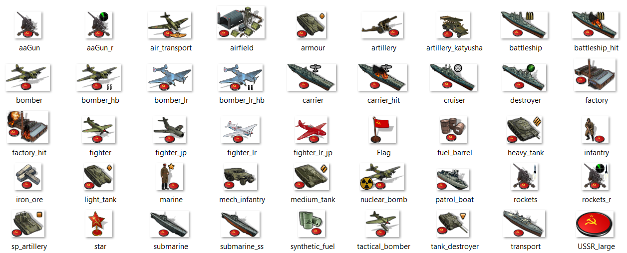
I generally wanted nation-specific units to be better than the standard equivalent. I'd be perfectly happy if the U.S. and Japan eschewed standard battleships completely, instead building Iowa and Yamato battleships.
Other than stuff like that, however, I want to see all the units get built. If in the course of play testing it becomes clear that some units just aren't getting built at all, or stop getting built after certain tech are researched, it might be time to tweak things a little.
If you want more strategic variety in waw, it'd seem to make more sense to fix the balance problems in it that make certain strats too effective compared to others.
I've played WAW maybe once or twice in my life. My two favorite maps are NML and NWO. Most people who play both WAW and NML say that NML is a significantly better map. My goal is not to make a better WAW. It is to take the things I love about NML, add to them, and migrate them to a WWII map.
-
I have small disagreements with (2) but I don't want to get hung up on something I think is an incredibly small issue. The gameplay difference to me from 14/15/16 is almost nothing since I think attempting to extract tiny amounts of PU gain from mass SBR is a losing strategy compared to investing those PU into typical power projection (compound growth >>> arbitrage).
-
More theory - applies to large maps like WAW. I am no expert on vanilla sized maps.
I find that because SBR runs can originate from only a few territories, a mass of bombers performing SBR end up providing a lot less flexibility than their range would imply. So they end up devoted to that purpose, and not to power projection.
edit-KurtGodel7 showed me this math is wrong!
SBR provide expected value of 3 PUs per run * 6 runs until they are shot down minus cost (15) = .5 PU per turn. This is a pathetic return on investment. Imagine you used that bomber instead to capture a small 2 PU territory on a frontier somewhere, that is 8x more profitable than a bombing run (your income increased, opponent's income decreased). And on a large map there are ALWAYS many options to project power.If I do some napkin math. your fortresses are much more appealing as SBR. And given their range, they are able to SBR while still projecting power (unlike normal bombers). And the US is typically the nation for which SBR is most appealing in the first place. So if you are trying to nix SBR, you may want to reconsider the +2SBR ability (and then lower cost).
Also, you mention you are not a frequent WAW player, so FYI - Japan will sorely miss having super bombers in the Pacific. This represents a significant Japan nerf that will need to be balanced in other ways.
-
I think the advantage of starting with something that shows the political boundaries circa 1945 rather than 1900 or 1914, is that they really haven't changed all that much. I mean aside from what's going on now, and then you can kinda get the vibe like WW2 into the Cold War era. Most of the warps I like kinda stretch out the south pacific and subtly enlarge most of the islands around the globe, so they're more visible. I like the idea of parking a fighter on malta for example hehe. But sorta recognizing that you're going to have some jumps in scale for stuff like that too. I lot of maps use circular motifs around capital cities say, kinda riffing on the original A&A Europe I suppose, but the downside there is that it's somewhat less adaptive across timelines. So a city circle that makes sense in 1914 might make less sense or just be unnecessary for 1941. I think if going through the effort, it might be better to avoid circles or graphical elements like that, since they're easier to add in later anyway. So for example, maybe just a Brandenburg blob, as opposed to a Berlin circle. You could still set up the boundaries so it's maybe totally encircled by East Germany or whatever, but just making it look more "terrain-y" as opposed to geometric abstraction. Basically an Oblast blob for Leningrad rather than a Leningrad Circle, if that makes sense lol, and just keep it consistent throughout. I think if upscaled to 13000, using the equirectangular Europe, you could get what maybe 3-4 territories for larger TTs like Germany, Poland, France, Italy? Any more than that and it's probably just going to spill over I'd wager, but I think you could still get something that's tactically engaging with that. Eastern front is a bit easier cause the TTs are generally larger. I'd say it's mainly making sure the SZ are large enough, like when 2 or more friendly powers are co-locating there. Having so more blue up north would probably help. Like you could still crop in at the very top of the arctic, but giving it just a bit more room for the shuck lanes that tend to develop up there.
-
@black_elk said in Proposed Map: Domination 1941:
I think the advantage of starting with something that shows the political boundaries circa 1945 rather than 1900 or 1914, is that they really haven't changed all that much. I mean aside from what's going on now, and then you can kinda get the vibe like WW2 into the Cold War era. Most of the warps I like kinda stretch out the south pacific and subtly enlarge most of the islands around the globe, so they're more visible. I like the idea of parking a fighter on malta for example hehe. But sorta recognizing that you're going to have some jumps in scale for stuff like that too. I lot of maps use circular motifs around capital cities say, kinda riffing on the original A&A Europe I suppose, but the downside there is that it's somewhat less adaptive across timelines. So a city circle that makes sense in 1914 might make less sense or just be unnecessary for 1941. I think if going through the effort, it might be better to avoid circles or graphical elements like that, since they're easier to add in later anyway. So for example, maybe just a Brandenburg blob, as opposed to a Berlin circle. You could still set up the boundaries so it's maybe totally encircled by East Germany or whatever, but just making it look more "terrain-y" as opposed to geometric abstraction. Basically an Oblast blob for Leningrad rather than a Leningrad Circle, if that makes sense lol, and just keep it consistent throughout. I think if upscaled to 13000, using the equirectangular Europe, you could get what maybe 3-4 territories for larger TTs like Germany, Poland, France, Italy? Any more than that and it's probably just going to spill over I'd wager, but I think you could still get something that's tactically engaging with that. Eastern front is a bit easier cause the TTs are generally larger. I'd say it's mainly making sure the SZ are large enough, like when 2 or more friendly powers are co-locating there. Having so more blue up north would probably help. Like you could still crop in at the very top of the arctic, but giving it just a bit more room for the shuck lanes that tend to develop up there.
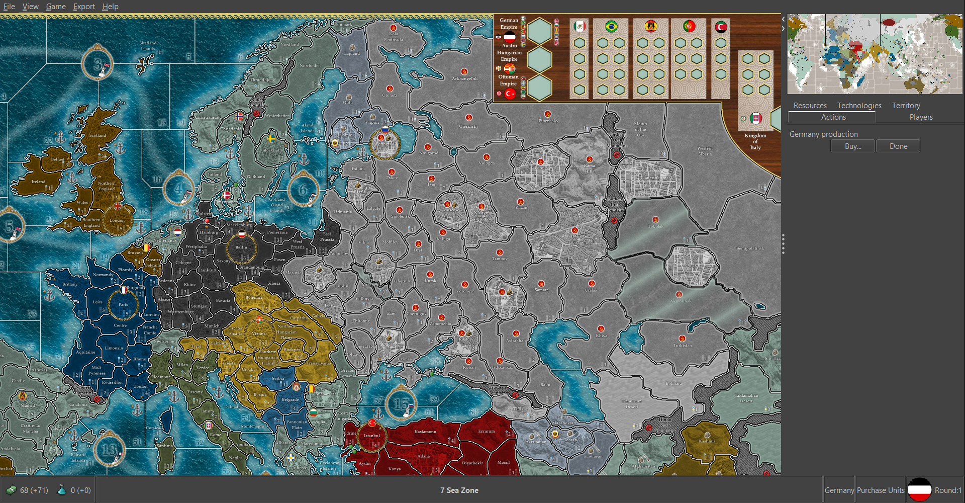
In New World Order, Germany consists of 14 territories at the start of the game. In No Man's Land, it starts with 17 territories. Roughly that number of territories seems about right for Germany, with the rest of Europe done on a similar scale.
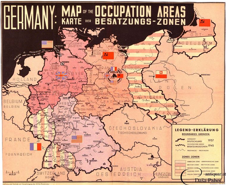
Historically Prussia had been part of Germany, but after WWII it and Silesia were ethnically cleansed of Germans and added to Poland. The eastern half of Poland was ethnically cleansed of Poles and added to the Soviet Union. Because clearly, the Soviet Union did not have enough space.
The question then becomes: do you draw a pre-1945 map, in which Prussia still exists? Or should it be post-1945, after Prussia had been erased? The former option would obviously be better for WWII, WWI, the Franco-Prussian War, the Napoleonic Wars, and any other European conflict prior to 1945. The latter would be better for cold war type maps, or anything after 1945. I'm envisioning a WWII map, so my vote is for the boundaries Europe had in 1941.
-
@luhhlz said in Proposed Map: Domination 1941:
More theory - applies to large maps like WAW. I am no expert on vanilla sized maps.
I find that because SBR runs can originate from only a few territories, a mass of bombers performing SBR end up providing a lot less flexibility than their range would imply. So they end up devoted to that purpose, and not to power projection.
SBR provide expected value of 3 PUs per run * 6 runs until they are shot down minus cost (15) = .5 PU per turn. This is a pathetic return on investment. Imagine you used that bomber instead to capture a small 2 PU territory on a frontier somewhere, that is 8x more profitable than a bombing run (your income increased, opponent's income decreased). And on a large map there are ALWAYS many options to project power.
If I do some napkin math. your fortresses are much more appealing as SBR. And given their range, they are able to SBR while still projecting power (unlike normal bombers). And the US is typically the nation for which SBR is most appealing in the first place. So if you are trying to nix SBR, you may want to reconsider the +2SBR ability (and then lower cost).
You make good points. Let's do some math.
Strategic bomber (dedicated to strategic bombing raids). Expected damage per raid: 3.5 PUs. Expected number of successful raids before being destroyed: 5. (Presumably it gets destroyed on the 6th raid before getting a chance to bomb.) Total expected value of bomber: 17.5 PUs. Cost of bomber: 16 PUs.
Now let's take the Superfortress. Expected damage per raid: 5.5 PUs. Expected number of successful raids before being destroyed: 5. Total expected value of bomber: 27.5 PUs. Cost of bomber: 22 PUs.
The above numbers tell me that either the cost of a Superfortress needs to go up, or the SBR damage needs to come down. If the cost stays at 22, but the bonus for bombing is reduced to +1, that would yield the following. Expected damage per raid: 4.5 PUs. Total expected value of the bomber: 22.5 PUs. Excellent. It seems to me that the price of the Superfortress could go down to as low as 20, but the bombing bonus should only be +1.
Also, you mention you are not a frequent WAW player, so FYI - Japan will sorely miss having super bombers in the Pacific. This represents a significant Japan nerf that will need to be balanced in other ways.
WAW nerfs Japan in the following ways:
- Divide it up into three "little Japans," making it extremely difficult to sink the U.S. Pacific Fleet.
- Give each little Japan a capital bordering water, making them all vulnerable to naval bombardments.
- Make Tokyo face east and west, so that you can't defend it from bombardment by defending any one sea zone in particular.
- Make naval bombardment unlimited (Revised rules). One infantry + 100 battleships = 100 bombardment shots.
In my proposed map there is one Japan, not three little Japans. There will be only one capital bordering the ocean, and it will border the ocean only on one side. Naval bombardment shots will be limited, as is the case in NML. (Anniversary edition rules.) 1 infantry + 100 battleships = 1 bombardment shot.
Japan may not have access to Superfortress tech, but it does have some other really good techs. Long Lance torpedoes are unique to Japan and improve the attack ability of subs and cruisers. It is the only nation in the game which can build 3 hit battleships. Kate technology allows Japanese fighters to attack on a 4. With all that stuff, I'd say there's plenty to balance out the disadvantage of no Superfortresses for Japan.
-
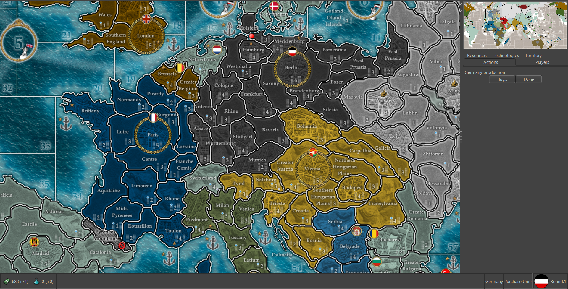
@kurtgodel7 So on the 1914 baseline Germany has 21 TTs I believe. That's probably more like what you're after, or maybe more than you'er after? lol So it has the 17 TTs I drew for Domination with the Berlin circle, but then Hepps added Stuttgart, Hamburg and Frankfurt as additional TTs in the west. A lot of the TTs sorta alternate like that between regional labels or more urban center labels, just cause of the way the gameplay/production spread was conceived. The Eastern half of G looks basically the same as Domination, so still showing Prussia, 1914 theme there. I'd think you'd want to do a slightly different division/labelling there for something set in the 1940s.
Here it is at 50% with the unit details turned off to show the tiles more clearly.
At 100%
I think if going for something like that, then the map would prob need to be quite large to accommodate the units. The planned unit roster for that game was pretty deep, like more than a dozen ground/air units that might need to fit a given tile. Not sure how it would actually play, as my version is incomplete. Perhaps Hepps sent Prastle or Redrum a version that is further along, mine is still missing some stuff, but if using the same basic Domination world projection for the baseline, I'd prob just build on that work for the contours of the shape of the world and whatnot, cause it's kinda aces. Like basically we just want to englarge the scale even further to whatever 4k and then redraft it for the late 30s/early 40s right?
If going from scratch, like to redesign the whole projection, or using a standard one like the equirectangular morph for Europe/World, I'd think you'd want a map that's pretty large overall to handle that many TTs in Europe. Just to support even a more regular unit roster like AA50 with that number of TT divisions for a WW2 map, the tiles need to be beefed up in scale I'd think. How many unit types and factions co-locating overall would be a consideration as well I guess, for unit for overflow, to tamp that down if possible, just for fewer overflow lines everywhere.
Here is a view of the vector from the wiki with a similar scale on Europe just so you can compare the shape and available space there at a glance.
I think my ideal WW2 game would have a fairly complex map (more TTs than Global), but also a relatively simple ruleset and a pretty straightforward unit roster. Sorta modelled on the familiar A&A games, just to offset that added complexity of a more carved up map. Basically a big ass map, but that plays more or less like AA50 in the nuts and bolts, just with more TTs hehe. I know everyone has a different play preference though. For the 3-4 divisions I mentioned with G, that'd be more like to draft a Global 1940 or expansion playscale off that same baseline map. Sort of a tradeoff there between the number of TTs and the complexity of the unit roster and the overall scale of the gameboard. Basically if you start very divided up for the first pass/first draft, then it's easier to just erase the lines afterwards to make larger tiles out of them. I enjoyed Frostion's Iron War map quite a bit, which kinda split the difference between an expansive unit roster with many factions, but also somewhat more simplified TT divisions. Not sure what would play best for what you have in mind. I still like the idea of somehow banging out a revamped map for Global though at the same time. It would be nice to have something with some fancy reliefs like WOPR did for AA50 but for the Global 1940 game, and some national sculpts like Frostion made, so I could deck out my digital dreamboard for that one too heheh.
So Domination 1941 would be the super divided up TTs, after that's drawn collapse the lines into larger TTs to match the Global 1940 divisions. But both with the same world shape basically, or same relative size, same ratios anyway. Global might not need to be as large in scale overall, but we just do it in vector to 4K so the resizing isn't as big of an issue, like the Dog suggested. I'm still trying to figure out inkscape again hehe.
ps. oh also just cause I was rambling about it on the previous page, some Empire TW views that I snagged from the Tactician's site. Also an NTW mod idea for the Great War I've seen floating around, that just used the Napoleon tiles hehe. It funny to see how they tried to push it into the 20th century there, despite not being able to redraw the Map Territories in that game.
I kinda always liked the idea of a hybrid A&A Total War game, and was bummed they didn't carry the Empire idea further like into the late colonial era. Would have been fun if they did the whole world instead of just the 3 theaters in Empire. Anyhow, just a ramble
Oh and here are some views showing the Frostion units. They are larger than the default scale in most games, but I feel like that's probably a good thing if trying to upscale the whole package.
I just like the designs and the fact that they're larger. Even if done as a uniform tint rather than individually painted, either way looks pretty good to me.
If we wanted to make an entirely new unit set, like for at 4K, then I think the best approach would be to photograph HBG sculpts or actual models at 1:72 or larger scale stuff for the vehicles and aircraft. Like just with a controlled/constant light source on a flat background. Snap em, then downscale them, and put em on a transparency with a dropshadow. That would probably look cool. I think the uniform tint or national colors w/ roundel should be an option that one could switch from a setting on the fly. That'd be a nice touch. I like how he gave some symbols though to differentiate unit type by basic shapes, or like for the colorblind.
-
So glad you pointed this out to me, you're right on the averaging and on the run it gets shot down it doesn't bomb. Thanks!
The change to Super sounds good!
-
@black_elk said in Proposed Map: Domination 1941:
@kurtgodel7 So on the 1914 baseline Germany has 21 TTs I believe. That's probably more like what you're after, or maybe more than you'er after? lol
Thanks for showing me that baseline 1914 Germany. After looking at it, I've decided I like the extra territories!
The Eastern half of G looks basically the same as Domination, so still showing Prussia, 1914 theme there. I'd think you'd want to do a slightly different division/labelling there for something set in the 1940s.
Prussia still existed during WWII, and had been reincorporated into Germany. No need to eliminate it. What might need a little changing around is Austria and the Balkans.
I think if going for something like that, then the map would prob need to be quite large to accommodate the units.
Understood. I think that large map might be exactly what a Domination 1941 needs.
The planned unit roster for that game was pretty deep, like more than a dozen ground/air units that might need to fit a given tile.
My proposed unit roster in the OP is somewhat deep also. I could pare it down a little if necessary. I'm on the fence about whether to include heavy guns. Also there are two nations which are currently capable of building conscripts, regular infantry, and elite infantry. That also can be pared down if need be, by prohibiting elite infantry to any nation capable of building conscripts.
Another thing which could be done to prevent unit crowding and add realism is this. Disallow combined Allied forces on Soviet soil. Two ways you could achieve that. 1) Treat the U.S.S.R. the same way it's treated in NML, except now it's on the opposite side. Meaning, that it would be neutral with respect to the other Allies. Non-Soviet Allied forces would not be allowed on Soviet soil. 2) Create a Lend-Lease rule. At the beginning of the Soviet player's turn, any non-Soviet Allied units on Soviet soil are automatically sold for cash. You'd want to impose a penalty for doing that, to prevent the U.S.S.R. from becoming overpowered. If a fighter is worth 10, for example, maybe you sell it for 8. If option 2 is onerous to implement, option 1 would be perfectly acceptable.
Like basically we just want to englarge the scale even further to whatever 4k and then redraft it for the late 30s/early 40s right?
Yeah that sounds true. I really like the Hepster/Hepps maps you've posted, so a WWII version of those would be absolutely perfect.
If going from scratch, like to redesign the whole projection, or using a standard one like the equirectangular morph for Europe/World, I'd think you'd want a map that's pretty large overall to handle that many TTs in Europe.
Makes sense.
Here is a view of the vector from the wiki with a similar scale on Europe just so you can compare the shape and available space there at a glance.
I see.
I think my ideal WW2 game would have a fairly complex map (more TTs than Global), but also a relatively simple ruleset and a pretty straightforward unit roster. Sorta modelled on the familiar A&A games, just to offset that added complexity of a more carved up map. Basically a big ass map, but that plays more or less like AA50 in the nuts and bolts, just with more TTs hehe.
I've played Global a number of times. Transports not participating in combat took a little getting used to! But once I was used to it, it seemed fine. Ditto with limited naval bombardment and the new sub rules. Naval bases made things a bit more tricky--a little harder to tell at a casual glance whether an opposing navy could get to you. The naval base has been bombed, but has it been bombed enough to prevent the bonus to fleet movement? What I liked the least about the new rules was airbases. They significantly slowed down naval combat due to the defender deciding whether to scramble aircraft. Also they made it a lot trickier to figure out which enemy aircraft could hit which targets. Yeah you could figure it out, but it was just one more thing to pay attention to.
I've spent the past ten years or so periodically thinking about new rules sets for this game. I've had lots of good ideas during that time, most of which involve added complexity. If I implement all or most of my ideas, that would be too much complexity, and a map that's cumbersome to play. So I developed the instinct of strongly pushing back against added complexity. I might have a dozen ideas, but maybe only one or two have a good enough ratio of complexity to strategic depth to make it past my filter.
That being said, I have at least one rules change which might be worth considering. Under all TripleA maps, units have an attack value and a defense value. That makes sense for infantry fighting other infantry. In real life, a defending infantry will dig a foxhole or use a building or large rock as cover, and so will be more combat-effective than an attacking infantry. But in naval combat, there is no meaningful distinction between attacker and defender. It's not as though the "defenders" will dig a trench in the ocean water, and use that water trench to give themselves an edge over the attackers.
With that in mind, why not replace attack/defense values with the following:
- Anti-land
- Anti-naval
- Anti-sub
- Anti-air
- Strategic bombing value
Doing things this way makes it possible to create meaningful distinctions between different aircraft types.
- Fighters would be great at anti-air, weak at anti-land and anti-naval.
- Dive bombers would be great at anti-land, decent at anti-naval and anti-air.
- Torpedo bombers would be great at anti-naval, decent at anti-sub, anti-land, and anti-air.
- Strategic bombers would be specialized for strategic bombing raids.
All this sounds well and good, but there is a problem. A fly in the ointment. That problem is what I call a destroyer going crazy. What do I mean by that? Imagine a naval combat. Destroyers are fighting cruisers, with everyone using their anti-naval combat value. Fine. In another combat, destroyers are fighting subs, with the destroyers using their anti-sub combat value. Also fine. In a third naval combat, destroyers are being attacked by enemy air. The destroyers are fighting back using their anti-air combat value. Also fine. Now imagine a large scale combat situation in which each side has surface ships, subs, and aircraft. This group of destroyers would be firing at their anti-naval combat value, and their anti-sub combat value, and their anti-air combat value. The destroyers are going crazy! That's not what one wants, because it punishes players for using multiple categories of units.
How to solve that problem? One option would be to simply ask the player, "At which targets do you want to fire first?" But that's cumbersome--way more cumbersome than airbase scrambling. Unacceptable. Better to make that selection automatic. Each round of combat the following would happen. 1) Your destroyers would fire until all enemy subs are destroyed. 2) Any destroyers which didn't fire at subs fire against enemy aircraft, until all enemy aircraft are destroyed. 3) Any destroyers which didn't fire at subs or aircraft fire at surface ships, until all surface ships have been destroyed. That would repeat each combat round. So maybe combat round 1 all your destroyers fire at subs. In combat round 2, some of your destroyers finish off the enemy subs, with the rest firing at enemy aircraft. In combat round 3, most of your destroyers focus on finishing off enemy aircraft, with the rest firing at enemy surface ships.
I acknowledge that the above system would slow major naval battles down a little. But major naval battles don't happen very often, so slowing them down a little when they do happen does not represent a major increase in player burden. But there is a major increase in strategic depth, because fighters, dive bombers, torpedo bombers, and strategic bombers each fill a very different role. Doing things this way would also allow a completely new way of handling strategic bombing raids. Each strategic bombing raid would be preceded by a dogfight, with aircraft firing at each other using their air combat values.
I didn't propose any of this in the OP, because I'd rather have a good map which actually gets implemented, than a perfect map which remains in my own imagination. I don't know how easy or difficult it would be to get the TripleA engine to do what I've described above.
Not sure what would play best for what you have in mind.
The Hepps/Hepster maps you've posted seem perfect, except that they'd need to be modified for WWII.
I still like the idea of somehow banging out a revamped map for Global though at the same time.
I won't stop you.
So Domination 1941 would be the super divided up TTs, after that's drawn collapse the lines into larger TTs to match the Global 1940 divisions. But both with the same world shape basically, or same relative size, same ratios anyway.
Sounds good to me.
Oh and here are some views showing the Frostion units.
There are two things to consider with units. 1) The beauty of the units. 2) Does a casual glance quickly reveal what's going on?
For me personally, consideration 2) is far more important than 1). If I'm immersed in a game, I want to know exactly what I have and exactly what my opponent has. I want to have that knowledge quickly and fully, without putting any real work into figuring out what is what. The units from NWO, NML, and Global do an outstanding job with this. It's about as easy to figure out what's going on, from a units perspective, as a person could ask.
Frostion's units look good. Much better than the units I'm used to seeing. But at least for me, a casual glance would not instantly reveal what was going on. Granted, I'm used to the types of units one sees in NWO or NML, not the units from Frostion. If I was used to Frostion's units, would they be just as easy to work with as the NWO or NML units? I don't know. But even if the answer to that question is yes, their use would still create a learning curve. That learning curve might discourage new people from trying the map. Would it be possible to use NWO type units as a default, but give players the option of seeing Frostion units instead? A player new to the map would at least want familiar-looking units. But once a player had played it a while, he might be willing to give Frostion units a try. By then he's already familiar with the map, so he's only needing to handle one unfamiliar thing at a time.
If we wanted to make an entirely new unit set, like for at 4K, then I think the best approach would be to photograph HBG sculpts or actual models at 1:72 or larger scale stuff for the vehicles and aircraft.
I admit that would look really cool.
When I looked at the unit icons you'd posted, I admit I felt the desire to have them, or something along those lines, included in the map. But that's looking at them in isolation. When I see them on the map, I think they would increase the difficulty of figuring out what's going on.
I have an analogy. Let's say I want to use an emoji. I'd use something like this
or this  . Those are cartoons, caricatures. They simplify and exaggerate the difference between a smiling face or a sad face. Let's say you were to eliminate those cartoons and replace them with emoji-sized photographs of people smiling or frowning. You'd still be able to see the difference in facial expressions. But it wouldn't be as easy. On the other hand, an actual photograph of a person would look better than this emoji: . Depending on the person, of course!
 ")
Why does this discussion board use cartoon emojis, instead of using emoji-sized photos of people's faces? Why does my cell phone use cartoon emojis? Why, in general, are cartoon emojis used, and why are tiny photos of people never used as emojis?
If you give people the option to use both traditional type units and Frostion style units, which will people prefer? Will they go with the ease and simplicity of traditional units, or with the coolness factor of Frostion's work? Having both options available would be good, so that people can choose whatever works best for them.
-
Yeah it's always a bit of a bind, cause on the one hand, if recycling material from more familiar games there is an ease of use advantage there (like if I see the same Infantry or Fighter sculpts in all the World War II games, I can kinda hit the ground running a bit faster, since I already know what's going on). On the other hand some of the initial choices about what those default units were going to look like were kinda arbitrary, and the preference is mostly habit I think. Like all the standard units are still building on Logan's work from early days, on tripleA Classic. They've been revamped at least 3 times in the time I've been around, but some major features persist throughout, so you kinda get a hodgepodge effect after time, as the same graphics are re-tinted or redrafted again and again, but still sorta stuck in 2003, with tripleA's capabilities at that time lol.
Then there's a separate issue, where if the same unit icons are re-used, but there's a change to the actual costs/abilities, that might lend itself to different kind of confusion. I don't have a hard preference really, except I do see that the 'official' games (the ones with the World War II labelling), are kinda stuck with a very particular look, that hasn't really caught up or advanced much, in the same way that other features of tripleA have.
Some of the unit stuff I drew for Pact of Steel or my various WW1 maps as a placeholder, just kinda reappear and refuse to die lol, or you'll see older stuff hanging on for ages, especially for certain unit types like ships or finding vestigial remains in the neutral sculpt sets etc. I think many of the standard unit designs are pretty strong and recognizable, obviously hehe, but there's still a scaling limit that maxes out based on whatever dimensions the unit graphics were drawn at initially. You can upscale them a bit, sure, but there's still that ceiling. I actually don't even have a computer monitor capable of displaying tripleA at a 4k resolution lol, but I'm just guessing there might be a need for new unit graphics for something like that, just so it looks decent, or can scale in the same way that the gameboard can, at higher resolutions.
Sounds like we've got some similar ideas regarding rules overhead and the advantages/disadvantages of increased complexity there. For my part even AA50 felt too rules intensive, so stuff like special Chinese production, DoW politics, or airbase scrambling etc the sort of stuff we see in Global was always bit much for my tastes. It's just a tough game to learn, even if you're a long time player. I mean I can get into it, and certainly have on occasion, but it loses some of that original charm that I think Classic and Revised had going on.
I don't know, I've seen maybe a couple dozen WW2 themed tripleA maps, and the ones that rise to the top for me usually come down to map design over rules design. Like I just think you can accomplish way more with the right PU values and TT divisions or something as simple as turn order sequence, than you can with special rules or production fields in most cases. I like a total war timeline of 1941/42 over say 1939/40, for similar reasons, because then you can kinda strip it down and make the rules more universal, without needing new game phases and such, or special one-off rules to make it thematically appropriate for an earlier start date, when some factions aren't yet at war.
I have many ideas and particular preferences I'm sure, but when it comes down to it, the only thing I can actually contribute is pretty much confined to the map or the graphics. I know how to do that stuff, but not much beyond. Getting into the nitty gritty of the XML, you can be virtually guaranteed I'll just dip and leave that to someone else haha. Knowing myself, I'm pretty good at starting, but not as great with the follow through. With a month on the grind I can probably get a baseline you can run through the utilities. Hepps' map is probably the most beautiful I've seen for tripleA. It's quite far along, but it hasn't been released, so I wouldn't want to just scoop it or steal his thunder there. I mean who knows right, he might still be tinkering, but it has been kinda quiet for a few years now. There are also some features there, in that completed baseline, which I sense wouldn't quite work for what you have in mind, since it's kinda hardcoded for 1914, and we'd have to change it or rescale it anyway. It's easier probably for me to just redraw it haha.
Doing new unit stuff is more involved, so not sure what the best approach is there. Like I can make some unit graphics stuff well enough, but a nice cohesive spread that's aesthetically consistent, that's a somewhat taller order. I'd say it's certainly simpler to reuse unit art assets than it is to create new stuff. Whether that's the default graphics or a riff on some of Frostion's ideas or whatever else, just to plug those in even as placeholders - cause it's easier to revisit units later on, whereas the map itself is more of one and done. Just cause it's somewhat harder to modify the map, once the ball is rolling, but you still kinda need to know how large they're going to be, cause that plays into the centers and how many unit's can fit in a given space before you get the spill over.
ps. Oil and Snow was another WW2 world theater map that I thought had some interesting ideas and some nice sound work. Different vibe than Ironwar in the graphics, but might be worth having a look at for ideas, along with the others mentioned on the previous page. For WW2 the competition is fairly steep, since that's the source, prob would have to really bring the A game for it to stand apart there. But then that's also why I like the idea of backfolding a bit into Global, like trying to create some level of compatibility there for the overall map projection or a unit set, or at least start with that in mind too. Cause I don't think it's really been revisited much since Veq did the heavy lifting for Global a few years back now, though I'm sure it remains one of the more popular games. I use Frostion's units for AA50 and have a set for G40 that just about works, so I'm kinda used to looking at them. But of course it's hard to top the timeless infantry unit we see displayed in all the tripleA icons and such hehe. I mean he's a winner right! Perhaps just sorta redoing the sculpts for that same look, but at a higher res would be the best? I mean a lot of the unit images are probably based on models or box cover illustrations anyway I'd guess, or riffs off stuff like that, as opposed to fully drawn from the ground up with no referents. I think the smallest of Frostion's units like inf are still at 54x54 pixels, with the larger stuff like tanks at 64 or 72, and the largest like warships and bombers at 98 pixels. Compared to NML which uses the standard 48x48 pixel box for all unit types, but I'd think you'd almost want them like twice that size, for a more modern display right?
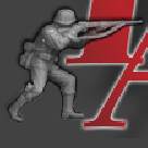
Here's the dude as we see him at the launch screen, in a box at 136. Bit of an upscale probably even there, judging from some of the blur, but still, you can get a lot more visual information in there when the image is like 3 times the size hehe.
-
@black_elk said in Proposed Map: Domination 1941:
Yeah it's always a bit of a bind, cause on the one hand, if recycling material from more familiar games there is an ease of use advantage there (like if I see the same Infantry or Fighter sculpts in all the World War II games, I can kinda hit the ground running a bit faster, since I already know what's going on). On the other hand some of the initial choices about what those default units were going to look like were kinda arbitrary, and the preference is mostly habit I think.
Agreed with both points. Just because I think I would prefer the ease and simplicity of traditional units to the coolness of the Frostion units, doesn't necessarily mean I'm right even about myself. Maybe I would like Frostion units more if I got used to them. Certainly I don't presume to know what everyone else might like! Using traditional units to get started seems like a good idea. My personal preference would be for Frostion-style units to be added in later as an option.
I don't have a hard preference really, except I do see that the 'official' games (the ones with the World War II labelling), are kinda stuck with a very particular look, that hasn't really caught up or advanced much, in the same way that other features of tripleA have.
You make a good point. Maybe my unit preferences are simple. As long as I can easily tell what's going on, I'm happy. But if it would be just as easy to tell what's going on, and the units looked significantly cooler? Obviously that would be better. Is that an achievable goal, or would an increase in the coolness factor cause a concomitant decrease in the ease of telling what's going on? Anything I say in answer to that question would just be a guess.
Some of the unit stuff I drew for Pact of Steel or my various WW1 maps as a placeholder, just kinda reappear and refuse to die lol,
That's funny.
Sounds like we've got some similar ideas regarding rules overhead and the advantages/disadvantages of increased complexity there. For my part even AA50 felt too rules intensive, so stuff like special Chinese production, DoW politics, or airbase scrambling etc the sort of stuff we see in Global was always bit much for my tastes. It's just a tough game to learn, even if you're a long time player. I mean I can get into it, and certainly have on occasion, but it loses some of that original charm that I think Classic and Revised had going on.
I'm with you.
The original Classic game was part of the Hasbro Gamemaster series. Larry's contributions were Axis and Allies Classic, Conquest of the Empire, and Broadsides and Boarding Parties. I've never played Broadsides. Reviews describe it as a light game, a fun game, but not a strategy game as are the others in the series. The sort of thing which takes maybe half an hour to play. The biggest flaw I noticed in Conquest of the Empire is that in most cases, any unit other than a catapult seems a waste of money. Michael Gray's contributions to the series were Fortress America and Samurai Swords. Both are very good games, with Samurai Swords being the more balanced of the two.
If one were to look at the average quality of Larry Harris's Gamemaster games, and compare that to the average of Michael Bay's games, it would be easy to conclude that Michael Bay was the better game designer. But Classic caught on, and became the first of several games based on that general rules set. Certainly there's a lot to be said for the Classic rules set, and Larry Harris's variations thereof.
But just because that particular rules set happened to emerge from the Gamemaster series, just because we have the collective habit of using that rules set, doesn't mean it's the only one we should be considering. What if we were to think outside that particular box? To design a new rules set from first principles, based on the objectives of simplicity, strategic depth, and historical realism? Could we come up with something significantly better than the rules of Classic?
Before answering that question let's look at some of the aspects of WWII.
- Manpower. Each nation had a limited supply of young men to recruit, with the Allies having a massive advantage in this area.
- Technology. A top-of-the-line fighter plane from 1941 was obsolete by '44. Tank design also advanced rapidly.
- Unit specialization. If you wanted to shoot down enemy aircraft you'd build fighters and aa guns. If you wanted to sink enemy surface ships you'd build battleships, torpedo bombers, dive bombers, and/or subs. If enemy subs were your target you'd build destroyers, or maybe torpedo bombers. If you wanted to destroy enemy land targets you'd build dive bombers.
- Air superiority. If you could take control of your own sky, you could defend against enemy air attacks. If you could take control over the enemy's sky, you would have a massive advantage.
- Industrialization. A good proxy for overall military production during WWII was military aircraft production. From '42 - '44 the following happened: the U.S.S.R. increased its military aircraft production by about 50%, the U.S. doubled its military aircraft production, and Germany and Japan each tripled their military aircraft production.
Are there ways to better incorporate those things into a WWII map than what we're used to? Of those five things, unit specialization and possibly air superiority could be taken care of with the combat system I'd described in my previous post. Manpower limitations are easily addressed. Create a new resource type, called manpower points, or MPs. MPs can only be collected from territories you originally owned. Any infantry-type unit will cost 1 MP, plus a PU cost of some sort. All other units would cost PUs only. This would allow the Allies to field much larger infantry forces than the Axis, as had been the case in the real war. Don't worry!--I've thought about and deeply considered the game balance implications of this.
But I'm getting off the subject with all this. The goal for now is to create a 1941 version of NML, using the Anniversary Edition rules.
I don't know, I've seen maybe a couple dozen WW2 themed tripleA maps, and the ones that rise to the top for me usually come down to map design over rules design. Like I just think you can accomplish way more with the right PU values and TT divisions or something as simple as turn order sequence, than you can with special rules or production fields in most cases.
Almost every TripleA map is based on Larry Harris rules. Let's look at the progression of those rules.
- Classic. The starting point.
- Revised. More or less the same rules as Classic, except that you're adding destroyers and artillery. Small rules modifications to accommodate these new units.
- Anniversary Edition. Transports no longer participate in combat. Subs can submerge before the battle unless an enemy destroyer is present. Subs and transports no longer block movement. Strategic bombing works differently. Those are all rules modifications, not increases in complexity. However, he also added national objectives and some weirdness involving China, and those are increases in complexity.
- Global. There is now diplomacy and declarations of war. There are airbases and scrambling. There are naval bases. There is tactical bombing of air and naval bases. These are not rules modifications. They are additions of complexity.
Complexity comes in two flavors: tactical and strategic. I'd classify airbases, naval bases, diplomacy, and national objectives as examples of tactical complexity. I personally don't like tactical complexity, and feel it should be kept to an absolute minimum.
But then there's strategic complexity. To give an example--compare NML with no tech, versus NML with tech turned on. Yes, having a tech system does make a map more complex. But it's strategic complexity. I would never dream of playing NML with tech turned off. NML's tech system really takes the map to the next level.
In my earlier post I proposed a new combat system, in which units would have anti-land, anti-naval, anti-sub, and anti-air combat values. Yes, this is somewhat more complex than attack/defense values. Is this increase in complexity tactical or strategic?
Imagine a NWO game, in which the player controlling Germany has decided to expand his air force. He has several different types of aircraft from which to choose. But whatever type he chooses, it will be good at projecting a threat against opposing navies. It will also be reasonably good at projecting a threat against enemy land targets.
Compare that to the build phase in my proposed rules set. If the player controlling Germany builds fighters, they'll be great at shooting down enemy aircraft, but not very useful for much else. If he chooses dive bombers they'll be great at destroying land targets, and decent against enemy aircraft and enemy naval targets. If he chooses torpedo bombers he projects a strong threat against enemy fleets, and gives himself a unit that's decent against enemy air and enemy land. The question of which type of air units to build has far greater strategic implications than had been the case in the NWO example.
My proposed combat system is an increase in strategic complexity, not an increase in tactical complexity. That in and of itself doesn't automatically make it good or worth adopting. But it does mean there is at least the possibility this new combat method is more like adding a good tech system, than it is like adding air bases or national objectives.
Getting into the nitty gritty of the XML, you can be virtually guaranteed I'll just dip and leave that to someone else haha.
Fair enough.
In a perfect world, I'll be able to talk the XML person into creating two different XML files. The first will be for Domination 1941, as proposed in the OP. The second would incorporate some fundamental changes to Larry Harris rules, such as the proposed combat system. Both would use the same map, which should make your job easier.
It's easier probably for me to just redraw it haha.
Yeah, sometimes it's easier to start from scratch than to try to modify an existing thing into something else.
Compared to NML which uses the standard 48x48 pixel box for all unit types, but I'd think you'd almost want them like twice that size, for a more modern display right?
Hmm. To be honest I'm not familiar enough with map design to have a firm opinion about this. I trust your judgement.
-
@Black_Elk
If you are going for a high res map like 13000px wide, then geographically it would be good to represent natural features like;- Pinsk/Pripet Marshes are represented, xml-wise no motorised allowed
- Carpathian/Urals/Himalayan etc mountain passes, maybe like The Shogun passes
- Rocky/Cliff shores that are impassable to have a full seaborne invasion, like lots of the Adriatic coast
-
@thedog Yeah for sure! My thought would be to include all the same major terrain features that Hepps laid out for the various mountain ranges and deserts, marshes and whatnot. Even if not all of them would come into play in Global, they could still be depicted on the gameboard in some way. I also dig the idea of coastlines and things like straits or canals beyond what we typically get in A&A. His 1914 map was pretty ambitious, cause in addition to all the politics stuff, he was pursuing a seasonal weather feature as well. All that stuff seems pretty cool to me, though perhaps outside the scope of this one.
@KurtGodel7 Sorry I meant to respond to the combat and manpower ideas, but got sidetracked hehe. All sounds pretty good to me! I'm certainly not wedded to the standard rules by any stretch. I've tried my hand at many HRs for AA50 and Global, prob enough to give Beelee experimental headaches for a decade lol, but am always intrigued by new ways to get more strategic depth out of the combat scheme. Manpower was an idea I liked as well, I tried to do an HR for something like that based on VCs in AA50 at one point, but don't know if it even caught on hehe. Not sure how easy/difficult it would to implement the scheme you laid out, but it's probably possible. That said, I still think quite a lot can be accomplished just with the production spread and the money. I'm a big fan of being able to parse the information at a glance, as displayed on the actual gameboard, as opposed to say tracking a bunch of Objectives that sort of exist outside the map. I haven't wrapped out with Larry in a long time, but my view was always that the A&A maps would have been more fun with higher value TTs, more production lily pads, and a higher economy generally. Fewer TTs worth zero or 1 PU, and more TTs at 2 or 3 PUs basically in Classic terms. But those values are also easier to change than say the shapes of the TTs or the TT connections, so I'd kinda just leave everything blank and figure it out later. We'll start with the map and go from there, prob the simplest hehe. I'll try to get something working svg in the weeks ahead, and push out a draft map raster at scale that you can mess around with once I get my head around inkscape.
Oh also, one final consideration, but kind of an important one, is whether you want a game which works for the single player too, or just a more traditional head-to-head PvP type game for 2 or more players. I only bring it up, because if you think you might like to try the former I have quite a few ideas. For the most part people seem to avoid designing maps with the AI first in mind, so we have a number of maps that are essentially unplayable outside the usual PvP - like they'll use features that the hardAI is just incapable of understanding/utilizing. I think there are certain approaches to map design which could potentially make a WW2 game a lot more entertaining for SP, or to make a game which can at least be learned that way before requiring a live opponent. But whether that's something you're interested in or not, I wasn't quite sure. Hepps for example has designed most of his maps to be entirely PvP exclusive, and kinda categorical on that one. Ironwar almost works for SP, but again, the main thrust of the design was PvP. We really don't have any larger WW2 maps that actually work with the hardAI under the v3 ruleset, so that might be a way to set any new offering apart from what's currently available. Not to suggest that you hobble your map design just based on what the AI can do lol, but I think there are ways (particularly in the opening round) where you can design for stronger and more consistent AI first turns (compared to playing vs another human) and set it up so the divergence there isn't quite as pronounced. Trying to play to the strengths of the HardAI basically, in designing the opener at least. Or similarly, to develop a standard difficulty setting vs AI from the launch, to create a challenge there that's entertaining. I think the odds on hooking a single player who wants to try something new, and just paint the map their colors for a few hours, are probably a little higher than finding 2 players itching to do the same in a lot of cases. Or at least, if you can get 1, then maybe they get really into it, and bring more opponents along. Anyhow, just something to think on.
-
Im a big fan of writing the xml with HardAI in mind, so I dont like National Objectives. Humans in game and the real world make up their own objectives as the war changes. So I write for single player with the hope that the map has enough interest for PvP.
Also I like upkeep/maintenance, in its simplest form of 1pu per unit, the AI does not factor this value in, so using 1,2,3+ pu per unit although attractive and realistic it's a none starter for me. Im happy that the system has a form of self limiting production.
With upkeep in mind the TT PU needs to double/triple/or more (last two maps I did I just doubled the PU, Lord of the Rings War of the Ring and britannia_roman_invasion2), so this fits @Black_Elk with your idea of more PU on map.
I wish to move away from AA style of play and to play the strengths of the TripleA engine. I would like to see a new unit type, lets call it a Combat HQ (insert better name), these are the Rommel's, Monty, Pattons HQs etc, each army has at least one. For example the Germans lots and the Russians one, the British could have a Sea Combat HQ, USA could have a Air Combat HQ.
These Combat HQ could have AA, AT +Attack/Defence so that say 5 units they are stacked with get combat bonuses.Also could do with a new map/project name?
maybe 1941 Command Decision? -
@thedog yeah for sure! I feel like if we could get one really solid SP AI showcase map going, that's sort of tripleA total war WW2 next level, that'd have very strong appeal for me. I like the HQ concept or like General/Admiralty officer corps something. The air superiority concept KurtGodel7 mentioned also sounds cool to me. It's such an air war, but then the base game always had some trouble getting that to mesh quite right hehe. All the newer A&A games feel very bomber centric to me. I don't know, it's a lot to mull over. I think the idea I liked is just taking your Global map say, and for every large territory there, just breaking that up into 2 or 3 or 4 more tiles, till you get something with a bit more push and pull going hehe.
In terms of TT divisions, I also like the idea that at the end of the game, something like this would at least be conceivable. Like where the final TT possession could break down along those territorial lines. You know, like doing the Konigsberg to Kaliningrad division and stuff of that sort, or using rivers, to get a few more tiles in there that break more 1945 in shape. Or at least to allow for a holdout endgame with more place to go in central Europe generally hehe.
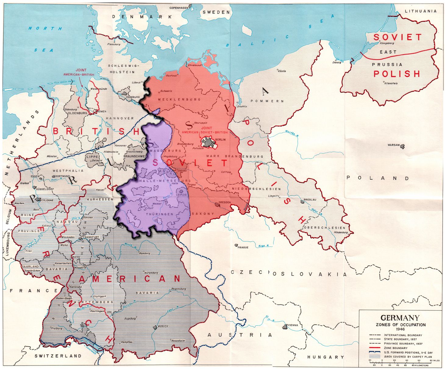
ps. thinking about terrain features, I'd like to see something with a bit more in the Americas as well. You know like the Rockies continental divide and southern desert for N. America and the Andes and Amazon in S. America. Few more contours following the rivers maybe for some TTs there. Just to match the sort of stuff going on in Eurasia and to give it some more interest in the geometry. Perhaps for the High Castle type scenarios, or at least to leave that open as a possibility at, as sorta the opposite end-of-the-end game, of those occupation zone images above lol.
-
Thinking about Sea Zones, Convoy routes etc and how to represent them on the map.
In my games I give the Sea Zones, 0-2PU values, this is meant to represent trade/fishing and the take over of those trade routes. (So no Convoy route circles)
For this map we could make each sea zone in the North Atlantic British owned. Each American Coastal sea Zone would still be American. When a U-Boat, enters the Sea Zone, it is just like a land TT, 0-2pu to Germany -PU to Britain.
(xml-wise we might be able to make the taken over Sea-Zone neutral and therefore not a gain for Germany)If an American ship moves into a German own Sea Zone it reverts to being British.
Does the above work or should we stick to circular Convoy route zones?
https://forums.triplea-game.org/tags/thedog
https://forums.triplea-game.org/topic/3741/curated-best-top-maps-triplea-guides -
@thedog I like the idea of handling sea areas just like land areas.
-
The terrain effects chart may look complicated in TWW, but it's not like it's 208 different interactions with no pattern; it mostly boils down to about 20 or so more basic interactions. It also helps that those basic interactions are mostly based on whether the units are real world effective in that terrain.
In my gameplay experience with TWW, it does add a fair bit of strategic depth; perhaps not a lot, but some, and it impacts what you want to build based on theaters of focus.
I'm not sure the issue is necessarily bad ratio of complexity to strategic depth; I mean, I doubt you've even played TWW to have a good sense of its strategic depth at all. I think it's at a more basic level: lots of complexity and a learning curve makes people avoid maps in the first place, regardless of whether the strategy is interesting.
One thing I can highly recommend to incorporate from TWW that helps address the 'one Japan situation' you mention is TWW's minor allied nations systems. It helps ensure a spread of theater investment, as well as limiting focused builds in one theater; while still all being one nation.
Strategic depth is often less about design choices than it is about fine-tuning the balance very precisely.
As to tech pigeon-holing; that mostly occurs when a tech improves one or a few units but not others; that changes the balance between units, rather than the balance between nations. It can change it in a way which makes one unit simply better than others so it becomes the primary thing built. The most extreme example I've seen is in Big World 2. The base-line units are reasonably well balanced, but if say the US pushes air tech, then you can reach a point where you've got all the standard units at standard costs OR you can build a 4/5/6 for 10 plane. And it turns out that 4/5/6 for 10 fighters are just crazy brutal and apply control to such a large area that sheer fighter spam is more effective than building much else. While you can't win a war without some ground troops, you can have the US be a pure air force that shuts everything down while the other allies handle the ground invasions.
While tech strategy and military strategy are intertwined, that doesn't always mean there's depth. It depends on how many different viable tech choices there are; which again is often more about fine-tuning the balance than anything. In NML, it's pretty good, but there are some issues; on average the econ techs tend to just be better for everyone. They're often the first filled techs for every nation. Naval is rarely used, though that's less because the naval techs are 'weak' and more because the central powers simply are'nt naval powers, and trying to focus on navy tends to be a bad plan for them.
I'd recommend you play a game or two of the Arda map, as it has some interesting unit diversity and complicated gameplay (albeit too complicated at times).
Hello! It looks like you're interested in this conversation, but you don't have an account yet.
Getting fed up of having to scroll through the same posts each visit? When you register for an account, you'll always come back to exactly where you were before, and choose to be notified of new replies (either via email, or push notification). You'll also be able to save bookmarks and upvote posts to show your appreciation to other community members.
With your input, this post could be even better 💗
Register Login